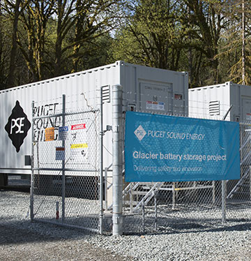
<?xml version="1.0" encoding="UTF-8"?>
<markers lastupdate="Apr 2025">
<marker lat="48.18" lng="-116.997" icon="blue" scale="4" serviceyear="1955" fcrps="True">
<owner><![CDATA[USCE]]></owner>
<ownertype>Federal</ownertype>
<balancingauthority>BPA</balancingauthority>
  <label>Albeni Falls</label>
  <desc><![CDATA[<strong><a target="_blank" href="https://en.wikipedia.org/wiki/Albeni_Falls_Dam">Albeni Falls</a></strong> (43mw Hydro)<br/>  Owner: USCE, in service 1955<br/>Owner type: Federal<br/>
<img src="https://www.nwcouncil.org/f/12787/albeni-falls-3.jpg" width="300" />]]></desc>
</marker>
<marker lat="46.801" lng="-122.308" icon="blue" scale="4" serviceyear="1945" fcrps="False">
<owner><![CDATA[City of Tacoma]]></owner>
<ownertype>Municipal</ownertype>
<balancingauthority>Tacoma</balancingauthority>
  <label>Alder</label>
  <desc><![CDATA[<strong><a target="_blank" href="https://en.wikipedia.org/wiki/Alder_Dam">Alder</a></strong> (50mw Hydro)<br/>  Owner: City of Tacoma, in service 1945<br/>Owner type: Municipal<br/>
<img src="https://upload.wikimedia.org/wikipedia/commons/thumb/d/d9/Alder.jpg/1280px-Alder.jpg" width="300" />]]></desc>
</marker>
<marker lat="42.779" lng="-112.875" icon="blue" scale="5" serviceyear="1978" fcrps="False">
<owner><![CDATA[Idaho Power Co.]]></owner>
<ownertype>IOU</ownertype>
<balancingauthority>IPC</balancingauthority>
  <label>American Falls</label>
  <desc><![CDATA[<strong><a target="_blank" href="https://en.wikipedia.org/wiki/American_Falls_Dam">American Falls</a></strong> (92mw Hydro)<br/>  Owner: Idaho Power Co., in service 1978<br/>Owner type: IOU<br/>
<img src="https://upload.wikimedia.org/wikipedia/commons/9/9e/US_ID_AmericanFalls.jpg" width="300" />]]></desc>
</marker>
<marker lat="43.357" lng="-115.451" icon="blue" scale="4" serviceyear="1950" fcrps="True">
<owner><![CDATA[USBR]]></owner>
<ownertype>Federal</ownertype>
<balancingauthority>IPC</balancingauthority>
  <label>Anderson Ranch</label>
  <desc><![CDATA[<strong><a target="_blank" href="https://en.wikipedia.org/wiki/Anderson_Ranch_Dam">Anderson Ranch</a></strong> (40mw Hydro)<br/>  Owner: USBR, in service 1950<br/>Owner type: Federal<br/>
<img src="https://upload.wikimedia.org/wikipedia/commons/thumb/5/54/Anderson_Ranch_Dam_and_Reservoir.JPG/1280px-Anderson_Ranch_Dam_and_Reservoir.JPG" width="300" />]]></desc>
</marker>
<marker lat="43.595556" lng="-115.922222" icon="blue" scale="3" serviceyear="2010" fcrps="False">
<owner><![CDATA[Boise-Kuna Irrigation District]]></owner>
<ownertype>Independent</ownertype>
<balancingauthority>IPC</balancingauthority>
  <label>Arrowrock 1 - 2</label>
  <desc><![CDATA[<strong><a target="_blank" href="https://en.wikipedia.org/wiki/Arrowrock_Dam">Arrowrock 1 - 2</a></strong> (18mw Hydro)<br/>  Owner: Boise-Kuna Irrigation District, in service 2010<br/>Owner type: Independent<br/>
<img src="https://upload.wikimedia.org/wikipedia/commons/thumb/d/dd/Arrowrock_Dam.jpg/220px-Arrowrock_Dam.jpg" width="300" />]]></desc>
</marker>
<marker lat="44.2234" lng="-111.4755" icon="blue" scale="3" serviceyear="1917" fcrps="False">
<owner><![CDATA[PacifiCorp]]></owner>
<ownertype>IOU</ownertype>
<balancingauthority>PACE</balancingauthority>
  <label>Ashton 1 - 3</label>
  <desc><![CDATA[<strong>Ashton 1 - 3</strong> (7mw Hydro)<br/>  Owner: PacifiCorp, in service 1917<br/>Owner type: IOU]]></desc>
</marker>
<marker lat="48.544" lng="-121.741" icon="blue" scale="5" serviceyear="1925" fcrps="False">
<owner><![CDATA[Puget Sound Energy]]></owner>
<ownertype>IOU</ownertype>
<balancingauthority>PSE</balancingauthority>
  <label>Baker</label>
  <desc><![CDATA[<strong><a target="_blank" href="https://en.wikipedia.org/wiki/Lower_Baker_Dam">Baker River (Lower) Unit 3</a></strong> (81mw Hydro)<br/>  Owner: Puget Sound Energy, in service 1925<br/>Owner type: IOU<br/>
<img src="https://www.nwcouncil.org/f/19228/baker_river.jpg" width="300" /><br/>
<strong><a target="_blank" href="https://en.wikipedia.org/wiki/Lower_Baker_Dam">Baker River (Lower) Unit 4</a></strong> (30mw Hydro)<br/>  Owner: Puget Sound Energy, in service 2014<br/>Owner type: IOU]]></desc>
</marker>
<marker lat="48.65" lng="-121.69" icon="blue" scale="5" serviceyear="1959" fcrps="False">
<owner><![CDATA[Puget Sound Energy]]></owner>
<ownertype>IOU</ownertype>
<balancingauthority>PSE</balancingauthority>
  <label>Baker River (Upper)</label>
  <desc><![CDATA[<strong><a target="_blank" href="https://en.wikipedia.org/wiki/Upper_Baker_Dam">Baker River (Upper)</a></strong> (105mw Hydro)<br/>  Owner: Puget Sound Energy, in service 1959<br/>Owner type: IOU<br/>
<img src="https://www.nwcouncil.org/f/19228/baker_river.jpg" width="300" />]]></desc>
</marker>
<marker lat="43.9304438" lng="-116.4365228" icon="blue" scale="3" serviceyear="1986" fcrps="True">
<owner><![CDATA[USBR]]></owner>
<ownertype>Federal</ownertype>
<balancingauthority>IPC</balancingauthority>
  <label>Black Canyon</label>
  <desc><![CDATA[<strong><a target="_blank" href="https://en.wikipedia.org/wiki/Black_Canyon_Diversion_Dam">Black Canyon</a></strong> (10mw Hydro)<br/>  Owner: USBR, in service 1986<br/>Owner type: Federal<br/>
<img src="https://upload.wikimedia.org/wikipedia/commons/0/03/Black_Canyon_%287172251800%29.jpg" width="300" />]]></desc>
</marker>
<marker lat="47.52027" lng="-111.26248" icon="blue" scale="3" serviceyear="1927" fcrps="False">
<owner><![CDATA[Northwestern Energy purchased from PPL Montana, finalized Nov. 2014.]]></owner>
<ownertype>IOU</ownertype>
<balancingauthority>NorthWestern</balancingauthority>
  <label>Black Eagle 1 - 3</label>
  <desc><![CDATA[<strong><a target="_blank" href="https://en.wikipedia.org/wiki/Black_Eagle_Dam">Black Eagle 1 - 3</a></strong> (21mw Hydro)<br/>  Owner: Northwestern Energy purchased from PPL Montana, finalized Nov. 2014., in service 1927<br/>Owner type: IOU<br/>
<img src="https://upload.wikimedia.org/wikipedia/commons/thumb/9/9b/GREAT_FALLS_PORTAGE%2C_CASCADE_COUNTY%2C_MONTANA.jpg/1920px-GREAT_FALLS_PORTAGE%2C_CASCADE_COUNTY%2C_MONTANA.jpg" width="300" />]]></desc>
</marker>
<marker lat="42.913" lng="-115.07" icon="blue" scale="4" serviceyear="1949" fcrps="False">
<owner><![CDATA[Idaho Power Co.]]></owner>
<ownertype>IOU</ownertype>
<balancingauthority>IPC</balancingauthority>
  <label>Bliss</label>
  <desc><![CDATA[<strong>Bliss</strong> (75mw Hydro)<br/>  Owner: Idaho Power Co., in service 1949<br/>Owner type: IOU]]></desc>
</marker>
<marker lat="45.638" lng="-121.942" icon="blue" scale="23" serviceyear="1938" fcrps="True">
<owner><![CDATA[USCE]]></owner>
<ownertype>Federal</ownertype>
<balancingauthority>BPA</balancingauthority>
  <label>Bonneville</label>
  <desc><![CDATA[<strong><a target="_blank" href="https://en.wikipedia.org/wiki/Bonneville_Dam">Bonneville</a></strong> (1,050mw Hydro)<br/>  Owner: USCE, in service 1938<br/>Owner type: Federal<br/>
<img src="https://upload.wikimedia.org/wikipedia/commons/thumb/8/8c/Spillway%2C_Bonneville_Dam-2.jpg/1280px-Spillway%2C_Bonneville_Dam-2.jpg" width="300" /><br/>
<strong>Bonneville Fishway</strong> (26mw Hydro)<br/>  Owner: USCE, in service 1981<br/>Owner type: Federal]]></desc>
</marker>
<marker lat="48.992" lng="-117.348" icon="blue" scale="23" serviceyear="1967" fcrps="False">
<owner><![CDATA[City of Seattle]]></owner>
<ownertype>Municipal</ownertype>
<balancingauthority>SCE</balancingauthority>
  <label>Boundary</label>
  <desc><![CDATA[<strong><a target="_blank" href="https://en.wikipedia.org/wiki/Boundary_Dam">Boundary</a></strong> (1,040mw Hydro)<br/>  Owner: City of Seattle, in service 1967<br/>Owner type: Municipal<br/>
<img src="https://upload.wikimedia.org/wikipedia/commons/thumb/5/57/Eggshell_face_of_Boundary_Dam_%283942410819%29.jpg/800px-Eggshell_face_of_Boundary_Dam_%283942410819%29.jpg" width="300" />]]></desc>
</marker>
<marker lat="48.781215" lng="-117.412244" icon="blue" scale="5" serviceyear="1955" fcrps="False">
<owner><![CDATA[Pend Oreille Co. PUD]]></owner>
<ownertype>PUD</ownertype>
<balancingauthority>Avista</balancingauthority>
  <label>Box Canyon</label>
  <desc><![CDATA[<strong><a target="_blank" href="https://en.wikipedia.org/wiki/Box_Canyon_Dam_(Washington)">Box Canyon</a></strong> (90mw Hydro)<br/>  Owner: Pend Oreille Co. PUD, in service 1955<br/>Owner type: PUD<br/>
<img src="https://upload.wikimedia.org/wikipedia/commons/d/dc/International_Selkirk_Loop_-_Box_Canyon_Dam_-_NARA_-_7719594.jpg" width="300" />]]></desc>
</marker>
<marker lat="44.841" lng="-116.896" icon="blue" scale="16" serviceyear="1958" fcrps="False">
<owner><![CDATA[Idaho Power Co.]]></owner>
<ownertype>IOU</ownertype>
<balancingauthority>IPC</balancingauthority>
  <label>Brownlee</label>
  <desc><![CDATA[<strong><a target="_blank" href="https://en.wikipedia.org/wiki/Brownlee_Dam">Brownlee</a></strong> (675mw Hydro)<br/>  Owner: Idaho Power Co., in service 1958<br/>Owner type: IOU<br/>
<img src="https://upload.wikimedia.org/wikipedia/commons/c/c4/Brownlee.jpg" width="300" />]]></desc>
</marker>
<marker lat="45.42901" lng="-122.23395" icon="blue" scale="3" serviceyear="1982" fcrps="False">
<owner><![CDATA[City of Portland]]></owner>
<ownertype>Independent</ownertype>
<balancingauthority>PGE</balancingauthority>
  <label>Bull Run</label>
  <desc><![CDATA[<strong><a target="_blank" href="https://en.wikipedia.org/wiki/Bull_Run_Hydroelectric_Project">Bull Run No. 1 (Portland Hydro)</a></strong> (24mw Hydro)<br/>  Owner: City of Portland, in service 1982<br/>Owner type: Independent]]></desc>
</marker>
<marker lat="42.5596337" lng="-114.055861" icon="blue" scale="3" serviceyear="1987" fcrps="False">
<owner><![CDATA[Enel SpA]]></owner>
<ownertype>Independent</ownertype>
<balancingauthority>IPC</balancingauthority>
  <label>Bypass</label>
  <desc><![CDATA[<strong>Bypass</strong> (10mw Hydro)<br/>  Owner: Enel SpA, in service 1987<br/>Owner type: Independent]]></desc>
</marker>
<marker lat="42.946" lng="-115.975" icon="blue" scale="5" serviceyear="1952" fcrps="False">
<owner><![CDATA[Idaho Power Co.]]></owner>
<ownertype>IOU</ownertype>
<balancingauthority>IPC</balancingauthority>
  <label>C.J. Strike</label>
  <desc><![CDATA[<strong><a target="_blank" href="https://en.wikipedia.org/wiki/C._J._Strike_Dam">C.J. Strike</a></strong> (83mw Hydro)<br/>  Owner: Idaho Power Co., in service 1952<br/>Owner type: IOU<br/>
<img src="https://www.tworvgypsies.us/!USA-trip-6-2013/photos-42-Bruneau_Dunes_SP/4-CJ_strike_dam/2013-08-08_08_CJStrike_Dam.jpg" width="300" />]]></desc>
</marker>
<marker lat="48.087" lng="-116.057" icon="blue" scale="8" serviceyear="1952" fcrps="False">
<owner><![CDATA[Avista]]></owner>
<ownertype>IOU</ownertype>
<balancingauthority>Avista</balancingauthority>
  <label>Cabinet Gorge 1 - 4</label>
  <desc><![CDATA[<strong><a target="_blank" href="https://en.wikipedia.org/wiki/Cabinet_Gorge_Dam">Cabinet Gorge 1 - 4</a></strong> (265mw Hydro)<br/>  Owner: Avista, in service 1952<br/>Owner type: IOU<br/>
<img src="https://upload.wikimedia.org/wikipedia/commons/thumb/f/f1/Cabinet_Gorge_Dam.JPG/1280px-Cabinet_Gorge_Dam.JPG" width="300" />]]></desc>
</marker>
<marker lat="46.649" lng="-111.728" icon="blue" scale="4" serviceyear="1953" fcrps="False">
<owner><![CDATA[USBR]]></owner>
<ownertype>Federal</ownertype>
<balancingauthority>NorthWestern</balancingauthority>
  <label>Canyon Ferry</label>
  <desc><![CDATA[<strong><a target="_blank" href="https://en.wikipedia.org/wiki/Canyon_Ferry_Dam">Canyon Ferry</a></strong> (50mw Hydro)<br/>  Owner: USBR, in service 1953<br/>Owner type: Federal<br/>
<img src="https://upload.wikimedia.org/wikipedia/commons/1/17/CanyonFerryDam2.jpg" width="300" />]]></desc>
</marker>
<marker lat="44.279" lng="-122.049" icon="blue" scale="5" serviceyear="1963" fcrps="False">
<owner><![CDATA[City of Eugene (EWEB)]]></owner>
<ownertype>Municipal</ownertype>
<balancingauthority>BPA</balancingauthority>
  <label>Carmen-Smith</label>
  <desc><![CDATA[<strong><a target="_blank" href="https://www.eweb.org/about-us/power-supply/mckenzie-river-hydro-projects/carmen-smith-hydropower-project">Carmen-Smith</a></strong> (114mw Hydro)<br/>  Owner: City of Eugene (EWEB), in service 1963<br/>Owner type: Municipal<br/>
<img src="https://www.nwcouncil.org/f/19183/carmen_smith.jpg" width="300" />]]></desc>
</marker>
<marker lat="44.7578" lng="-115.561" icon="blue" scale="3" serviceyear="1926" fcrps="False">
<owner><![CDATA[Idaho Power Co.]]></owner>
<ownertype>IOU</ownertype>
<balancingauthority>IPC</balancingauthority>
  <label>Cascade 1 &amp; 2</label>
  <desc><![CDATA[<strong>Cascade 1 & 2</strong> (12mw Hydro)<br/>  Owner: Idaho Power Co., in service 1926<br/>Owner type: IOU]]></desc>
</marker>
<marker lat="47.419" lng="-121.781" icon="blue" scale="3" serviceyear="1905" fcrps="False">
<owner><![CDATA[City of Seattle]]></owner>
<ownertype>Municipal</ownertype>
<balancingauthority>SCE</balancingauthority>
  <label>Cedar Falls (Masonry Dam)</label>
  <desc><![CDATA[<strong><a target="_blank" href="https://en.wikipedia.org/wiki/Seattle_Municipal_Light_and_Power_Plant">Cedar Falls (Masonry Dam)</a></strong> (20mw Hydro)<br/>  Owner: City of Seattle, in service 1905<br/>Owner type: Municipal<br/>
<img src="https://upload.wikimedia.org/wikipedia/commons/thumb/4/4d/Cedar_Falls_crib_dam%2C_1903_%2850532947523%29.jpg/1280px-Cedar_Falls_crib_dam%2C_1903_%2850532947523%29.jpg" width="300" />]]></desc>
</marker>
<marker lat="47.808" lng="-119.985" icon="blue" scale="4" serviceyear="1927" fcrps="False">
<owner><![CDATA[Chelan Co. PUD]]></owner>
<ownertype>PUD</ownertype>
<balancingauthority>Chelan Co. PUD</balancingauthority>
  <label>Chelan</label>
  <desc><![CDATA[<strong><a target="_blank" href="https://en.wikipedia.org/wiki/Lake_Chelan_Dam">Chelan</a></strong> (48mw Hydro)<br/>  Owner: Chelan Co. PUD, in service 1927<br/>Owner type: PUD<br/>
<img src="https://upload.wikimedia.org/wikipedia/commons/thumb/9/95/HD.11C.081_%2814926342072%29.jpg/1280px-HD.11C.081_%2814926342072%29.jpg" width="300" />]]></desc>
</marker>
<marker lat="47.999" lng="-119.634" icon="blue" scale="50" serviceyear="1955" fcrps="True">
<owner><![CDATA[USCE]]></owner>
<ownertype>Federal</ownertype>
<balancingauthority>BPA</balancingauthority>
  <label>Chief Joseph</label>
  <desc><![CDATA[<strong><a target="_blank" href="https://en.wikipedia.org/wiki/Chief_Joseph_Dam">Chief Joseph</a></strong> (2,458mw Hydro)<br/>  Owner: USCE, in service 1955<br/>Owner type: Federal<br/>
<img src="https://upload.wikimedia.org/wikipedia/commons/6/6c/Chief_Joseph_Dam.jpg" width="300" />]]></desc>
</marker>
<marker lat="43.267" lng="-122.409" icon="blue" scale="3" serviceyear="1953" fcrps="False">
<owner><![CDATA[PacifiCorp]]></owner>
<ownertype>IOU</ownertype>
<balancingauthority>PACW</balancingauthority>
  <label>Clearwater</label>
  <desc><![CDATA[<strong>Clearwater</strong> (26mw Hydro)<br/>  Owner: PacifiCorp, in service 1953<br/>Owner type: IOU]]></desc>
</marker>
<marker lat="47.554" lng="-111.148" icon="blue" scale="4" serviceyear="1958" fcrps="False">
<owner><![CDATA[Northwestern Energy purchased from PPL Montana, finalized Nov. 2014.]]></owner>
<ownertype>IOU</ownertype>
<balancingauthority>NorthWestern</balancingauthority>
  <label>Cochrane</label>
  <desc><![CDATA[<strong><a target="_blank" href="https://en.wikipedia.org/wiki/Cochrane_Dam">Cochrane</a></strong> (59mw Hydro)<br/>  Owner: Northwestern Energy purchased from PPL Montana, finalized Nov. 2014., in service 1958<br/>Owner type: IOU<br/>
<img src="https://nw-enviro.com/wp-content/uploads/2018/08/IMG_0774-1024x768.jpg" width="300" />]]></desc>
</marker>
<marker lat="41.9798639" lng="-122.3344629" icon="blue" scale="3" serviceyear="1918" fcrps="False">
<owner><![CDATA[PacifiCorp]]></owner>
<ownertype>IOU</ownertype>
<balancingauthority>PACW</balancingauthority>
  <label>COPCO 1 (1 &amp; 2)</label>
  <desc><![CDATA[<strong>COPCO 1 (1 & 2)</strong> (20mw Hydro)<br/>  Owner: PacifiCorp, in service 1918<br/>Owner type: IOU]]></desc>
</marker>
<marker lat="41.981" lng="-122.336" icon="blue" scale="3" serviceyear="1925" fcrps="False">
<owner><![CDATA[PacifiCorp]]></owner>
<ownertype>IOU</ownertype>
<balancingauthority>PACW</balancingauthority>
  <label>COPCO 2</label>
  <desc><![CDATA[<strong>COPCO 2</strong> (27mw Hydro)<br/>  Owner: PacifiCorp, in service 1925<br/>Owner type: IOU]]></desc>
</marker>
<marker lat="44.128" lng="-122.24" icon="blue" scale="4" serviceyear="1964" fcrps="True">
<owner><![CDATA[USCE]]></owner>
<ownertype>Federal</ownertype>
<balancingauthority>BPA</balancingauthority>
  <label>Cougar</label>
  <desc><![CDATA[<strong><a target="_blank" href="https://en.wikipedia.org/wiki/Cougar_Dam">Cougar</a></strong> (29mw Hydro)<br/>  Owner: USCE, in service 1964<br/>Owner type: Federal<br/>
<img src="https://upload.wikimedia.org/wikipedia/commons/3/3d/Cougar_Dam_Oregon.jpg" width="300" />]]></desc>
</marker>
<marker lat="46.466" lng="-122.109" icon="blue" scale="4" serviceyear="1994" fcrps="False">
<owner><![CDATA[Lewis County PUD]]></owner>
<ownertype>PUD</ownertype>
<balancingauthority>BPA</balancingauthority>
  <label>Cowlitz Falls</label>
  <desc><![CDATA[<strong><a target="_blank" href="https://en.wikipedia.org/wiki/Cowlitz_Falls_Dam">Cowlitz Falls</a></strong> (70mw Hydro)<br/>  Owner: Lewis County PUD, in service 1994<br/>Owner type: PUD<br/>
<img src="https://iihrengineering.com/wp-content/uploads/2018/05/Cowlitz-Dam-Lewis-Co-PUD-NEW.png" width="300" />]]></desc>
</marker>
<marker lat="47.423" lng="-123.221" icon="blue" scale="4" serviceyear="1926" fcrps="False">
<owner><![CDATA[City of Tacoma]]></owner>
<ownertype>Municipal</ownertype>
<balancingauthority>Tacoma</balancingauthority>
  <label>Cushman 1</label>
  <desc><![CDATA[<strong><a target="_blank" href="https://en.wikipedia.org/wiki/Cushman_Dam_No._1">Cushman 1</a></strong> (43mw Hydro)<br/>  Owner: City of Tacoma, in service 1926<br/>Owner type: Municipal<br/>
<img src="https://upload.wikimedia.org/wikipedia/commons/thumb/c/c9/Cushman_Dam_1.jpg/1280px-Cushman_Dam_1.jpg" width="300" />]]></desc>
</marker>
<marker lat="47.37" lng="-123.159" icon="blue" scale="5" serviceyear="1930" fcrps="False">
<owner><![CDATA[City of Tacoma]]></owner>
<ownertype>Municipal</ownertype>
<balancingauthority>Tacoma</balancingauthority>
  <label>Cushman 2</label>
  <desc><![CDATA[<strong><a target="_blank" href="https://en.wikipedia.org/wiki/Cushman_Dam_No._2">Cushman 2</a></strong> (81mw Hydro)<br/>  Owner: City of Tacoma, in service 1930<br/>Owner type: Municipal<br/>
<img src="https://upload.wikimedia.org/wikipedia/commons/thumb/0/0a/Cushman_Dam_No_2_turbines_panoramic.jpg/1920px-Cushman_Dam_No_2_turbines_panoramic.jpg" width="300" />]]></desc>
</marker>
<marker lat="41.836667" lng="-112.0475" icon="blue" scale="4" serviceyear="1927" fcrps="False">
<owner><![CDATA[PacifiCorp]]></owner>
<ownertype>IOU</ownertype>
<balancingauthority>PACE</balancingauthority>
  <label>Cutler 1-2</label>
  <desc><![CDATA[<strong>Cutler 1-2</strong> (30mw Hydro)<br/>  Owner: PacifiCorp, in service 1927<br/>Owner type: IOU]]></desc>
</marker>
<marker lat="44.722" lng="-122.251" icon="blue" scale="5" serviceyear="1953" fcrps="True">
<owner><![CDATA[USCE]]></owner>
<ownertype>Federal</ownertype>
<balancingauthority>BPA</balancingauthority>
  <label>Detroit</label>
  <desc><![CDATA[<strong><a target="_blank" href="https://en.wikipedia.org/wiki/Detroit_Dam">Detroit</a></strong> (126mw Hydro)<br/>  Owner: USCE, in service 1953<br/>Owner type: Federal<br/>
<img src="https://upload.wikimedia.org/wikipedia/commons/0/0d/Detroit_Dam_%282019%29.jpg" width="300" />]]></desc>
</marker>
<marker lat="48.716" lng="-121.14" icon="blue" scale="6" serviceyear="1936" fcrps="False">
<owner><![CDATA[City of Seattle]]></owner>
<ownertype>Municipal</ownertype>
<balancingauthority>SCE</balancingauthority>
  <label>Diablo</label>
  <desc><![CDATA[<strong><a target="_blank" href="https://en.wikipedia.org/wiki/Ross_Dam">Diablo</a></strong> (153mw Hydro)<br/>  Owner: City of Seattle, in service 1936<br/>Owner type: Municipal<br/>
<img src="https://www.nwcouncil.org/f/19189/diablo.jpg" width="300" />]]></desc>
</marker>
<marker lat="46.52" lng="-116.299" icon="blue" scale="11" serviceyear="1973" fcrps="True">
<owner><![CDATA[USCE]]></owner>
<ownertype>Federal</ownertype>
<balancingauthority>BPA</balancingauthority>
  <label>Dworshak</label>
  <desc><![CDATA[<strong><a target="_blank" href="https://en.wikipedia.org/wiki/Dworshak_Dam">Dworshak</a></strong> (400mw Hydro)<br/>  Owner: USCE, in service 1973<br/>Owner type: Federal<br/>
<img src="https://upload.wikimedia.org/wikipedia/commons/f/fc/Dworshak_Dam_1.jpg" width="300" />]]></desc>
</marker>
<marker lat="46.993" lng="-122.173" icon="blue" scale="3" serviceyear="1904" fcrps="False">
<owner><![CDATA[Electron Hydro LLC (subsidiary of JAVA Holdings of Alberta).  Sold by PSE Aug 2013.]]></owner>
<ownertype>IOU</ownertype>
<balancingauthority>PSE</balancingauthority>
  <label>Electron</label>
  <desc><![CDATA[<strong>Electron</strong> (23mw Hydro)<br/>  Owner: Electron Hydro LLC (subsidiary of JAVA Holdings of Alberta).  Sold by PSE Aug 2013., in service 1904<br/>Owner type: IOU]]></desc>
</marker>
<marker lat="44.016987" lng="-111.58249" icon="blue" scale="3" serviceyear="1993" fcrps="False">
<owner><![CDATA[Marysville Hydro Partners]]></owner>
<ownertype>Independent</ownertype>
<balancingauthority>BPA</balancingauthority>
  <label>Falls River</label>
  <desc><![CDATA[<strong>Falls River</strong> (9mw Hydro)<br/>  Owner: Marysville Hydro Partners, in service 1993<br/>Owner type: Independent]]></desc>
</marker>
<marker lat="45.268" lng="-122.318" icon="blue" scale="4" serviceyear="1907" fcrps="False">
<owner><![CDATA[Portland General Electric]]></owner>
<ownertype>IOU</ownertype>
<balancingauthority>PGE</balancingauthority>
  <label>Faraday</label>
  <desc><![CDATA[<strong><a target="_blank" href="https://hydroreform.org/hydro-project/faraday-p-2195/">Faraday</a></strong> (37mw Hydro)<br/>  Owner: Portland General Electric, in service 1907<br/>Owner type: IOU<br/>
<img src="https://www.nwcouncil.org/f/19186/faraday.jpg" width="300" />]]></desc>
</marker>
<marker lat="43.909653" lng="-111.285421" icon="blue" scale="3" serviceyear="1985" fcrps="False">
<owner><![CDATA[CDM Hydroelectric]]></owner>
<ownertype>Independent</ownertype>
<balancingauthority>PACE</balancingauthority>
  <label>Felt</label>
  <desc><![CDATA[<strong>Felt Hydroelectric Plant</strong> (7mw Hydro)<br/>  Owner: CDM Hydroelectric, in service 1985<br/>Owner type: Independent]]></desc>
</marker>
<marker lat="48.013" lng="-106.411" icon="blue" scale="4" serviceyear="1943" fcrps="False">
<owner><![CDATA[USCE]]></owner>
<ownertype>Federal</ownertype>
<balancingauthority>WAPA</balancingauthority>
  <label>Fort Peck</label>
  <desc><![CDATA[<strong><a target="_blank" href="https://en.wikipedia.org/wiki/Fort_Peck_Dam">Fort Peck 1 - 2</a></strong> (62mw Hydro)<br/>  Owner: USCE, in service 1943<br/>Owner type: Federal<br/>
<img src="https://upload.wikimedia.org/wikipedia/commons/4/48/Fort_Peck_Dam_%28Fort_Peck_Montana%29_1986_01.jpg" width="300" /><br/>
<strong><a target="_blank" href="https://en.wikipedia.org/wiki/Fort_Peck_Dam">Fort Peck 3</a></strong> (44mw Hydro)<br/>  Owner: USCE, in service 1951<br/>Owner type: Federal<br/>
<img src="https://upload.wikimedia.org/wikipedia/commons/4/48/Fort_Peck_Dam_%28Fort_Peck_Montana%29_1986_01.jpg" width="300" /><br/>
<strong><a target="_blank" href="https://en.wikipedia.org/wiki/Fort_Peck_Dam">Fort Peck 4 - 5</a></strong> (80mw Hydro)<br/>  Owner: USCE, in service 1951<br/>Owner type: Federal<br/>
<img src="https://upload.wikimedia.org/wikipedia/commons/4/48/Fort_Peck_Dam_%28Fort_Peck_Montana%29_1986_01.jpg" width="300" />]]></desc>
</marker>
<marker lat="44.415791" lng="-122.670563" icon="blue" scale="3" serviceyear="1968" fcrps="True">
<owner><![CDATA[USCE]]></owner>
<ownertype>Federal</ownertype>
<balancingauthority>BPA</balancingauthority>
  <label>Foster</label>
  <desc><![CDATA[<strong><a target="_blank" href="https://en.wikipedia.org/wiki/Foster_Dam">Foster</a></strong> (20mw Hydro)<br/>  Owner: USCE, in service 1968<br/>Owner type: Federal<br/>
<img src="https://www.nwcouncil.org/f/19187/foster.jpg" width="300" />]]></desc>
</marker>
<marker lat="43.420833" lng="-112.101944" icon="blue" scale="3" serviceyear="1988" fcrps="False">
<owner><![CDATA[City of Idaho Falls]]></owner>
<ownertype>Municipal</ownertype>
<balancingauthority>PACE</balancingauthority>
  <label>Gem State</label>
  <desc><![CDATA[<strong><a target="_blank" href="https://en.wikipedia.org/wiki/Gem_State_Dam">Gem State</a></strong> (23mw Hydro)<br/>  Owner: City of Idaho Falls, in service 1988<br/>Owner type: Municipal]]></desc>
</marker>
<marker lat="48.698" lng="-121.207" icon="blue" scale="7" serviceyear="1924" fcrps="False">
<owner><![CDATA[City of Seattle]]></owner>
<ownertype>Municipal</ownertype>
<balancingauthority>SCE</balancingauthority>
  <label>Gorge</label>
  <desc><![CDATA[<strong><a target="_blank" href="https://en.wikipedia.org/wiki/Ross_Dam">Gorge</a></strong> (207mw Hydro)<br/>  Owner: City of Seattle, in service 1924<br/>Owner type: Municipal<br/>
<img src="https://www.nwcouncil.org/f/19196/gorge.jpg" width="300" />]]></desc>
</marker>
<marker lat="42.588056" lng="-111.728889" icon="blue" scale="4" serviceyear="1914" fcrps="False">
<owner><![CDATA[PacifiCorp]]></owner>
<ownertype>IOU</ownertype>
<balancingauthority>PACE</balancingauthority>
  <label>Grace</label>
  <desc><![CDATA[<strong>Grace</strong> (33mw Hydro)<br/>  Owner: PacifiCorp, in service 1914<br/>Owner type: IOU]]></desc>
</marker>
<marker lat="47.967" lng="-118.977" icon="blue" scale="50" serviceyear="1941" fcrps="True">
<owner><![CDATA[USBR]]></owner>
<ownertype>Federal</ownertype>
<balancingauthority>BPA</balancingauthority>
  <label>Grand Coulee</label>
  <desc><![CDATA[<strong><a target="_blank" href="https://en.wikipedia.org/wiki/Grand_Coulee_Dam">Grand Coulee</a></strong> (6,495mw Hydro, map marker not shown to scale)<br/>  Owner: USBR, in service 1941<br/>Owner type: Federal<br/>
<img src="https://upload.wikimedia.org/wikipedia/commons/7/73/Grand_Coulee_Dam.jpg" width="300" />]]></desc>
</marker>
<marker lat="44.45" lng="-122.548" icon="blue" scale="5" serviceyear="1967" fcrps="True">
<owner><![CDATA[USCE]]></owner>
<ownertype>Federal</ownertype>
<balancingauthority>BPA</balancingauthority>
  <label>Green Peter</label>
  <desc><![CDATA[<strong><a target="_blank" href="https://en.wikipedia.org/wiki/Green_Peter_Dam">Green Peter</a></strong> (92mw Hydro)<br/>  Owner: USCE, in service 1967<br/>Owner type: Federal<br/>
<img src="https://www.nwcouncil.org/f/19192/green_peter.jpg" width="300" />]]></desc>
</marker>
<marker lat="42.587264" lng="-114.067554" icon="blue" scale="3" serviceyear="1990" fcrps="False">
<owner><![CDATA[Enel SpA]]></owner>
<ownertype>Independent</ownertype>
<balancingauthority>IPC</balancingauthority>
  <label>Hazelton A</label>
  <desc><![CDATA[<strong>Hazelton A</strong> (9mw Hydro)<br/>  Owner: Enel SpA, in service 1990<br/>Owner type: Independent]]></desc>
</marker>
<marker lat="42.60412" lng="-114.08458" icon="blue" scale="3" serviceyear="1993" fcrps="False">
<owner><![CDATA[N. Side Canal Co.]]></owner>
<ownertype>Independent</ownertype>
<balancingauthority>IPC</balancingauthority>
  <label>Hazelton B</label>
  <desc><![CDATA[<strong>Hazelton B</strong> (8mw Hydro)<br/>  Owner: N. Side Canal Co., in service 1993<br/>Owner type: Independent]]></desc>
</marker>
<marker lat="45.245" lng="-116.702" icon="blue" scale="10" serviceyear="1967" fcrps="False">
<owner><![CDATA[Idaho Power Co.]]></owner>
<ownertype>IOU</ownertype>
<balancingauthority>IPC</balancingauthority>
  <label>Hell's Canyon</label>
  <desc><![CDATA[<strong><a target="_blank" href="https://en.wikipedia.org/wiki/Hells_Canyon_Dam">Hell's Canyon</a></strong> (392mw Hydro)<br/>  Owner: Idaho Power Co., in service 1967<br/>Owner type: IOU<br/>
<img src="https://www.nwcouncil.org/f/19195/hells_canyon.jpg" width="300" />]]></desc>
</marker>
<marker lat="47.976" lng="-121.685" icon="blue" scale="5" serviceyear="1984" fcrps="False">
<owner><![CDATA[Snohomish Co. PUD]]></owner>
<ownertype>PUD</ownertype>
<balancingauthority>BPA</balancingauthority>
  <label>Henry M. Jackson (Culmback)</label>
  <desc><![CDATA[<strong><a target="_blank" href="https://en.wikipedia.org/wiki/Culmback_Dam">Henry M. Jackson (Culmback)</a></strong> (112mw Hydro)<br/>  Owner: Snohomish Co. PUD, in service 1984<br/>Owner type: PUD<br/>
<img src="https://www.wta.org/site_images/hikes/hike-image-2021-06-14-2559737713/@@images/cfa3da7c-9c3b-42b4-b13d-44bffc4f57be.jpeg" width="300" />]]></desc>
</marker>
<marker lat="43.711" lng="-122.425" icon="blue" scale="4" serviceyear="1962" fcrps="True">
<owner><![CDATA[USCE]]></owner>
<ownertype>Federal</ownertype>
<balancingauthority>BPA</balancingauthority>
  <label>Hills Creek</label>
  <desc><![CDATA[<strong><a target="_blank" href="https://en.wikipedia.org/wiki/Hills_Creek_Dam">Hills Creek</a></strong> (35mw Hydro)<br/>  Owner: USCE, in service 1962<br/>Owner type: Federal<br/>
<img src="https://www.nwcouncil.org/f/19201/hills_creek.jpg" width="300" />]]></desc>
</marker>
<marker lat="46.991" lng="-112.004" icon="blue" scale="4" serviceyear="1918" fcrps="False">
<owner><![CDATA[Northwestern Energy purchased from PPL Montana, finalized Nov. 2014.]]></owner>
<ownertype>IOU</ownertype>
<balancingauthority>NorthWestern</balancingauthority>
  <label>Holter</label>
  <desc><![CDATA[<strong><a target="_blank" href="https://en.wikipedia.org/wiki/Holter_Dam">Holter</a></strong> (38mw Hydro)<br/>  Owner: Northwestern Energy purchased from PPL Montana, finalized Nov. 2014., in service 1918<br/>Owner type: IOU<br/>
<img src="https://www.nwcouncil.org/f/19198/holter.jpg" width="300" />]]></desc>
</marker>
<marker lat="43.909096" lng="-116.192183" icon="blue" scale="3" serviceyear="1995" fcrps="False">
<owner><![CDATA[Innergex Power]]></owner>
<ownertype>Independent</ownertype>
<balancingauthority>IPC</balancingauthority>
  <label>Horseshoe Bend Hydroelectric</label>
  <desc><![CDATA[<strong>Horseshoe Bend Hydroelectric</strong> (9mw Hydro)<br/>  Owner: Innergex Power, in service 1995<br/>Owner type: Independent]]></desc>
</marker>
<marker lat="48.341" lng="-114.015" icon="blue" scale="11" serviceyear="1952" fcrps="True">
<owner><![CDATA[USBR]]></owner>
<ownertype>Federal</ownertype>
<balancingauthority>BPA</balancingauthority>
  <label>Hungry Horse</label>
  <desc><![CDATA[<strong><a target="_blank" href="https://en.wikipedia.org/wiki/Hungry_Horse_Dam">Hungry Horse</a></strong> (428mw Hydro)<br/>  Owner: USBR, in service 1952<br/>Owner type: Federal<br/>
<img src="https://www.nwcouncil.org/f/19202/hungry_horse.jpg" width="300" />]]></desc>
</marker>
<marker lat="46.253" lng="-118.893" icon="blue" scale="15" serviceyear="1962" fcrps="True">
<owner><![CDATA[USCE]]></owner>
<ownertype>Federal</ownertype>
<balancingauthority>BPA</balancingauthority>
  <label>Ice Harbor</label>
  <desc><![CDATA[<strong><a target="_blank" href="https://en.wikipedia.org/wiki/Ice_Harbor_Dam">Ice Harbor</a></strong> (603mw Hydro)<br/>  Owner: USCE, in service 1962<br/>Owner type: Federal<br/>
<img src="https://www.nwcouncil.org/f/19207/ice_harbor.jpg" width="300" />]]></desc>
</marker>
<marker lat="43.491619" lng="-112.045062" icon="blue" scale="3" serviceyear="1982" fcrps="False">
<owner><![CDATA[City of Idaho Falls]]></owner>
<ownertype>Municipal</ownertype>
<balancingauthority>PACE</balancingauthority>
  <label>Idaho Falls City Plant 3</label>
  <desc><![CDATA[<strong>Idaho Falls City Plant 3</strong> (8mw Hydro)<br/>  Owner: City of Idaho Falls, in service 1982<br/>Owner type: Municipal]]></desc>
</marker>
<marker lat="43.468218" lng="-112.062253" icon="blue" scale="3" serviceyear="1982" fcrps="False">
<owner><![CDATA[City of Idaho Falls]]></owner>
<ownertype>Municipal</ownertype>
<balancingauthority>PACE</balancingauthority>
  <label>Idaho Falls Lower No. 1 (Unit 2)</label>
  <desc><![CDATA[<strong>Idaho Falls Lower No. 1 (Unit 2)</strong> (8mw Hydro)<br/>  Owner: City of Idaho Falls, in service 1982<br/>Owner type: Municipal]]></desc>
</marker>
<marker lat="43.552754" lng="-112.050641" icon="blue" scale="3" serviceyear="1982" fcrps="False">
<owner><![CDATA[City of Idaho Falls]]></owner>
<ownertype>Municipal</ownertype>
<balancingauthority>PACE</balancingauthority>
  <label>Idaho Falls Upper Plant 4</label>
  <desc><![CDATA[<strong>Idaho Falls Upper Plant 4</strong> (8mw Hydro)<br/>  Owner: City of Idaho Falls, in service 1982<br/>Owner type: Municipal]]></desc>
</marker>
<marker lat="42.123" lng="-122.048" icon="blue" scale="5" serviceyear="1958" fcrps="False">
<owner><![CDATA[PacifiCorp]]></owner>
<ownertype>IOU</ownertype>
<balancingauthority>PACW</balancingauthority>
  <label>John C. Boyle</label>
  <desc><![CDATA[<strong>John C. Boyle</strong> (99mw Hydro)<br/>  Owner: PacifiCorp, in service 1958<br/>Owner type: IOU]]></desc>
</marker>
<marker lat="45.717" lng="-120.693" icon="blue" scale="44" serviceyear="1968" fcrps="True">
<owner><![CDATA[USCE]]></owner>
<ownertype>Federal</ownertype>
<balancingauthority>BPA</balancingauthority>
  <label>John Day</label>
  <desc><![CDATA[<strong><a target="_blank" href="https://en.wikipedia.org/wiki/John_Day_Dam">John Day</a></strong> (2,160mw Hydro)<br/>  Owner: USCE, in service 1968<br/>Owner type: Federal<br/>
<img src="https://www.nwcouncil.org/f/19205/john_day.jpg" width="300" />]]></desc>
</marker>
<marker lat="46.834" lng="-122.322" icon="blue" scale="4" serviceyear="1912" fcrps="False">
<owner><![CDATA[City of Tacoma]]></owner>
<ownertype>Municipal</ownertype>
<balancingauthority>Tacoma</balancingauthority>
  <label>LaGrande</label>
  <desc><![CDATA[<strong><a target="_blank" href="https://en.wikipedia.org/wiki/LaGrande_Dam">LaGrande</a></strong> (65mw Hydro)<br/>  Owner: City of Tacoma, in service 1912<br/>Owner type: Municipal<br/>
<img src="https://upload.wikimedia.org/wikipedia/commons/thumb/b/b4/HD.11C.079_%2813960015835%29.jpg/1280px-HD.11C.079_%2813960015835%29.jpg" width="300" />]]></desc>
</marker>
<marker lat="43.323" lng="-122.194" icon="blue" scale="4" serviceyear="1955" fcrps="False">
<owner><![CDATA[PacifiCorp]]></owner>
<ownertype>IOU</ownertype>
<balancingauthority>PACW</balancingauthority>
  <label>Lemolo</label>
  <desc><![CDATA[<strong><a target="_blank" href="https://en.wikipedia.org/wiki/Lemolo_Lake">Lemolo 1</a></strong> (32mw Hydro)<br/>  Owner: PacifiCorp, in service 1955<br/>Owner type: IOU<br/>
<img src="https://www.nwcouncil.org/f/19206/lemolo.jpg" width="300" /><br/>
<strong><a target="_blank" href="https://en.wikipedia.org/wiki/Lemolo_Lake">Lemolo 2</a></strong> (39mw Hydro)<br/>  Owner: PacifiCorp, in service 1956<br/>Owner type: IOU<br/>
<img src="https://www.nwcouncil.org/f/19206/lemolo.jpg" width="300" />]]></desc>
</marker>
<marker lat="48.41" lng="-115.316" icon="blue" scale="13" serviceyear="1975" fcrps="True">
<owner><![CDATA[USCE]]></owner>
<ownertype>Federal</ownertype>
<balancingauthority>BPA</balancingauthority>
  <label>Libby</label>
  <desc><![CDATA[<strong><a target="_blank" href="https://en.wikipedia.org/wiki/Libby_Dam">Libby</a></strong> (525mw Hydro)<br/>  Owner: USCE, in service 1975<br/>Owner type: Federal<br/>
<img src="https://www.nwcouncil.org/f/19209/libby.jpg" width="300" />]]></desc>
</marker>
<marker lat="47.829" lng="-117.918" icon="blue" scale="4" serviceyear="1910" fcrps="False">
<owner><![CDATA[Avista]]></owner>
<ownertype>IOU</ownertype>
<balancingauthority>Avista</balancingauthority>
  <label>Little Falls 1- 4</label>
  <desc><![CDATA[<strong><a target="_blank" href="https://en.wikipedia.org/wiki/Little_Falls_Hydroelectric_Power_Plant">Little Falls 1- 4</a></strong> (43mw Hydro)<br/>  Owner: Avista, in service 1910<br/>Owner type: IOU<br/>
<img src="https://www.nwcouncil.org/f/19208/little_falls.jpg" width="300" />]]></desc>
</marker>
<marker lat="46.589" lng="-118.024" icon="blue" scale="18" serviceyear="1970" fcrps="True">
<owner><![CDATA[USCE]]></owner>
<ownertype>Federal</ownertype>
<balancingauthority>BPA</balancingauthority>
  <label>Little Goose</label>
  <desc><![CDATA[<strong><a target="_blank" href="https://en.wikipedia.org/wiki/Little_Goose_Dam">Little Goose</a></strong> (810mw Hydro)<br/>  Owner: USCE, in service 1970<br/>Owner type: Federal<br/>
<img src="https://www.nwcouncil.org/f/19211/little_goose.jpg" width="300" />]]></desc>
</marker>
<marker lat="47.837" lng="-117.84" icon="blue" scale="4" serviceyear="1915" fcrps="False">
<owner><![CDATA[Avista]]></owner>
<ownertype>IOU</ownertype>
<balancingauthority>Avista</balancingauthority>
  <label>Long Lake 1 - 4</label>
  <desc><![CDATA[<strong><a target="_blank" href="https://en.wikipedia.org/wiki/Long_Lake_Dam">Long Lake 1 - 4</a></strong> (71mw Hydro)<br/>  Owner: Avista, in service 1915<br/>Owner type: IOU<br/>
<img src="https://www.nwcouncil.org/f/19212/long_lake.jpg" width="300" />]]></desc>
</marker>
<marker lat="43.916" lng="-122.753" icon="blue" scale="6" serviceyear="1955" fcrps="True">
<owner><![CDATA[USCE]]></owner>
<ownertype>Federal</ownertype>
<balancingauthority>BPA</balancingauthority>
  <label>Lookout Point</label>
  <desc><![CDATA[<strong><a target="_blank" href="https://en.wikipedia.org/wiki/Lookout_Point_Dam">Lookout Point</a></strong> (138mw Hydro)<br/>  Owner: USCE, in service 1955<br/>Owner type: Federal<br/>
<img src="https://www.nwcouncil.org/f/19210/lookout_point.jpg" width="300" />]]></desc>
</marker>
<marker lat="42.671" lng="-122.673" icon="blue" scale="4" serviceyear="1977" fcrps="True">
<owner><![CDATA[USCE]]></owner>
<ownertype>Federal</ownertype>
<balancingauthority>BPA</balancingauthority>
  <label>Lost Creek</label>
  <desc><![CDATA[<strong><a target="_blank" href="https://www.nwd-wc.usace.army.mil/dd/common/projects/www/los.html">Lost Creek</a></strong> (49mw Hydro)<br/>  Owner: USCE, in service 1977<br/>Owner type: Federal<br/>
<img src="https://www.nwcouncil.org/f/19213/lost_creek.jpg" width="300" />]]></desc>
</marker>
<marker lat="43.572258" lng="-116.748031" icon="blue" scale="3" serviceyear="1984" fcrps="False">
<owner><![CDATA[South Forks Joint Venture]]></owner>
<ownertype>Independent</ownertype>
<balancingauthority>IPC</balancingauthority>
  <label>Low Line Canal Drop (South Forks Hydro)</label>
  <desc><![CDATA[<strong>Low Line Canal Drop (South Forks Hydro)</strong> (8mw Hydro)<br/>  Owner: South Forks Joint Venture, in service 1984<br/>Owner type: Independent]]></desc>
</marker>
<marker lat="46.662" lng="-117.426" icon="blue" scale="18" serviceyear="1975" fcrps="True">
<owner><![CDATA[USCE]]></owner>
<ownertype>Federal</ownertype>
<balancingauthority>BPA</balancingauthority>
  <label>Lower Granite</label>
  <desc><![CDATA[<strong><a target="_blank" href="https://en.wikipedia.org/wiki/Lower_Granite_Dam">Lower Granite</a></strong> (810mw Hydro)<br/>  Owner: USCE, in service 1975<br/>Owner type: Federal<br/>
<img src="https://www.nwcouncil.org/f/19214/lower_granite.jpg" width="300" />]]></desc>
</marker>
<marker lat="42.866027" lng="-114.906133" icon="blue" scale="3" serviceyear="1911" fcrps="False">
<owner><![CDATA[Idaho Power Co.]]></owner>
<ownertype>IOU</ownertype>
<balancingauthority>IPC</balancingauthority>
  <label>Lower Malad</label>
  <desc><![CDATA[<strong>Lower Malad</strong> (14mw Hydro)<br/>  Owner: Idaho Power Co., in service 1911<br/>Owner type: IOU]]></desc>
</marker>
<marker lat="46.562" lng="-118.538" icon="blue" scale="18" serviceyear="1969" fcrps="True">
<owner><![CDATA[USCE]]></owner>
<ownertype>Federal</ownertype>
<balancingauthority>BPA</balancingauthority>
  <label>Lower Monumental</label>
  <desc><![CDATA[<strong><a target="_blank" href="https://en.wikipedia.org/wiki/Lower_Monumental_Dam">Lower Monumental</a></strong> (810mw Hydro)<br/>  Owner: USCE, in service 1969<br/>Owner type: Federal<br/>
<img src="https://www.nwcouncil.org/f/19218/lower_monumental.jpg" width="300" />]]></desc>
</marker>
<marker lat="42.843" lng="-114.903" icon="blue" scale="4" serviceyear="1910" fcrps="False">
<owner><![CDATA[Idaho Power Co.]]></owner>
<ownertype>IOU</ownertype>
<balancingauthority>IPC</balancingauthority>
  <label>Lower Salmon Falls</label>
  <desc><![CDATA[<strong><a target="_blank" href="https://en.wikipedia.org/wiki/Lower_Salmon_Falls_Dam">Lower Salmon Falls</a></strong> (60mw Hydro)<br/>  Owner: Idaho Power Co., in service 1910<br/>Owner type: IOU]]></desc>
</marker>
<marker lat="43.528" lng="-116.059" icon="blue" scale="5" serviceyear="1988" fcrps="False">
<owner><![CDATA[Boise Proj. Board of Control]]></owner>
<ownertype>Independent</ownertype>
<balancingauthority>IPC</balancingauthority>
  <label>Lucky Peak</label>
  <desc><![CDATA[<strong><a target="_blank" href="https://en.wikipedia.org/wiki/Lucky_Peak_Dam">Lucky Peak</a></strong> (101mw Hydro)<br/>  Owner: Boise Proj. Board of Control, in service 1988<br/>Owner type: Independent<br/>
<img src="https://upload.wikimedia.org/wikipedia/commons/thumb/b/b0/USACE_Lucky_Peak_Dam_Idaho.jpg/1280px-USACE_Lucky_Peak_Dam_Idaho.jpg" width="300" />]]></desc>
</marker>
<marker lat="43.254348" lng="-114.36199" icon="blue" scale="3" serviceyear="1989" fcrps="False">
<owner><![CDATA[Magic Reservoir Hydro Inc]]></owner>
<ownertype>Independent</ownertype>
<balancingauthority>IPC</balancingauthority>
  <label>Magic Dam</label>
  <desc><![CDATA[<strong>Magic Dam</strong> (9mw Hydro)<br/>  Owner: Magic Reservoir Hydro Inc, in service 1989<br/>Owner type: Independent]]></desc>
</marker>
<marker lat="47.617" lng="-119.298" icon="blue" scale="3" serviceyear="1986" fcrps="False">
<owner><![CDATA[S. Columbia Basin Irr. Dist.]]></owner>
<ownertype>Independent</ownertype>
<balancingauthority>SCE</balancingauthority>
  <label>Main Canal Headworks</label>
  <desc><![CDATA[<strong>Main Canal Headworks</strong> (26mw Hydro)<br/>  Owner: S. Columbia Basin Irr. Dist., in service 1986<br/>Owner type: Independent]]></desc>
</marker>
<marker lat="46.504" lng="-122.587" icon="blue" scale="6" serviceyear="1963" fcrps="False">
<owner><![CDATA[City of Tacoma]]></owner>
<ownertype>Municipal</ownertype>
<balancingauthority>Tacoma</balancingauthority>
  <label>Mayfield</label>
  <desc><![CDATA[<strong><a target="_blank" href="https://en.wikipedia.org/wiki/Lake_Mayfield">Mayfield</a></strong> (162mw Hydro)<br/>  Owner: City of Tacoma, in service 1963<br/>Owner type: Municipal<br/>
<img src="https://upload.wikimedia.org/wikipedia/commons/thumb/8/8a/Mayfield_dam.jpg/1280px-Mayfield_dam.jpg" width="300" />]]></desc>
</marker>
<marker lat="45.937" lng="-119.301" icon="blue" scale="22" serviceyear="1953" fcrps="True">
<owner><![CDATA[USCE]]></owner>
<ownertype>Federal</ownertype>
<balancingauthority>BPA</balancingauthority>
  <label>McNary</label>
  <desc><![CDATA[<strong><a target="_blank" href="https://en.wikipedia.org/wiki/McNary_Dam">McNary</a></strong> (991mw Hydro)<br/>  Owner: USCE, in service 1953<br/>Owner type: Federal<br/>
<img src="https://www.nwcouncil.org/f/19215/mcnary.jpg" width="300" />]]></desc>
</marker>
<marker lat="45.957" lng="-122.554" icon="blue" scale="6" serviceyear="1932" fcrps="False">
<owner><![CDATA[PacifiCorp]]></owner>
<ownertype>IOU</ownertype>
<balancingauthority>PACW</balancingauthority>
  <label>Merwin (Ariel dam)</label>
  <desc><![CDATA[<strong><a target="_blank" href="https://en.wikipedia.org/wiki/Merwin_Dam">Merwin (Ariel dam)</a></strong> (136mw Hydro)<br/>  Owner: PacifiCorp, in service 1932<br/>Owner type: IOU]]></desc>
</marker>
<marker lat="42.525" lng="-114.013" icon="blue" scale="4" serviceyear="1992" fcrps="False">
<owner><![CDATA[Milner Dam Inc. (Co-licensed w/Idaho Power Co.)]]></owner>
<ownertype>Independent</ownertype>
<balancingauthority>IPC</balancingauthority>
  <label>Milner</label>
  <desc><![CDATA[<strong><a target="_blank" href="https://en.wikipedia.org/wiki/Milner_Dam">Milner</a></strong> (59mw Hydro)<br/>  Owner: Milner Dam Inc. (Co-licensed w/Idaho Power Co.), in service 1992<br/>Owner type: Independent<br/>
<img src="https://upload.wikimedia.org/wikipedia/commons/4/42/Milner-dam-id-us.jpg" width="300" />]]></desc>
</marker>
<marker lat="42.67" lng="-113.48" icon="blue" scale="4" serviceyear="1927" fcrps="True">
<owner><![CDATA[USBR]]></owner>
<ownertype>Federal</ownertype>
<balancingauthority>BPA</balancingauthority>
  <label>Minidoka</label>
  <desc><![CDATA[<strong><a target="_blank" href="https://en.wikipedia.org/wiki/Minidoka_Dam">Minidoka</a></strong> (28mw Hydro)<br/>  Owner: USBR, in service 1927<br/>Owner type: Federal<br/>
<img src="https://www.nwcouncil.org/f/19219/minidoka.jpg" width="300" />]]></desc>
</marker>
<marker lat="47.581" lng="-111.059" icon="blue" scale="4" serviceyear="1930" fcrps="False">
<owner><![CDATA[Northwestern Energy purchased from PPL Montana, finalized Nov. 2014.]]></owner>
<ownertype>IOU</ownertype>
<balancingauthority>NorthWestern</balancingauthority>
  <label>Morony</label>
  <desc><![CDATA[<strong><a target="_blank" href="https://en.wikipedia.org/wiki/Morony_Dam">Morony</a></strong> (47mw Hydro)<br/>  Owner: Northwestern Energy purchased from PPL Montana, finalized Nov. 2014., in service 1930<br/>Owner type: IOU<br/>
<img src="https://upload.wikimedia.org/wikipedia/commons/thumb/e/e7/Morony_Dam_-_Montana_-_2007.jpg/1024px-Morony_Dam_-_Montana_-_2007.jpg" width="300" />]]></desc>
</marker>
<marker lat="46.535" lng="-122.424" icon="blue" scale="9" serviceyear="1905" fcrps="False">
<owner><![CDATA[City of Tacoma]]></owner>
<ownertype>Municipal</ownertype>
<balancingauthority>Tacoma</balancingauthority>
  <label>Mossyrock</label>
  <desc><![CDATA[<strong><a target="_blank" href="https://en.wikipedia.org/wiki/Mossyrock_Dam">Mossyrock</a></strong> (300mw Hydro)<br/>  Owner: City of Tacoma, in service 1905<br/>Owner type: Municipal<br/>
<img src="https://upload.wikimedia.org/wikipedia/commons/thumb/e/e8/Mossyrock_Dam_today.jpg/1280px-Mossyrock_Dam_today.jpg" width="300" />]]></desc>
</marker>
<marker lat="47.775" lng="-117.543" icon="blue" scale="4" serviceyear="1908" fcrps="False">
<owner><![CDATA[Avista]]></owner>
<ownertype>IOU</ownertype>
<balancingauthority>Avista</balancingauthority>
  <label>Nine Mile 1 - 4</label>
  <desc><![CDATA[<strong><a target="_blank" href="https://en.wikipedia.org/wiki/Nine_Mile_Dam">Nine Mile 1 - 4</a></strong> (38mw Hydro)<br/>  Owner: Avista, in service 1908<br/>Owner type: IOU<br/>
<img src="https://upload.wikimedia.org/wikipedia/commons/thumb/9/94/Nine_Mile_Dam_20150704.JPG/1280px-Nine_Mile_Dam_20150704.JPG" width="300" />]]></desc>
</marker>
<marker lat="45.244" lng="-122.278" icon="blue" scale="4" serviceyear="1958" fcrps="False">
<owner><![CDATA[Portland General Electric]]></owner>
<ownertype>IOU</ownertype>
<balancingauthority>PGE</balancingauthority>
  <label>North Fork</label>
  <desc><![CDATA[<strong><a target="_blank" href="https://en.wikipedia.org/wiki/North_Fork_Dam_(Clackamas_County,_Oregon)">North Fork</a></strong> (41mw Hydro)<br/>  Owner: Portland General Electric, in service 1958<br/>Owner type: IOU<br/>
<img src="https://www.nwcouncil.org/f/19217/north_fork.jpg" width="300" />]]></desc>
</marker>
<marker lat="47.96" lng="-115.734" icon="blue" scale="12" serviceyear="1959" fcrps="False">
<owner><![CDATA[Avista]]></owner>
<ownertype>IOU</ownertype>
<balancingauthority>Avista</balancingauthority>
  <label>Noxon Rapids 1 - 5</label>
  <desc><![CDATA[<strong><a target="_blank" href="https://en.wikipedia.org/wiki/Noxon_Rapids_Dam">Noxon Rapids 1 - 5</a></strong> (488mw Hydro)<br/>  Owner: Avista, in service 1959<br/>Owner type: IOU<br/>
<img src="https://upload.wikimedia.org/wikipedia/commons/thumb/c/cb/Noxon_Reservoir.JPG/1280px-Noxon_Reservoir.JPG" width="300" />]]></desc>
</marker>
<marker lat="45.122" lng="-122.068" icon="blue" scale="4" serviceyear="1924" fcrps="False">
<owner><![CDATA[Portland General Electric]]></owner>
<ownertype>IOU</ownertype>
<balancingauthority>PGE</balancingauthority>
  <label>Oak Grove (Three Lynx)</label>
  <desc><![CDATA[<strong><a target="_blank" href="https://en.wikipedia.org/wiki/Oak_Grove_Hydroelectric_Project">Oak Grove (Three Lynx)</a></strong> (51mw Hydro)<br/>  Owner: Portland General Electric, in service 1924<br/>Owner type: IOU<br/>
<img src="https://www.nwcouncil.org/f/19222/oak_grove.jpg" width="300" />]]></desc>
</marker>
<marker lat="42.1807" lng="-111.8057" icon="blue" scale="4" serviceyear="1915" fcrps="False">
<owner><![CDATA[PacifiCorp]]></owner>
<ownertype>IOU</ownertype>
<balancingauthority>PACE</balancingauthority>
  <label>Oneida 1- 3</label>
  <desc><![CDATA[<strong>Oneida 1- 3</strong> (30mw Hydro)<br/>  Owner: PacifiCorp, in service 1915<br/>Owner type: IOU]]></desc>
</marker>
<marker lat="44.971" lng="-116.835" icon="blue" scale="7" serviceyear="1961" fcrps="False">
<owner><![CDATA[Idaho Power Co.]]></owner>
<ownertype>IOU</ownertype>
<balancingauthority>IPC</balancingauthority>
  <label>Oxbow</label>
  <desc><![CDATA[<strong><a target="_blank" href="https://en.wikipedia.org/wiki/Oxbow_Dam">Oxbow</a></strong> (190mw Hydro)<br/>  Owner: Idaho Power Co., in service 1961<br/>Owner type: IOU<br/>
<img src="https://upload.wikimedia.org/wikipedia/commons/c/c6/Oxbowdam.jpg" width="300" />]]></desc>
</marker>
<marker lat="46.603" lng="-121.657" icon="blue" scale="4" serviceyear="1964" fcrps="False">
<owner><![CDATA[Energy Northwest]]></owner>
<ownertype>JOA</ownertype>
<balancingauthority>BPA</balancingauthority>
  <label>Packwood Lake</label>
  <desc><![CDATA[<strong><a target="_blank" href="https://en.wikipedia.org/wiki/Packwood_Lake#Packwood_Dam">Packwood Lake</a></strong> (28mw Hydro)<br/>  Owner: Energy Northwest, in service 1964<br/>Owner type: JOA]]></desc>
</marker>
<marker lat="43.335" lng="-111.205" icon="blue" scale="6" serviceyear="1957" fcrps="True">
<owner><![CDATA[USBR]]></owner>
<ownertype>Federal</ownertype>
<balancingauthority>PACE</balancingauthority>
  <label>Palisades</label>
  <desc><![CDATA[<strong><a target="_blank" href="https://en.wikipedia.org/wiki/Palisades_Dam">Palisades</a></strong> (176mw Hydro)<br/>  Owner: USBR, in service 1957<br/>Owner type: Federal<br/>
<img src="https://upload.wikimedia.org/wikipedia/commons/5/57/Palisades.jpg" width="300" />]]></desc>
</marker>
<marker lat="44.694" lng="-121.23" icon="blue" scale="5" serviceyear="1957" fcrps="False">
<owner><![CDATA[Portland General Electric (2/3), Warm Springs Power Enterprises (1/3)]]></owner>
<ownertype>IOU/Independent</ownertype>
<balancingauthority>PGE</balancingauthority>
  <label>Pelton</label>
  <desc><![CDATA[<strong><a target="_blank" href="https://en.wikipedia.org/wiki/Pelton_Dam">Pelton</a></strong> (110mw Hydro)<br/>  Owner: Portland General Electric (2/3), Warm Springs Power Enterprises (1/3), in service 1957<br/>Owner type: IOU/Independent<br/>
<img src="https://upload.wikimedia.org/wikipedia/commons/thumb/d/d6/Pelton_Dam.jpg/1280px-Pelton_Dam.jpg" width="300" />]]></desc>
</marker>
<marker lat="47.71" lng="-116.96" icon="blue" scale="3" serviceyear="1906" fcrps="False">
<owner><![CDATA[Avista]]></owner>
<ownertype>IOU</ownertype>
<balancingauthority>Avista</balancingauthority>
  <label>Post Falls (Middle channel) 1 - 6</label>
  <desc><![CDATA[<strong><a target="_blank" href="https://www.myavista.com/connect/articles/2018/08/post-falls-dam">Post Falls (Middle channel) 1 - 6</a></strong> (15mw Hydro)<br/>  Owner: Avista, in service 1906<br/>Owner type: IOU<br/>
<img src="https://www.nwcouncil.org/f/19221/post_falls.jpg" width="300" />]]></desc>
</marker>
<marker lat="46.645" lng="-119.901" icon="blue" scale="21" serviceyear="1959" fcrps="False">
<owner><![CDATA[Grant Co. PUD]]></owner>
<ownertype>PUD</ownertype>
<balancingauthority>Grant Co. PUD</balancingauthority>
  <label>Priest Rapids</label>
  <desc><![CDATA[<strong><a target="_blank" href="https://en.wikipedia.org/wiki/Priest_Rapids_Dam">Priest Rapids</a></strong> (950mw Hydro)<br/>  Owner: Grant Co. PUD, in service 1959<br/>Owner type: PUD<br/>
<img src="https://upload.wikimedia.org/wikipedia/commons/thumb/d/d3/THE_SPILLWAY_AT_PRIEST_RAPODS_DAM_-_NARA_-_548016.jpg/1280px-THE_SPILLWAY_AT_PRIEST_RAPODS_DAM_-_NARA_-_548016.jpg" width="300" />]]></desc>
</marker>
<marker lat="42.759" lng="-122.497" icon="blue" scale="4" serviceyear="1920" fcrps="False">
<owner><![CDATA[PacifiCorp]]></owner>
<ownertype>IOU</ownertype>
<balancingauthority>PACW</balancingauthority>
  <label>Prospect</label>
  <desc><![CDATA[<strong><a target="_blank" href="https://www.pacificorp.com/content/dam/pcorp/documents/en/pacificorp/energy/hydro/rogue-river/Prospect_History_Web_Content_Final.pdf">Prospect</a></strong> (32mw Hydro)<br/>  Owner: PacifiCorp, in service 1920<br/>Owner type: IOU]]></desc>
</marker>
<marker lat="47.539" lng="-111.194" icon="blue" scale="4" serviceyear="2013" fcrps="False">
<owner><![CDATA[Northwestern Energy purchased from PPL Montana, finalized Nov. 2014.]]></owner>
<ownertype>IOU</ownertype>
<balancingauthority>NorthWestern</balancingauthority>
  <label>Rainbow 9 (Redevelopment)</label>
  <desc><![CDATA[<strong>Rainbow 9 (Redevelopment)</strong> (59mw Hydro)<br/>  Owner: Northwestern Energy purchased from PPL Montana, finalized Nov. 2014., in service 2013<br/>Owner type: IOU]]></desc>
</marker>
<marker lat="47.346" lng="-120.091" icon="blue" scale="15" serviceyear="1931" fcrps="False">
<owner><![CDATA[Chelan Co. PUD]]></owner>
<ownertype>PUD</ownertype>
<balancingauthority>Chelan Co. PUD</balancingauthority>
  <label>Rock Island</label>
  <desc><![CDATA[<strong><a target="_blank" href="https://en.wikipedia.org/wiki/Rock_Island_Dam">Rock Island</a></strong> (629mw Hydro)<br/>  Owner: Chelan Co. PUD, in service 1931<br/>Owner type: PUD<br/>
<img src="https://upload.wikimedia.org/wikipedia/commons/d/d3/Rock_Island_Dam_001.jpg" width="300" />]]></desc>
</marker>
<marker lat="47.536" lng="-120.284" icon="blue" scale="28" serviceyear="1961" fcrps="False">
<owner><![CDATA[Chelan Co. PUD]]></owner>
<ownertype>PUD</ownertype>
<balancingauthority>Chelan Co. PUD</balancingauthority>
  <label>Rocky Reach</label>
  <desc><![CDATA[<strong><a target="_blank" href="https://en.wikipedia.org/wiki/Rocky_Reach_Dam">Rocky Reach</a></strong> (1,300mw Hydro)<br/>  Owner: Chelan Co. PUD, in service 1961<br/>Owner type: PUD<br/>
<img src="https://upload.wikimedia.org/wikipedia/commons/thumb/4/4c/RockyReachDam.jpg/1280px-RockyReachDam.jpg" width="300" />]]></desc>
</marker>
<marker lat="48.73" lng="-121.07" icon="blue" scale="9" serviceyear="1952" fcrps="False">
<owner><![CDATA[City of Seattle]]></owner>
<ownertype>Municipal</ownertype>
<balancingauthority>SCE</balancingauthority>
  <label>Ross</label>
  <desc><![CDATA[<strong><a target="_blank" href="https://en.wikipedia.org/wiki/Ross_Dam">Ross</a></strong> (339mw Hydro)<br/>  Owner: City of Seattle, in service 1952<br/>Owner type: Municipal<br/>
<img src="https://www.nwcouncil.org/f/19225/ross.jpg" width="300" />]]></desc>
</marker>
<marker lat="44.606" lng="-121.276" icon="blue" scale="9" serviceyear="1964" fcrps="False">
<owner><![CDATA[Portland General Electric (2/3), Warm Springs Power Enterprises (1/3)]]></owner>
<ownertype>IOU/Independent</ownertype>
<balancingauthority>PGE</balancingauthority>
  <label>Round Butte</label>
  <desc><![CDATA[<strong><a target="_blank" href="https://en.wikipedia.org/wiki/Round_Butte_Dam">Round Butte</a></strong> (300mw Hydro)<br/>  Owner: Portland General Electric (2/3), Warm Springs Power Enterprises (1/3), in service 1964<br/>Owner type: IOU/Independent<br/>
<img src="https://www.nwcouncil.org/sites/default/files/styles/full/public/round-butte-dam.jpg" width="300" />]]></desc>
</marker>
<marker lat="47.57" lng="-111.121" icon="blue" scale="4" serviceyear="1915" fcrps="False">
<owner><![CDATA[Northwestern Energy purchased from PPL Montana, finalized Nov. 2014.]]></owner>
<ownertype>IOU</ownertype>
<balancingauthority>NorthWestern</balancingauthority>
  <label>Ryan</label>
  <desc><![CDATA[<strong><a target="_blank" href="https://en.wikipedia.org/wiki/Ryan_Dam">Ryan</a></strong> (54mw Hydro)<br/>  Owner: Northwestern Energy purchased from PPL Montana, finalized Nov. 2014., in service 1915<br/>Owner type: IOU<br/>
<img src="https://upload.wikimedia.org/wikipedia/commons/thumb/1/1d/Ryan_Dam.jpg/1280px-Ryan_Dam.jpg" width="300" />]]></desc>
</marker>
<marker lat="47.678" lng="-114.235" icon="blue" scale="7" serviceyear="1938" fcrps="False">
<owner><![CDATA[Owned by Salish-Kootenai tribe, operated by Energy Keepers. (Previouslty owned by PPL Montana and NorthWestern Energy).]]></owner>
<ownertype>Tribal</ownertype>
<balancingauthority>NorthWestern</balancingauthority>
  <label>Salish Kootenai</label>
  <desc><![CDATA[<strong><a target="_blank" href="https://en.wikipedia.org/wiki/Kerr_Dam">Salish Kootenai</a></strong> (208mw Hydro)<br/>  Owner: Owned by Salish-Kootenai tribe, operated by Energy Keepers. (Previouslty owned by PPL Montana and NorthWestern Energy)., in service 1938<br/>Owner type: Tribal<br/>
<img src="https://www.nwcouncil.org/f/19226/selis_ksanka.jpg" width="300" />]]></desc>
</marker>
<marker lat="42.596" lng="-114.4" icon="blue" scale="3" serviceyear="1907" fcrps="False">
<owner><![CDATA[Idaho Power Co.]]></owner>
<ownertype>IOU</ownertype>
<balancingauthority>IPC</balancingauthority>
  <label>Shoshone Falls 1- 3</label>
  <desc><![CDATA[<strong><a target="_blank" href="https://en.wikipedia.org/wiki/Shoshone_Falls">Shoshone Falls 1- 3</a></strong> (13mw Hydro)<br/>  Owner: Idaho Power Co., in service 1907<br/>Owner type: IOU<br/>
<img src="https://upload.wikimedia.org/wikipedia/commons/thumb/b/b1/Shoshone_Falls%2C_Idaho.jpg/1280px-Shoshone_Falls%2C_Idaho.jpg" width="300" />]]></desc>
</marker>
<marker lat="48.929744" lng="-116.656349" icon="blue" scale="4" serviceyear="1990" fcrps="False">
<owner><![CDATA[Smith Creek Mgmt LLC purchased from EWEB in July 2016. JAVA Holdings 75%/Smith Creek Mgmt LLC 25%]]></owner>
<ownertype>Independent</ownertype>
<balancingauthority>BPA</balancingauthority>
  <label>Smith Creek (Smith Falls) 1 - 3</label>
  <desc><![CDATA[<strong>Smith Creek (Smith Falls) 1 - 3</strong> (38mw Hydro)<br/>  Owner: Smith Creek Mgmt LLC purchased from EWEB in July 2016. JAVA Holdings 75%/Smith Creek Mgmt LLC 25%, in service 1990<br/>Owner type: Independent]]></desc>
</marker>
<marker lat="47.544" lng="-121.84" icon="blue" scale="4" serviceyear="1910" fcrps="False">
<owner><![CDATA[Puget Sound Energy]]></owner>
<ownertype>IOU</ownertype>
<balancingauthority>PSE</balancingauthority>
  <label>Snoqualmie Falls</label>
  <desc><![CDATA[<strong><a target="_blank" href="https://www.pse.com/en/pages/facilities/snoqualmie-falls">Snoqualmie Falls</a></strong> (39mw Hydro)<br/>  Owner: Puget Sound Energy, in service 1910<br/>Owner type: IOU<br/>
<img src="https://www.pse.com/-/media/Project/PSE/Portal/ArticleImages/ArticleImage-SnoqualmieFallsHydro.jpg?h=374&iar=0&w=360&modified=20210202233411&hash=2C640574F86F6215165BA5CBF5707A89" width="300" />]]></desc>
</marker>
<marker lat="47.502" lng="-119.291" icon="blue" scale="5" serviceyear="1984" fcrps="False">
<owner><![CDATA[Columbia Basin Irr. Dists.]]></owner>
<ownertype>Independent</ownertype>
<balancingauthority>SCE</balancingauthority>
  <label>Summer Falls</label>
  <desc><![CDATA[<strong>Summer Falls</strong> (92mw Hydro)<br/>  Owner: Columbia Basin Irr. Dists., in service 1984<br/>Owner type: Independent]]></desc>
</marker>
<marker lat="43.244" lng="-116.378" icon="blue" scale="4" serviceyear="1901" fcrps="False">
<owner><![CDATA[Idaho Power Co.]]></owner>
<ownertype>IOU</ownertype>
<balancingauthority>IPC</balancingauthority>
  <label>Swan Falls</label>
  <desc><![CDATA[<strong><a target="_blank" href="https://en.wikipedia.org/wiki/Swan_Falls_Dam">Swan Falls</a></strong> (27mw Hydro)<br/>  Owner: Idaho Power Co., in service 1901<br/>Owner type: IOU]]></desc>
</marker>
<marker lat="46.061" lng="-122.201" icon="blue" scale="8" serviceyear="1958" fcrps="False">
<owner><![CDATA[PacifiCorp]]></owner>
<ownertype>IOU</ownertype>
<balancingauthority>PACW</balancingauthority>
  <label>Swift 1</label>
  <desc><![CDATA[<strong><a target="_blank" href="https://en.wikipedia.org/wiki/Swift_Dam">Swift 1</a></strong> (240mw Hydro)<br/>  Owner: PacifiCorp, in service 1958<br/>Owner type: IOU]]></desc>
</marker>
<marker lat="46.059" lng="-122.26" icon="blue" scale="4" serviceyear="1958" fcrps="False">
<owner><![CDATA[Cowlitz PUD]]></owner>
<ownertype>PUD</ownertype>
<balancingauthority>PACW</balancingauthority>
  <label>Swift 2</label>
  <desc><![CDATA[<strong><a target="_blank" href="https://en.wikipedia.org/wiki/Swift_Dam">Swift 2</a></strong> (70mw Hydro)<br/>  Owner: Cowlitz PUD, in service 1958<br/>Owner type: PUD]]></desc>
</marker>
<marker lat="45.612" lng="-121.149" icon="blue" scale="38" serviceyear="1957" fcrps="True">
<owner><![CDATA[USCE]]></owner>
<ownertype>Federal</ownertype>
<balancingauthority>BPA</balancingauthority>
  <label>The Dalles</label>
  <desc><![CDATA[<strong><a target="_blank" href="https://en.wikipedia.org/wiki/The_Dalles_Dam">The Dalles</a></strong> (1,807mw Hydro)<br/>  Owner: USCE, in service 1957<br/>Owner type: Federal<br/>
<img src="https://upload.wikimedia.org/wikipedia/commons/b/b2/Epa-archives_the_dalles_dam-cropped.jpg" width="300" />]]></desc>
</marker>
<marker lat="47.594" lng="-115.358" icon="blue" scale="5" serviceyear="1915" fcrps="False">
<owner><![CDATA[Northwestern Energy purchased from PPL Montana, finalized Nov. 2014.]]></owner>
<ownertype>IOU</ownertype>
<balancingauthority>NorthWestern</balancingauthority>
  <label>Thompson Falls</label>
  <desc><![CDATA[<strong><a target="_blank" href="https://en.wikipedia.org/wiki/Thompson_Falls_Dam">Thompson Falls</a></strong> (92mw Hydro)<br/>  Owner: Northwestern Energy purchased from PPL Montana, finalized Nov. 2014., in service 1915<br/>Owner type: IOU<br/>
<img src="https://upload.wikimedia.org/wikipedia/commons/thumb/1/1d/THOMPSON_FALLS_HYDROELECTRIC_DAM_H.D.%3B_SANDERS_COUNTY.jpg/1280px-THOMPSON_FALLS_HYDROELECTRIC_DAM_H.D.%3B_SANDERS_COUNTY.jpg" width="300" />]]></desc>
</marker>
<marker lat="42.744" lng="-114.841" icon="blue" scale="3" serviceyear="1912" fcrps="False">
<owner><![CDATA[Idaho Power Co.]]></owner>
<ownertype>IOU</ownertype>
<balancingauthority>IPC</balancingauthority>
  <label>Thousand Springs 1 - 3</label>
  <desc><![CDATA[<strong>Thousand Springs 1 - 3</strong> (7mw Hydro)<br/>  Owner: Idaho Power Co., in service 1912<br/>Owner type: IOU]]></desc>
</marker>
<marker lat="43.265307" lng="-122.420339" icon="blue" scale="4" serviceyear="1949" fcrps="False">
<owner><![CDATA[PacifiCorp]]></owner>
<ownertype>IOU</ownertype>
<balancingauthority>PACW</balancingauthority>
  <label>Toketee Falls</label>
  <desc><![CDATA[<strong>Toketee Falls</strong> (43mw Hydro)<br/>  Owner: PacifiCorp, in service 1949<br/>Owner type: IOU]]></desc>
</marker>
<marker lat="42.589" lng="-114.355" icon="blue" scale="4" serviceyear="1935" fcrps="False">
<owner><![CDATA[Idaho Power Co.]]></owner>
<ownertype>IOU</ownertype>
<balancingauthority>IPC</balancingauthority>
  <label>Twin Falls (IPC)</label>
  <desc><![CDATA[<strong>Twin Falls (IPC)</strong> (53mw Hydro)<br/>  Owner: Idaho Power Co., in service 1935<br/>Owner type: IOU]]></desc>
</marker>
<marker lat="47.443979" lng="-121.687332" icon="blue" scale="3" serviceyear="1989" fcrps="False">
<owner><![CDATA[Enel SpA (dba Twin Falls Hydro Associates)]]></owner>
<ownertype>Independent</ownertype>
<balancingauthority>PSE</balancingauthority>
  <label>Twin Falls (TFHA)</label>
  <desc><![CDATA[<strong>Twin Falls (TFHA)</strong> (20mw Hydro)<br/>  Owner: Enel SpA (dba Twin Falls Hydro Associates), in service 1989<br/>Owner type: Independent]]></desc>
</marker>
<marker lat="42.864" lng="-114.886" icon="blue" scale="3" serviceyear="1948" fcrps="False">
<owner><![CDATA[Idaho Power Co.]]></owner>
<ownertype>IOU</ownertype>
<balancingauthority>IPC</balancingauthority>
  <label>Upper Malad</label>
  <desc><![CDATA[<strong><a target="_blank" href="https://www.idahopower.com/energy-environment/energy/energy-sources/hydroelectric/hydroelectric-plants/">Upper Malad</a></strong> (8mw Hydro)<br/>  Owner: Idaho Power Co., in service 1948<br/>Owner type: IOU]]></desc>
</marker>
<marker lat="42.768" lng="-114.925" icon="blue" scale="3" serviceyear="1937" fcrps="False">
<owner><![CDATA[Idaho Power Co.]]></owner>
<ownertype>IOU</ownertype>
<balancingauthority>IPC</balancingauthority>
  <label>Upper Salmon 1 &amp; 2 (A)</label>
  <desc><![CDATA[<strong>Upper Salmon 1 & 2 (A)</strong> (18mw Hydro)<br/>  Owner: Idaho Power Co., in service 1937<br/>Owner type: IOU]]></desc>
</marker>
<marker lat="42.765" lng="-114.896" icon="blue" scale="3" serviceyear="1947" fcrps="False">
<owner><![CDATA[Idaho Power Co.]]></owner>
<ownertype>IOU</ownertype>
<balancingauthority>IPC</balancingauthority>
  <label>Upper Salmon 3 &amp; 4 (B)</label>
  <desc><![CDATA[<strong>Upper Salmon 3 & 4 (B)</strong> (17mw Hydro)<br/>  Owner: Idaho Power Co., in service 1947<br/>Owner type: IOU]]></desc>
</marker>
<marker lat="46.88" lng="-119.969" icon="blue" scale="26" serviceyear="1963" fcrps="False">
<owner><![CDATA[Grant Co. PUD]]></owner>
<ownertype>PUD</ownertype>
<balancingauthority>Grant Co. PUD</balancingauthority>
  <label>Wanapum</label>
  <desc><![CDATA[<strong><a target="_blank" href="https://en.wikipedia.org/wiki/Wanapum_Dam">Wanapum</a></strong> (1,220mw Hydro)<br/>  Owner: Grant Co. PUD, in service 1963<br/>Owner type: PUD<br/>
<img src="https://upload.wikimedia.org/wikipedia/commons/thumb/9/97/Wanapum_Dam_from_West_Shore_-_downstream_10360031.jpg/1920px-Wanapum_Dam_from_West_Shore_-_downstream_10360031.jpg" width="300" />]]></desc>
</marker>
<marker lat="47.95" lng="-119.859" icon="blue" scale="18" serviceyear="1967" fcrps="False">
<owner><![CDATA[Douglas Co. PUD]]></owner>
<ownertype>PUD</ownertype>
<balancingauthority>Douglas Co. PUD</balancingauthority>
  <label>Wells</label>
  <desc><![CDATA[<strong><a target="_blank" href="https://en.wikipedia.org/wiki/Wells_Dam">Wells</a></strong> (774mw Hydro)<br/>  Owner: Douglas Co. PUD, in service 1967<br/>Owner type: PUD<br/>
<img src="https://upload.wikimedia.org/wikipedia/commons/thumb/6/6d/Wells_Dam_from_Azwell_WA.jpg/1024px-Wells_Dam_from_Azwell_WA.jpg" width="300" />]]></desc>
</marker>
<marker lat="42.629" lng="-114.175" icon="blue" scale="3" serviceyear="1993" fcrps="False">
<owner><![CDATA[Hazelton/Wilson Joint Venture]]></owner>
<ownertype>Independent</ownertype>
<balancingauthority>IPC</balancingauthority>
  <label>Wilson Lake</label>
  <desc><![CDATA[<strong>Wilson Lake</strong> (8mw Hydro)<br/>  Owner: Hazelton/Wilson Joint Venture, in service 1993<br/>Owner type: Independent]]></desc>
</marker>
<marker lat="45.963" lng="-122.334" icon="blue" scale="6" serviceyear="1953" fcrps="False">
<owner><![CDATA[PacifiCorp]]></owner>
<ownertype>IOU</ownertype>
<balancingauthority>PACW</balancingauthority>
  <label>Yale</label>
  <desc><![CDATA[<strong><a target="_blank" href="https://en.wikipedia.org/wiki/Yale_Dam">Yale</a></strong> (134mw Hydro)<br/>  Owner: PacifiCorp, in service 1953<br/>Owner type: IOU]]></desc>
</marker>
<marker lat="45.307" lng="-107.957" icon="blue" scale="8" serviceyear="1966" fcrps="False">
<owner><![CDATA[USBR]]></owner>
<ownertype>Federal</ownertype>
<balancingauthority>WAUW</balancingauthority>
  <label>Yellowtail</label>
  <desc><![CDATA[<strong><a target="_blank" href="https://en.wikipedia.org/wiki/Yellowtail_Dam">Yellowtail</a></strong> (250mw Hydro)<br/>  Owner: USBR, in service 1966<br/>Owner type: Federal<br/>
<img src="https://upload.wikimedia.org/wikipedia/commons/b/b7/Photo_of_Yellowtail_Dam%2C_Montana.jpeg" width="300" />]]></desc>
</marker>
<marker lat="42.53061" lng="-114.429584" icon="red" scale="3" serviceyear="1948" fcrps="False">
<owner><![CDATA[The Amalgamated Sugar Co.]]></owner>
<ownertype>Independent</ownertype>
<balancingauthority>IPC</balancingauthority>
  <label>Amalgamated Sugar (TASCO) (Twin Falls) 1-3</label>
  <desc><![CDATA[<strong>Amalgamated Sugar (TASCO) (Twin Falls) 1-3</strong> (10mw Coal)<br/>  Owner: The Amalgamated Sugar Co., in service 1948<br/>Owner type: Independent]]></desc>
</marker>
<marker lat="46.756" lng="-122.857" icon="red" scale="17" serviceyear="1973" fcrps="False">
<owner><![CDATA[TransAlta]]></owner>
<ownertype>Independent</ownertype>
<balancingauthority>BPA</balancingauthority>
  <label>Centralia</label>
  <desc><![CDATA[<strong><a target="_blank" href="https://en.wikipedia.org/wiki/Centralia_Power_Plant">Centralia 2</a></strong> (730mw Coal)<br/>  Owner: TransAlta, in service 1973<br/>Owner type: Independent<br/>
<img src="https://upload.wikimedia.org/wikipedia/commons/thumb/8/85/Centralia_Power_Plant%2C_September_2020.jpg/1280px-Centralia_Power_Plant%2C_September_2020.jpg" width="300" />]]></desc>
</marker>
<marker lat="45.884204" lng="-106.612002" icon="red" scale="18" serviceyear="1984" fcrps="False">
<owner><![CDATA[Talen Energy Corp (formerly PPL Montana) (30%); PSE (25%); PGE (20%), Avista (15%); PacifiCorp (10%)]]></owner>
<ownertype>IOU/Independent</ownertype>
<balancingauthority>Avista, NorthWestern (Talen Energy share), PACW (share), PGE (share), PSE (share)</balancingauthority>
  <label>Colstrip</label>
  <desc><![CDATA[<strong><a target="_blank" href="https://www.talenenergy.com/plant/colstrip-units-3-4/">Colstrip 3</a></strong> (778mw Coal)<br/>  Owner: Talen Energy Corp (formerly PPL Montana) (30%); PSE (25%); PGE (20%), Avista (15%); PacifiCorp (10%), in service 1984<br/>Owner type: IOU/Independent<br/>
<img src="https://upload.wikimedia.org/wikipedia/en/a/a9/Colstripplants.jpg" width="300" /><br/>
<strong><a target="_blank" href="https://www.talenenergy.com/plant/colstrip-units-3-4/">Colstrip 4</a></strong> (778mw Coal)<br/>  Owner: NorthWestern (30%); PSE (25%); PGE (20%), Avista (15%); PacifiCorp (10%), in service 1986<br/>Owner type: IOU/Independent<br/>
<img src="https://upload.wikimedia.org/wikipedia/en/a/a9/Colstripplants.jpg" width="300" /><br/>
<strong>Montana One (Colstrip Energy) (Rosebud)</strong> (46mw Coal)<br/>  Owner: Colstrip Energy, LP, in service 1990<br/>Owner type: Independent]]></desc>
</marker>
<marker lat="45.755337" lng="-107.599945" icon="red" scale="5" serviceyear="2006" fcrps="False">
<owner><![CDATA[Beowulf Energy (formerly owned by Rocky Mountain Power)]]></owner>
<ownertype>Independent</ownertype>
<balancingauthority>NorthWestern</balancingauthority>
  <label>Hardin Generating Station</label>
  <desc><![CDATA[<strong><a target="_blank" href="https://www.gem.wiki/Hardin_Generating_Station">Hardin Generating Station</a></strong> (116mw Coal)<br/>  Owner: Beowulf Energy (formerly owned by Rocky Mountain Power), in service 2006<br/>Owner type: Independent<br/>
<img src="https://www.nwcouncil.org/f/19193/hardin.jpg" width="300" />]]></desc>
</marker>
<marker lat="41.729" lng="-108.777" icon="red" scale="15" serviceyear="1974" fcrps="False">
<owner><![CDATA[PAC (66.7%); IPC 33%]]></owner>
<ownertype>IOU</ownertype>
<balancingauthority>IPC (share), PACE (share)</balancingauthority>
  <label>Jim Bridger</label>
  <desc><![CDATA[<strong><a target="_blank" href="https://www.gem.wiki/Jim_Bridger_Steam_Plant">Jim Bridger 1</a></strong> (608mw Coal)<br/>  Owner: PAC (66.7%); IPC 33%, in service 1974<br/>Owner type: IOU<br/>
<strong><a target="_blank" href="https://www.gem.wiki/Jim_Bridger_Steam_Plant">Jim Bridger 2</a></strong> (617mw Coal)<br/>  Owner: PAC (66.7%); IPC 33%, in service 1975<br/>Owner type: IOU<br/>
<strong><a target="_blank" href="https://www.gem.wiki/Jim_Bridger_Steam_Plant">Jim Bridger 3</a></strong> (608mw Coal)<br/>  Owner: PAC (66.7%); IPC 33%, in service 1976<br/>Owner type: IOU<br/>
<strong><a target="_blank" href="https://www.gem.wiki/Jim_Bridger_Steam_Plant">Jim Bridger 4</a></strong> (608mw Coal)<br/>  Owner: PAC (66.7%); IPC 33%, in service 1979<br/>Owner type: IOU]]></desc>
</marker>
<marker lat="40.873" lng="-117.167" icon="red" scale="8" serviceyear="1981" fcrps="False">
<owner><![CDATA[SPP (50%); IPC (50%)]]></owner>
<ownertype>IOU</ownertype>
<balancingauthority>NEVP</balancingauthority>
  <label>North Valmy</label>
  <desc><![CDATA[<strong>North Valmy 1</strong> (277mw Coal)<br/>  Owner: SPP (50%); IPC (50%), in service 1981<br/>Owner type: IOU<br/>
<strong>North Valmy 2</strong> (290mw Coal)<br/>  Owner: SPP (50%); IPC (50%), in service 1985<br/>Owner type: IOU]]></desc>
</marker>
<marker lat="47.71593" lng="-104.135366" icon="red" scale="3" serviceyear="1951" fcrps="False">
<owner><![CDATA[Holly Sugar Corporation]]></owner>
<ownertype>Independent</ownertype>
<balancingauthority>Northwestern</balancingauthority>
  <label>Sidney Sugars</label>
  <desc><![CDATA[<strong>Sidney Sugars</strong> (4.0mw Coal)<br/>  Owner: Holly Sugar Corporation, in service 1951<br/>Owner type: Independent]]></desc>
</marker>
<marker lat="46.13109" lng="-122.982786" icon="red" scale="4" serviceyear="1976" fcrps="False">
<owner><![CDATA[Weyerhaeuser Co.]]></owner>
<ownertype>Independent</ownertype>
<balancingauthority>BPA</balancingauthority>
  <label>Weyerhaeuser / Longview Fibre</label>
  <desc><![CDATA[<strong>Weyerhaeuser (Longview) TG 5 (Nippon Dynawave Packaging)</strong> (31mw Coal)<br/>  Owner: Weyerhaeuser Co., in service 1976<br/>Owner type: Independent]]></desc>
</marker>
<marker lat="45.93" lng="-112.524" icon="yellow" scale="4" serviceyear="2006" fcrps="False">
<owner><![CDATA[Basin Creek Power]]></owner>
<ownertype>Independent</ownertype>
<balancingauthority>NorthWestern</balancingauthority>
  <label>Basin Creek</label>
  <desc><![CDATA[<strong>Basin Creek</strong> (55mw Natural Gas)<br/>  Owner: Basin Creek Power, in service 2006<br/>Owner type: Independent]]></desc>
</marker>
<marker lat="46.174" lng="-123.178" icon="yellow" scale="14" serviceyear="1974" fcrps="False">
<owner><![CDATA[Portland General Electric]]></owner>
<ownertype>IOU</ownertype>
<balancingauthority>PGE</balancingauthority>
  <label>Beaver / Port Westward</label>
  <desc><![CDATA[<strong>Beaver 1-7</strong> (586mw Natural Gas)<br/>  Owner: Portland General Electric, in service 1974<br/>Owner type: IOU<br/>
<strong>Beaver 8</strong> (25mw Natural Gas)<br/>  Owner: Portland General Electric, in service 1999<br/>Owner type: IOU<br/>
<strong><a target="_blank" href="https://www.oregon.gov/energy/facilities-safety/facilities/Pages/PWG.aspx">Port Westward</a></strong> (483mw Natural Gas)<br/>  Owner: Portland General Electric, in service 2007<br/>Owner type: IOU<br/>
<img src="https://www.nwcouncil.org/f/19220/port_westward.jpg" width="300" />]]></desc>
</marker>
<marker lat="43.118" lng="-115.686" icon="yellow" scale="6" serviceyear="2005" fcrps="False">
<owner><![CDATA[Idaho Power Co.]]></owner>
<ownertype>IOU</ownertype>
<balancingauthority>IPC</balancingauthority>
  <label>Bennett Mountain</label>
  <desc><![CDATA[<strong>Bennett Mountain</strong> (173mw Natural Gas)<br/>  Owner: Idaho Power Co., in service 2005<br/>Owner type: IOU]]></desc>
</marker>
<marker lat="47.69641" lng="-117.147488" icon="yellow" scale="3" serviceyear="2002" fcrps="False">
<owner><![CDATA[Avista]]></owner>
<ownertype>IOU</ownertype>
<balancingauthority>Avista</balancingauthority>
  <label>Boulder Park 1-6</label>
  <desc><![CDATA[<strong>Boulder Park 1-6</strong> (25mw Natural Gas)<br/>  Owner: Avista, in service 2002<br/>Owner type: IOU]]></desc>
</marker>
<marker lat="45.6964" lng="-119.808" icon="yellow" scale="11" serviceyear="2016" fcrps="False">
<owner><![CDATA[Portland General Electric]]></owner>
<ownertype>IOU</ownertype>
<balancingauthority>PGE</balancingauthority>
  <label>Carty Generating Station</label>
  <desc><![CDATA[<strong><a target="_blank" href="https://www.oregon.gov/energy/facilities-safety/facilities/pages/cgs.aspx">Carty Generating Station</a></strong> (440mw Natural Gas)<br/>  Owner: Portland General Electric, in service 2016<br/>Owner type: IOU]]></desc>
</marker>
<marker lat="46.622" lng="-122.917" icon="yellow" scale="16" serviceyear="2003" fcrps="False">
<owner><![CDATA[PacifiCorp - purchased from SUEZ in 2008.  Originally operated by TNA Merchant Projects, a subsidiary of SUEZ.]]></owner>
<ownertype>IOU</ownertype>
<balancingauthority>BPA</balancingauthority>
  <label>Chehalis Generating Facility</label>
  <desc><![CDATA[<strong>Chehalis Generating Facility</strong> (698mw Natural Gas)<br/>  Owner: PacifiCorp - purchased from SUEZ in 2008.  Originally operated by TNA Merchant Projects, a subsidiary of SUEZ., in service 2003<br/>Owner type: IOU]]></desc>
</marker>
<marker lat="45.8496" lng="-119.674" icon="yellow" scale="8" serviceyear="1995" fcrps="False">
<owner><![CDATA[Portland General Electric]]></owner>
<ownertype>IOU</ownertype>
<balancingauthority>PGE</balancingauthority>
  <label>Coyote Springs</label>
  <desc><![CDATA[<strong><a target="_blank" href="https://www.oregon.gov/energy/facilities-safety/facilities/Pages/COY.aspx">Coyote Springs 1</a></strong> (266mw Natural Gas)<br/>  Owner: Portland General Electric, in service 1995<br/>Owner type: IOU<br/>
<img src="https://live.staticflickr.com/5047/5227068931_c205dc296c_b.jpg" width="300" /><br/>
<strong><a target="_blank" href="https://www.oregon.gov/energy/facilities-safety/facilities/Pages/COY.aspx">Coyote Springs 2</a></strong> (287mw Natural Gas)<br/>  Owner: Avista.  (Mirant sold its 50% interest share to Avista in 2005.), in service 2003<br/>Owner type: IOU<br/>
<img src="https://live.staticflickr.com/5047/5227068931_c205dc296c_b.jpg" width="300" />]]></desc>
</marker>
<marker lat="48.214332" lng="-104.398117" icon="yellow" scale="5" serviceyear="2010" fcrps="False">
<owner><![CDATA[Basin Electric Power Cooperative]]></owner>
<ownertype>Coop</ownertype>
<balancingauthority>SWPP</balancingauthority>
  <label>Culbertson Generating Station</label>
  <desc><![CDATA[<strong><a target="_blank" href="https://www.basinelectric.com/about-us/Generation/index?location=CulbertsonGenerationStation">Culbertson Generating Station</a></strong> (91mw Natural Gas)<br/>  Owner: Basin Electric Power Cooperative, in service 2010<br/>Owner type: Coop]]></desc>
</marker>
<marker lat="43.179" lng="-115.734" icon="yellow" scale="6" serviceyear="2008" fcrps="False">
<owner><![CDATA[Idaho Power Co.]]></owner>
<ownertype>IOU</ownertype>
<balancingauthority>IPC</balancingauthority>
  <label>Danskin</label>
  <desc><![CDATA[<strong><a target="_blank" href="https://en.wikipedia.org/wiki/Danskin_Power_Plant">Danskin (Evander Andrews) CT1</a></strong> (179mw Natural Gas)<br/>  Owner: Idaho Power Co., in service 2008<br/>Owner type: IOU<br/>
<strong><a target="_blank" href="https://en.wikipedia.org/wiki/Danskin_Power_Plant">Danskin (Evander Andrews) CT2 (ex. Danskin 1)</a></strong> (46mw Natural Gas)<br/>  Owner: Idaho Power Co., in service 2001<br/>Owner type: IOU<br/>
<strong><a target="_blank" href="https://en.wikipedia.org/wiki/Danskin_Power_Plant">Danskin (Evander Andrews) CT3 (ex. Danskin 2)</a></strong> (46mw Natural Gas)<br/>  Owner: Idaho Power Co., in service 2001<br/>Owner type: IOU]]></desc>
</marker>
<marker lat="46.10163" lng="-112.8728" icon="yellow" scale="7" serviceyear="2011" fcrps="False">
<owner><![CDATA[NorthWestern Energy]]></owner>
<ownertype>IOU</ownertype>
<balancingauthority>NorthWestern</balancingauthority>
  <label>Dave Gates Generating Station (Mill Creek)</label>
  <desc><![CDATA[<strong><a target="_blank" href="https://www.corvalgroup.com/project/northwestern-energy-david-gates-generating-station-at-mill-creek/">Dave Gates Generating Station (Mill Creek)</a></strong> (203mw Natural Gas)<br/>  Owner: NorthWestern Energy, in service 2011<br/>Owner type: IOU<br/>
<img src="https://www.corvalgroup.com/wp-content/uploads/FOS-AST-Piping-to-CTG-s-CROP-768x485.jpg" width="300" />]]></desc>
</marker>
<marker lat="42.911839" lng="-112.5315" icon="yellow" scale="3" serviceyear="1986" fcrps="False">
<owner><![CDATA[Simplot Leasing Corp]]></owner>
<ownertype>Independent</ownertype>
<balancingauthority>IPC</balancingauthority>
  <label>Don Plant (Simplot Pocatello)</label>
  <desc><![CDATA[<strong>Don Plant (Simplot Pocatello)</strong> (16mw Natural Gas)<br/>  Owner: Simplot Leasing Corp, in service 1986<br/>Owner type: Independent]]></desc>
</marker>
<marker lat="48.748" lng="-122.487" icon="yellow" scale="6" serviceyear="1993" fcrps="False">
<owner><![CDATA[Puget Sound Energy.  PSE acquired from Encogen NW LP in 1999.]]></owner>
<ownertype>IOU</ownertype>
<balancingauthority>PSE</balancingauthority>
  <label>Encogen</label>
  <desc><![CDATA[<strong>Encogen</strong> (176mw Natural Gas)<br/>  Owner: Puget Sound Energy.  PSE acquired from Encogen NW LP in 1999., in service 1993<br/>Owner type: IOU]]></desc>
</marker>
<marker lat="48.829" lng="-122.692" icon="yellow" scale="8" serviceyear="1994" fcrps="False">
<owner><![CDATA[Puget Sound Energy purchased power plant from Tenaska Power Partners in Dec 2012 in response to a 2011 RFP for external power supplies.]]></owner>
<ownertype>IOU</ownertype>
<balancingauthority>PSE</balancingauthority>
  <label>Ferndale (Tenaska Washington Partners Cogeneration Station)</label>
  <desc><![CDATA[<strong>Ferndale (Tenaska Washington Partners Cogeneration Station)</strong> (286mw Natural Gas)<br/>  Owner: Puget Sound Energy purchased power plant from Tenaska Power Partners in Dec 2012 in response to a 2011 RFP for external power supplies., in service 1994<br/>Owner type: IOU]]></desc>
</marker>
<marker lat="47.086" lng="-122.366" icon="yellow" scale="8" serviceyear="2002" fcrps="False">
<owner><![CDATA[EPCOR dba Frederickson Power, LLC (50.15%)/Puget Sound Energy (49.85%).  EPCOR sold the 49.85% share to PSE in 2004.]]></owner>
<ownertype>IOU/Independent</ownertype>
<balancingauthority>BPA</balancingauthority>
  <label>Frederickson</label>
  <desc><![CDATA[<strong><a target="_blank" href="https://www.atlanticpower.com/assets/projects/frederickson">Frederickson Power</a></strong> (249mw Natural Gas)<br/>  Owner: EPCOR dba Frederickson Power, LLC (50.15%)/Puget Sound Energy (49.85%).  EPCOR sold the 49.85% share to PSE in 2004., in service 2002<br/>Owner type: IOU/Independent<br/>
<img src="https://www.nwcouncil.org/f/19190/frederickson.jpg" width="300" />]]></desc>
</marker>
<marker lat="47.08" lng="-122.366" icon="yellow" scale="5" serviceyear="1981" fcrps="False">
<owner><![CDATA[Puget Sound Energy]]></owner>
<ownertype>IOU</ownertype>
<balancingauthority>PSE</balancingauthority>
  <label>Frederickson</label>
  <desc><![CDATA[<strong><a target="_blank" href="https://www.atlanticpower.com/assets/projects/frederickson">Frederickson 1</a></strong> (89mw Natural Gas)<br/>  Owner: Puget Sound Energy, in service 1981<br/>Owner type: IOU<br/>
<img src="https://www.nwcouncil.org/f/19190/frederickson.jpg" width="300" /><br/>
<strong><a target="_blank" href="https://www.atlanticpower.com/assets/projects/frederickson">Frederickson 2</a></strong> (89mw Natural Gas)<br/>  Owner: Puget Sound Energy, in service 1981<br/>Owner type: IOU<br/>
<img src="https://www.nwcouncil.org/f/19190/frederickson.jpg" width="300" />]]></desc>
</marker>
<marker lat="48.446" lng="-122.444" icon="yellow" scale="5" serviceyear="1984" fcrps="False">
<owner><![CDATA[Puget Sound Energy]]></owner>
<ownertype>IOU</ownertype>
<balancingauthority>PSE</balancingauthority>
  <label>Fredonia</label>
  <desc><![CDATA[<strong>Fredonia 1</strong> (129mw Natural Gas)<br/>  Owner: Puget Sound Energy, in service 1984<br/>Owner type: IOU<br/>
<strong>Fredonia 2</strong> (129mw Natural Gas)<br/>  Owner: Puget Sound Energy, in service 1984<br/>Owner type: IOU<br/>
<strong>Fredonia 3</strong> (59mw Natural Gas)<br/>  Owner: Puget Sound Energy, in service 2001<br/>Owner type: IOU<br/>
<strong>Fredonia 4</strong> (59mw Natural Gas)<br/>  Owner: Puget Sound Energy, in service 2001<br/>Owner type: IOU]]></desc>
</marker>
<marker lat="47.0539" lng="-104.74" icon="yellow" scale="4" serviceyear="1979" fcrps="False">
<owner><![CDATA[Montana Dakota Utilities Co.]]></owner>
<ownertype>IOU</ownertype>
<balancingauthority>MISO</balancingauthority>
  <label>Glendive GT1</label>
  <desc><![CDATA[<strong>Glendive GT1</strong> (41mw Natural Gas)<br/>  Owner: Montana Dakota Utilities Co., in service 1979<br/>Owner type: IOU<br/>
<strong>Glendive GT2</strong> (43mw Natural Gas)<br/>  Owner: Montana Dakota Utilities Co., in service 2003<br/>Owner type: IOU]]></desc>
</marker>
<marker lat="45.812" lng="-120.833" icon="yellow" scale="8" serviceyear="2004" fcrps="False">
<owner><![CDATA[Puget Sound Energy.  PSE purchased from Calpine in Feb 2007.]]></owner>
<ownertype>IOU</ownertype>
<balancingauthority>BPA</balancingauthority>
  <label>Goldendale</label>
  <desc><![CDATA[<strong><a target="_blank" href="https://www.pse.com/en/pages/facilities/goldendale">Goldendale</a></strong> (284mw Natural Gas)<br/>  Owner: Puget Sound Energy.  PSE purchased from Calpine in Feb 2007., in service 2004<br/>Owner type: IOU<br/>
<img src="https://www.nwcouncil.org/f/19191/goldendale.jpg" width="300" />]]></desc>
</marker>
<marker lat="47.005813" lng="-123.39969" icon="yellow" scale="16" serviceyear="2008" fcrps="False">
<owner><![CDATA[Invenergy (dba Grays Harbor Energy)]]></owner>
<ownertype>Independent</ownertype>
<balancingauthority>BPA</balancingauthority>
  <label>Grays Harbor Energy Facility (Satsop)</label>
  <desc><![CDATA[<strong><a target="_blank" href="https://www.efsec.wa.gov/energy-facilities/grays-harbor-energy-center">Grays Harbor Energy Facility (Satsop)</a></strong> (698mw Natural Gas)<br/>  Owner: Invenergy (dba Grays Harbor Energy), in service 2008<br/>Owner type: Independent<br/>
<img src="https://s3.us-west-2.amazonaws.com/uploads.jhkelly.com/2019/05/16231017/SATSOP-1-768x461.jpg" width="300" />]]></desc>
</marker>
<marker lat="45.804" lng="-119.369" icon="yellow" scale="8" serviceyear="1996" fcrps="False">
<owner><![CDATA[PacifiCorp (50%), Perennial Power (Sumitomo) (50%)
Hermiston Operating Co. contracts for O&M]]></owner>
<ownertype>IOU/Independent</ownertype>
<balancingauthority>PACW</balancingauthority>
  <label>Hermiston Generating Project</label>
  <desc><![CDATA[<strong><a target="_blank" href="https://www.oregon.gov/energy/facilities-safety/facilities/Pages/HGP.aspx">Hermiston Generating Project CC 1A & 1B</a></strong> (237mw Natural Gas)<br/>  Owner: PacifiCorp (50%), Perennial Power (Sumitomo) (50%)
Hermiston Operating Co. contracts for O&M, in service 1996<br/>Owner type: IOU/Independent<br/>
<img src="https://www.nwcouncil.org/f/19197/hermiston.jpg" width="300" /><br/>
<strong><a target="_blank" href="https://www.oregon.gov/energy/facilities-safety/facilities/Pages/HGP.aspx">Hermiston Generating Project CC 2A & 2B</a></strong> (237mw Natural Gas)<br/>  Owner: PacifiCorp (50%), Perennial Power (Sumitomo) (50%)
Hermiston Operating Co. contracts for O&M, in service 1996<br/>Owner type: IOU/Independent<br/>
<img src="https://www.nwcouncil.org/f/19197/hermiston.jpg" width="300" />]]></desc>
</marker>
<marker lat="45.795" lng="-119.311" icon="yellow" scale="16" serviceyear="2002" fcrps="False">
<owner><![CDATA[Calpine, dba Hermiston Power Partners]]></owner>
<ownertype>Independent</ownertype>
<balancingauthority>BPA</balancingauthority>
  <label>Hermiston Power Project</label>
  <desc><![CDATA[<strong><a target="_blank" href="https://www.oregon.gov/energy/facilities-safety/facilities/Pages/HGP.aspx">Hermiston Power Project</a></strong> (689mw Natural Gas)<br/>  Owner: Calpine, dba Hermiston Power Partners, in service 2002<br/>Owner type: Independent<br/>
<img src="https://www.nwcouncil.org/f/19197/hermiston.jpg" width="300" />]]></desc>
</marker>
<marker lat="42.174" lng="-121.814" icon="yellow" scale="13" serviceyear="2001" fcrps="False">
<owner><![CDATA[Avangrid]]></owner>
<ownertype>Independent</ownertype>
<balancingauthority>PACW</balancingauthority>
  <label>Klamath Cogeneration</label>
  <desc><![CDATA[<strong>Klamath Cogeneration Project</strong> (502mw Natural Gas)<br/>  Owner: Avangrid, in service 2001<br/>Owner type: Independent<br/>
<strong>Klamath Generation Peakers 1 & 2</strong> (59mw Natural Gas)<br/>  Owner: Avangrid, in service 2002<br/>Owner type: Independent<br/>
<strong>Klamath Generation Peakers 3 & 4</strong> (59mw Natural Gas)<br/>  Owner: Avangrid, in service 2002<br/>Owner type: Independent]]></desc>
</marker>
<marker lat="47.804447" lng="-116.86832" icon="yellow" scale="9" serviceyear="2001" fcrps="False">
<owner><![CDATA[Energy Investor Funds (80%), Goldman Sachs (20%)]]></owner>
<ownertype>Independent</ownertype>
<balancingauthority>Avista</balancingauthority>
  <label>Lancaster (Rathdrum Generating Station)</label>
  <desc><![CDATA[<strong>Lancaster (Rathdrum Generating Station)</strong> (302mw Natural Gas)<br/>  Owner: Energy Investor Funds (80%), Goldman Sachs (20%), in service 2001<br/>Owner type: Independent]]></desc>
</marker>
<marker lat="43.904282" lng="-116.820559" icon="yellow" scale="9" serviceyear="2012" fcrps="False">
<owner><![CDATA[Idaho Power Co.]]></owner>
<ownertype>IOU</ownertype>
<balancingauthority>IPC</balancingauthority>
  <label>Langley Gulch</label>
  <desc><![CDATA[<strong><a target="_blank" href="https://www.tic-inc.com/!trash/power1/gas/langley-gulch-power-plant/">Langley Gulch</a></strong> (319mw Natural Gas)<br/>  Owner: Idaho Power Co., in service 2012<br/>Owner type: IOU]]></desc>
</marker>
<marker lat="48.478" lng="-122.566" icon="yellow" scale="6" serviceyear="1991" fcrps="False">
<owner><![CDATA[March Point Associates]]></owner>
<ownertype>Independent</ownertype>
<balancingauthority>PSE</balancingauthority>
  <label>March Point</label>
  <desc><![CDATA[<strong>March Point</strong> (140mw Natural Gas)<br/>  Owner: March Point Associates, in service 1991<br/>Owner type: Independent]]></desc>
</marker>
<marker lat="46.396296" lng="-105.869443" icon="yellow" scale="3" serviceyear="1972" fcrps="False">
<owner><![CDATA[Montana Dakota Utilities Co.]]></owner>
<ownertype>IOU</ownertype>
<balancingauthority>MISO</balancingauthority>
  <label>Miles City GT</label>
  <desc><![CDATA[<strong>Miles City GT</strong> (23mw Natural Gas)<br/>  Owner: Montana Dakota Utilities Co., in service 1972<br/>Owner type: IOU]]></desc>
</marker>
<marker lat="47.736" lng="-117.366" icon="yellow" scale="4" serviceyear="1978" fcrps="False">
<owner><![CDATA[Avista]]></owner>
<ownertype>IOU</ownertype>
<balancingauthority>Avista</balancingauthority>
  <label>Northeast</label>
  <desc><![CDATA[<strong>Northeast 1</strong> (31mw Natural Gas)<br/>  Owner: Avista, in service 1978<br/>Owner type: IOU<br/>
<strong>Northeast 2</strong> (31mw Natural Gas)<br/>  Owner: Avista, in service 1978<br/>Owner type: IOU]]></desc>
</marker>
<marker lat="46.174" lng="-123.178" icon="yellow" scale="7" serviceyear="2014" fcrps="False">
<owner><![CDATA[Portland General Electric]]></owner>
<ownertype>IOU</ownertype>
<balancingauthority>PGE</balancingauthority>
  <label>Port Westward 2</label>
  <desc><![CDATA[<strong><a target="_blank" href="https://www.oregon.gov/energy/facilities-safety/facilities/Pages/PWG.aspx">Port Westward 2</a></strong> (226mw Natural Gas)<br/>  Owner: Portland General Electric, in service 2014<br/>Owner type: IOU]]></desc>
</marker>
<marker lat="47.786" lng="-116.922" icon="yellow" scale="5" serviceyear="1994" fcrps="False">
<owner><![CDATA[Avista]]></owner>
<ownertype>IOU</ownertype>
<balancingauthority>Avista</balancingauthority>
  <label>Rathdrum</label>
  <desc><![CDATA[<strong>Rathdrum (Boekel Rd) 1</strong> (83mw Natural Gas)<br/>  Owner: Avista, in service 1994<br/>Owner type: IOU<br/>
<strong>Rathdrum (Boekel Rd) 2</strong> (83mw Natural Gas)<br/>  Owner: Avista, in service 1994<br/>Owner type: IOU]]></desc>
</marker>
<marker lat="45.649" lng="-122.726" icon="yellow" scale="8" serviceyear="1997" fcrps="False">
<owner><![CDATA[Clark Public Utilities]]></owner>
<ownertype>PUD</ownertype>
<balancingauthority>BPA</balancingauthority>
  <label>River Road Generating Plant</label>
  <desc><![CDATA[<strong>River Road Generating Plant</strong> (248mw Natural Gas)<br/>  Owner: Clark Public Utilities, in service 1997<br/>Owner type: PUD]]></desc>
</marker>
<marker lat="48.993" lng="-122.274" icon="yellow" scale="5" serviceyear="1993" fcrps="False">
<owner><![CDATA[Puget Sound Energy. PSE purchased from Sumas Cogeneration Jul 2008.]]></owner>
<ownertype>IOU</ownertype>
<balancingauthority>PSE</balancingauthority>
  <label>Sumas Cogeneration Station</label>
  <desc><![CDATA[<strong><a target="_blank" href="https://www.pse.com/-/media/PDFs/001-Energy-Supply/007-Thermal-Power/4153_065_wb_Sumas_dcg.pdf">Sumas Cogeneration Station</a></strong> (126mw Natural Gas)<br/>  Owner: Puget Sound Energy. PSE purchased from Sumas Cogeneration Jul 2008., in service 1993<br/>Owner type: IOU]]></desc>
</marker>
<marker lat="48.4718" lng="-122.56" icon="yellow" scale="3" serviceyear="2002" fcrps="False">
<owner><![CDATA[Tesoro Northwest]]></owner>
<ownertype>Independent</ownertype>
<balancingauthority></balancingauthority>
  <label>Tesoro ICs</label>
  <desc><![CDATA[<strong>Tesoro ICs</strong> (18mw Natural Gas)<br/>  Owner: Tesoro Northwest, in service 2002<br/>Owner type: Independent]]></desc>
</marker>
<marker lat="44.6587" lng="-123.064331" icon="yellow" scale="3" serviceyear="2001" fcrps="False">
<owner><![CDATA[Wah Chang]]></owner>
<ownertype>Independent</ownertype>
<balancingauthority></balancingauthority>
  <label>Wah Chang</label>
  <desc><![CDATA[<strong>Wah Chang</strong> (14mw Natural Gas)<br/>  Owner: Wah Chang, in service 2001<br/>Owner type: Independent]]></desc>
</marker>
<marker lat="46.13109" lng="-122.982786" icon="yellow" scale="9" serviceyear="2008" fcrps="False">
<owner><![CDATA[Puget Sound Energy (purchased from Wayzata in 2008)]]></owner>
<ownertype>IOU</ownertype>
<balancingauthority>BPA</balancingauthority>
  <label>Weyerhaeuser / Longview Fibre</label>
  <desc><![CDATA[<strong><a target="_blank" href="https://www.pse.com/en/pages/facilities/mint-farm">Mint Farm</a></strong> (319mw Natural Gas)<br/>  Owner: Puget Sound Energy (purchased from Wayzata in 2008), in service 2008<br/>Owner type: IOU<br/>
<img src="https://www.pse.com/-/media/Project/PSE/Portal/ArticleImages/ArticleImage-MintFarm.jpg?h=374&iar=0&w=360&modified=20210202233410&hash=37C1065C605C47F6B0B548437C957CDA" width="300" />]]></desc>
</marker>
<marker lat="48.886" lng="-122.754" icon="yellow" scale="5" serviceyear="1981" fcrps="False">
<owner><![CDATA[Puget Sound Energy]]></owner>
<ownertype>IOU</ownertype>
<balancingauthority>PSE</balancingauthority>
  <label>Whitehorn Generation Station</label>
  <desc><![CDATA[<strong><a target="_blank" href="https://en.wikipedia.org/wiki/Whitehorn_Generating_Station">Whitehorn Generating Station 2</a></strong> (85mw Natural Gas)<br/>  Owner: Puget Sound Energy, in service 1981<br/>Owner type: IOU<br/>
<strong><a target="_blank" href="https://en.wikipedia.org/wiki/Whitehorn_Generating_Station">Whitehorn Generating Station 3</a></strong> (85mw Natural Gas)<br/>  Owner: Puget Sound Energy, in service 1981<br/>Owner type: IOU<b]]></desc>
</marker>
<marker lat="42.782" lng="-112.375" icon="darkgreen" scale="3" serviceyear="2014" fcrps="False">
<owner><![CDATA[Bannock County]]></owner>
<ownertype>Independent</ownertype>
<balancingauthority>IPC</balancingauthority>
  <label>Bannock County LFG to Energy 1</label>
  <desc><![CDATA[<strong><a target="_blank" href="https://www.bannockcounty.us/landfill-gas-generator/">Bannock County LFG to Energy 1</a></strong> (1.6mw Biomass)<br/>  Owner: Bannock County, in service 2014<br/>Owner type: Independent<br/>
<img src="https://www.bannockcounty.us/wp-content/uploads/2021/07/landfill-gas-generator-250836_1067x675.jpg" width="300" />]]></desc>
</marker>
<marker lat="42.787778" lng="-112.3656" icon="darkgreen" scale="3" serviceyear="2019" fcrps="False">
<owner><![CDATA[Bannock County]]></owner>
<ownertype>Independent</ownertype>
<balancingauthority>IPC</balancingauthority>
  <label>Bannock County LFG to Energy 2</label>
  <desc><![CDATA[<strong>Bannock County LFG to Energy 2</strong> (1.6mw Biomass)<br/>  Owner: Bannock County, in service 2019<br/>Owner type: Independent]]></desc>
</marker>
<marker lat="42.717204" lng="-114.616717" icon="darkgreen" scale="3" serviceyear="2009" fcrps="False">
<owner><![CDATA[Cargill Environmental Finance]]></owner>
<ownertype>Independent</ownertype>
<balancingauthority>IPC</balancingauthority>
  <label>Bettencourt B6 Dairy (Cargill)</label>
  <desc><![CDATA[<strong><a target="_blank" href="https://youtu.be/CLxF0EgXGXM">Bettencourt B6 Dairy (Cargill)</a></strong> (2.3mw Biomass)<br/>  Owner: Cargill Environmental Finance, in service 2009<br/>Owner type: Independent]]></desc>
</marker>
<marker lat="42.788344" lng="-114.635735" icon="darkgreen" scale="3" serviceyear="2008" fcrps="False">
<owner><![CDATA[Cargill Environmental Finance]]></owner>
<ownertype>Independent</ownertype>
<balancingauthority>IPC</balancingauthority>
  <label>Bettencourt Dry Creek Biofactory (Cargill)</label>
  <desc><![CDATA[<strong><a target="_blank" href="https://youtu.be/CLxF0EgXGXM">Bettencourt Dry Creek Biofactory (Cargill)</a></strong> (2.3mw Biomass)<br/>  Owner: Cargill Environmental Finance, in service 2008<br/>Owner type: Independent]]></desc>
</marker>
<marker lat="42.846975" lng="-114.800487" icon="darkgreen" scale="3" serviceyear="2009" fcrps="False">
<owner><![CDATA[Dean Foods Co./AgPower Partners]]></owner>
<ownertype>Independent</ownertype>
<balancingauthority>IPC</balancingauthority>
  <label>Big Sky West Dairy Digester</label>
  <desc><![CDATA[<strong><a target="_blank" href="https://www.epa.gov/sites/default/files/2016-07/documents/big_sky_west_-_rev_7-18-16.pdf">Big Sky West Dairy Digester</a></strong> (1.5mw Biomass)<br/>  Owner: Dean Foods Co./AgPower Partners, in service 2009<br/>Owner type: Independent]]></desc>
</marker>
<marker lat="46.975556" lng="-122.290556" icon="darkgreen" scale="3" serviceyear="2013" fcrps="False">
<owner><![CDATA[BioFuels Washington, LLC]]></owner>
<ownertype>Municipal</ownertype>
<balancingauthority>PSE</balancingauthority>
  <label>Biofuels Washington Renewable Energy Facility</label>
  <desc><![CDATA[<strong>Biofuels Washington Renewable Energy Facility</strong> (4.5mw Biomass)<br/>  Owner: BioFuels Washington, LLC, in service 2013<br/>Owner type: Municipal]]></desc>
</marker>
<marker lat="42.436" lng="-122.85" icon="darkgreen" scale="4" serviceyear="1985" fcrps="False">
<owner><![CDATA[Biomass 1, L.P.]]></owner>
<ownertype>Independent</ownertype>
<balancingauthority>PACW</balancingauthority>
  <label>Biomass One</label>
  <desc><![CDATA[<strong><a target="_blank" href="https://www.biomassone.com/">Biomass One</a></strong> (30mw Biomass)<br/>  Owner: Biomass 1, L.P., in service 1985<br/>Owner type: Independent<br/>
<img src="https://www.nwcouncil.org/f/19180/biomass_one.jpg" width="300" />]]></desc>
</marker>
<marker lat="43.630127" lng="-112.28169" icon="darkgreen" scale="3" serviceyear="2011" fcrps="False">
<owner><![CDATA[Cargill Environmental Finance]]></owner>
<ownertype>Independent</ownertype>
<balancingauthority>PACE</balancingauthority>
  <label>Cargill Kettle Butte Bio Factory</label>
  <desc><![CDATA[<strong>Cargill Kettle Butte Bio Factory</strong> (1.8mw Biomass)<br/>  Owner: Cargill Environmental Finance, in service 2011<br/>Owner type: Independent]]></desc>
</marker>
<marker lat="46.426" lng="-116.958" icon="darkgreen" scale="5" serviceyear="1950" fcrps="False">
<owner><![CDATA[Clearwater Paper]]></owner>
<ownertype>Independent</ownertype>
<balancingauthority>Avista</balancingauthority>
  <label>Clearwater Paper</label>
  <desc><![CDATA[<strong>Clearwater Paper</strong> (94mw Biomass)<br/>  Owner: Clearwater Paper, in service 1950<br/>Owner type: Independent]]></desc>
</marker>
<marker lat="44.697279" lng="-123.223496" icon="darkgreen" scale="3" serviceyear="1995" fcrps="False">
<owner><![CDATA[Power Resources Cooperative]]></owner>
<ownertype>Coop</ownertype>
<balancingauthority>BPA</balancingauthority>
  <label>Coffin Butte 1 - 5</label>
  <desc><![CDATA[<strong><a target="_blank" href="https://www.pngcpower.com/the-future/coffin-butte-resource-project/coffin-butte-faqs/">Coffin Butte 1 - 5</a></strong> (5mw Biomass)<br/>  Owner: Power Resources Cooperative, in service 1995<br/>Owner type: Coop<br/>
<img src="https://www.nwcouncil.org/f/19184/coffin_butte.jpg" width="300" />]]></desc>
</marker>
<marker lat="45.596391" lng="-122.720041" icon="darkgreen" scale="3" serviceyear="2008" fcrps="False">
<owner><![CDATA[City of Portland]]></owner>
<ownertype>Independent</ownertype>
<balancingauthority></balancingauthority>
  <label>Columbia Blvd Wastewater Treatment Plant</label>
  <desc><![CDATA[<strong><a target="_blank" href="https://www.portlandoregon.gov/bes/58744">Columbia Blvd Wastewater Treatment Plant</a></strong> (1.7mw Biomass)<br/>  Owner: City of Portland, in service 2008<br/>Owner type: Independent<br/>
<img src="https://www.portlandoregon.gov/shared/cfm/image.cfm?id=549527" width="300" />]]></desc>
</marker>
<marker lat="45.616193" lng="-120.243065" icon="darkgreen" scale="3" serviceyear="2009" fcrps="False">
<owner><![CDATA[Waste Management, Inc.]]></owner>
<ownertype>Independent</ownertype>
<balancingauthority>BPA</balancingauthority>
  <label>Columbia Ridge Landfill</label>
  <desc><![CDATA[<strong><a target="_blank" href="https://www.wmnorthwest.com/landfill/columbiaridge.htm">Columbia Ridge Landfill</a></strong> (6mw Biomass)<br/>  Owner: Waste Management, Inc., in service 2009<br/>Owner type: Independent<br/>
<img src="https://www.wmnorthwest.com/landfill/landfillcities/columbiaridge/gif/photo4t.jpg" width="300" /><br/>
<strong><a target="_blank" href="https://www.wmnorthwest.com/landfill/columbiaridge.htm">Columbia Ridge Landfill Expansion</a></strong> (6mw Biomass)<br/>  Owner: Waste Management, Inc., in service 2014<br/>Owner type: Independent]]></desc>
</marker>
<marker lat="46.954071" lng="-123.761086" icon="darkgreen" scale="3" serviceyear="1957" fcrps="False">
<owner><![CDATA[Cosmo Specialty Fibers (purchased from Weyerhaeuser Sept 2010)]]></owner>
<ownertype>Independent</ownertype>
<balancingauthority>BPA</balancingauthority>
  <label>Cosmo Specialty Fibers TG 1 (Weyerhaeuser Cosmopolis) </label>
  <desc><![CDATA[<strong>Cosmo Specialty Fibers TG 1 (Weyerhaeuser Cosmopolis) </strong> (8mw Biomass)<br/>  Owner: Cosmo Specialty Fibers (purchased from Weyerhaeuser Sept 2010), in service 1957<br/>Owner type: Independent<br/>
<strong>Cosmo Specialty Fibers TG 2 (Weyerhaeuser Cosmopolis) </strong> (8mw Biomass)<br/>  Owner: Cosmo Specialty Fibers (purchased from Weyerhaeuser Sept 2010), in service 1957<br/>Owner type: Independent]]></desc>
</marker>
<marker lat="45.048" lng="-122.963" icon="darkgreen" scale="3" serviceyear="1986" fcrps="False">
<owner><![CDATA[Ogden-Martin]]></owner>
<ownertype>Independent</ownertype>
<balancingauthority>PGE</balancingauthority>
  <label>Covanta Marion</label>
  <desc><![CDATA[<strong>Covanta Marion</strong> (13mw Biomass)<br/>  Owner: Ogden-Martin, in service 1986<br/>Owner type: Independent]]></desc>
</marker>
<marker lat="46.407021" lng="-120.122464" icon="darkgreen" scale="3" serviceyear="2006" fcrps="False">
<owner><![CDATA[DeRuyter Dairy]]></owner>
<ownertype>Independent</ownertype>
<balancingauthority>PACW</balancingauthority>
  <label>DeRuyter Dairy</label>
  <desc><![CDATA[<strong>DeRuyter Dairy</strong> (1.2mw Biomass)<br/>  Owner: DeRuyter Dairy, in service 2006<br/>Owner type: Independent]]></desc>
</marker>
<marker lat="43.28991" lng="-123.361267" icon="darkgreen" scale="3" serviceyear="2006" fcrps="False">
<owner><![CDATA[Douglas County Forest Products]]></owner>
<ownertype>Independent</ownertype>
<balancingauthority>PACW</balancingauthority>
  <label>Douglas County Forest Products</label>
  <desc><![CDATA[<strong>Douglas County Forest Products</strong> (6mw Biomass)<br/>  Owner: Douglas County Forest Products, in service 2006<br/>Owner type: Independent]]></desc>
</marker>
<marker lat="42.432265" lng="-122.889452" icon="darkgreen" scale="3" serviceyear="2007" fcrps="False">
<owner><![CDATA[Oregon Environmental Industries]]></owner>
<ownertype>Independent</ownertype>
<balancingauthority>PACW</balancingauthority>
  <label>Dry Creek Landfill</label>
  <desc><![CDATA[<strong><a target="_blank" href="https://roguedisposal.com/about-us/environment/gas-to-energy">Dry Creek Landfill</a></strong> (3.2mw Biomass)<br/>  Owner: Oregon Environmental Industries, in service 2007<br/>Owner type: Independent<br/>
<img src="https://roguedisposal.imgix.net/images/photo_environmental_initiative_gas_to_energy.jpg?auto=compress%2Cformat&crop=focalpoint&domain=roguedisposal.imgix.net&fit=crop&fp-x=0.5&fp-y=0.5&h=700&ixlib=php-3.3.1&usm=20&w=1400" width="300" />]]></desc>
</marker>
<marker lat="45.403787" lng="-122.764526" icon="darkgreen" scale="3" serviceyear="2015" fcrps="False">
<owner><![CDATA[Clean Water Services]]></owner>
<ownertype>Independent</ownertype>
<balancingauthority>PGE</balancingauthority>
  <label>Durham Advanced Wastewater Treatment Plant</label>
  <desc><![CDATA[<strong><a target="_blank" href="https://chptap.lbl.gov/profile/61/Durham_WWTF-Project_Profile.pdf">Durham Advanced Wastewater Treatment Plant</a></strong> (1.7mw Biomass)<br/>  Owner: Clean Water Services, in service 2015<br/>Owner type: Independent<br/>
<img src="https://www.nwcouncil.org/sites/default/files/durhamwastewater.JPG" width="300" />]]></desc>
</marker>
<marker lat="44.957171" lng="-116.38659" icon="darkgreen" scale="3" serviceyear="1983" fcrps="False">
<owner><![CDATA[Tamarack Energy Corp]]></owner>
<ownertype>Independent</ownertype>
<balancingauthority>IPC</balancingauthority>
  <label>Evergreen Forest Products (Tamarack)</label>
  <desc><![CDATA[<strong>Evergreen Forest Products (Tamarack)</strong> (6mw Biomass)<br/>  Owner: Tamarack Energy Corp, in service 1983<br/>Owner type: Independent]]></desc>
</marker>
<marker lat="45.43402" lng="-123.803327" icon="darkgreen" scale="3" serviceyear="2012" fcrps="False">
<owner><![CDATA[Farm Power Northwest]]></owner>
<ownertype>Independent</ownertype>
<balancingauthority>BPA</balancingauthority>
  <label>Farm Power Tillamook (POTB Digester)</label>
  <desc><![CDATA[<strong><a target="_blank" href="https://chptap.lbl.gov/profile/77/Farm_Power_Northwest-Project_Profile.pdf">Farm Power Tillamook (POTB Digester)</a></strong> (1.0mw Biomass)<br/>  Owner: Farm Power Northwest, in service 2012<br/>Owner type: Independent]]></desc>
</marker>
<marker lat="47.706563" lng="-116.807166" icon="darkgreen" scale="3" serviceyear="2012" fcrps="False">
<owner><![CDATA[Kootenai Electric Cooperative]]></owner>
<ownertype>Coop</ownertype>
<balancingauthority>Avista</balancingauthority>
  <label>Fighting Creek</label>
  <desc><![CDATA[<strong><a target="_blank" href="https://www.kec.com/fighting-creek-landfill-gas-project">Fighting Creek</a></strong> (3.2mw Biomass)<br/>  Owner: Kootenai Electric Cooperative, in service 2012<br/>Owner type: Coop<br/>
<img src="https://www.nwcouncil.org/sites/default/files/2018-09/fighting%20creek%20Edited.jpg" width="300" />]]></desc>
</marker>
<marker lat="45.674376" lng="-119.62096" icon="darkgreen" scale="3" serviceyear="2007" fcrps="False">
<owner><![CDATA[Finley Bioenergy (Waste Connections, Inc.)]]></owner>
<ownertype>Independent</ownertype>
<balancingauthority>BPA</balancingauthority>
  <label>Finley Buttes Regional Landfill</label>
  <desc><![CDATA[<strong><a target="_blank" href="https://finleybutteslandfill.com/">Finley Buttes Regional Landfill</a></strong> (4.8mw Biomass)<br/>  Owner: Finley Bioenergy (Waste Connections, Inc.), in service 2007<br/>Owner type: Independent<br/>
<img src="https://www.finleybutteslandfill.com/wp-content/uploads/2019/10/WC6.jpg" width="300" />]]></desc>
</marker>
<marker lat="48.12031" lng="-114.25804" icon="darkgreen" scale="3" serviceyear="2009" fcrps="False">
<owner><![CDATA[Flathead Electric Cooperative]]></owner>
<ownertype>Coop</ownertype>
<balancingauthority>BPA</balancingauthority>
  <label>Flathead County Landfill</label>
  <desc><![CDATA[<strong><a target="_blank" href="https://www.flatheadelectric.com/innovative-projects/landfill-tour/">Flathead County Landfill</a></strong> (1.6mw Biomass)<br/>  Owner: Flathead Electric Cooperative, in service 2009<br/>Owner type: Coop<br/>
<img src="https://www.flatheadelectric.com/wp-content/uploads/Landfill-630x230-1.jpg" width="300" />]]></desc>
</marker>
<marker lat="44.77193" lng="-122.607254" icon="darkgreen" scale="3" serviceyear="2007" fcrps="False">
<owner><![CDATA[Evergreen Biopower]]></owner>
<ownertype>Independent</ownertype>
<balancingauthority>PACW</balancingauthority>
  <label>Freres Lumber (Evergreen BioPower)</label>
  <desc><![CDATA[<strong>Freres Lumber (Evergreen BioPower)</strong> (10mw Biomass)<br/>  Owner: Evergreen Biopower, in service 2007<br/>Owner type: Independent]]></desc>
</marker>
<marker lat="44.605949" lng="-123.93797" icon="darkgreen" scale="4" serviceyear="1954" fcrps="False">
<owner><![CDATA[Georgia-Pacific Corp.]]></owner>
<ownertype>Independent</ownertype>
<balancingauthority>BPA</balancingauthority>
  <label>Georgia-Pacific (Toledo)</label>
  <desc><![CDATA[<strong>Georgia-Pacific (Toledo)</strong> (30mw Biomass)<br/>  Owner: Georgia-Pacific Corp., in service 1954<br/>Owner type: Independent]]></desc>
</marker>
<marker lat="46.16" lng="-123.412" icon="darkgreen" scale="4" serviceyear="1996" fcrps="False">
<owner><![CDATA[Clatskanie Co. PUD; EWEB]]></owner>
<ownertype>Municipal/PUD</ownertype>
<balancingauthority>BPA</balancingauthority>
  <label>Georgia-Pacific (Wauna)</label>
  <desc><![CDATA[<strong>Georgia-Pacific (Wauna)</strong> (36mw Biomass)<br/>  Owner: Clatskanie Co. PUD; EWEB, in service 1996<br/>Owner type: Municipal/PUD]]></desc>
</marker>
<marker lat="48.261819" lng="-121.598179" icon="darkgreen" scale="3" serviceyear="2007" fcrps="False">
<owner><![CDATA[Hampton Lumber Co.]]></owner>
<ownertype>Independent</ownertype>
<balancingauthority>BPA</balancingauthority>
  <label>Hampton Lumber (Darrington)</label>
  <desc><![CDATA[<strong>Hampton Lumber (Darrington)</strong> (7mw Biomass)<br/>  Owner: Hampton Lumber Co., in service 2007<br/>Owner type: Independent]]></desc>
</marker>
<marker lat="43.70263" lng="-116.281243" icon="darkgreen" scale="3" serviceyear="2006" fcrps="False">
<owner><![CDATA[G2 Energy dba Hidden Hollow LLC]]></owner>
<ownertype>Independent</ownertype>
<balancingauthority>IPC</balancingauthority>
  <label>Hidden Hollow</label>
  <desc><![CDATA[<strong>Hidden Hollow</strong> (3.2mw Biomass)<br/>  Owner: G2 Energy dba Hidden Hollow LLC, in service 2006<br/>Owner type: Independent]]></desc>
</marker>
<marker lat="43.477887" lng="-121.690387" icon="darkgreen" scale="3" serviceyear="1938" fcrps="False">
<owner><![CDATA[Interfor Pacific]]></owner>
<ownertype>Independent</ownertype>
<balancingauthority></balancingauthority>
  <label>Interfor Pacific Gilchrist</label>
  <desc><![CDATA[<strong>Interfor Pacific Gilchrist</strong> (1.5mw Biomass)<br/>  Owner: Interfor Pacific, in service 1938<br/>Owner type: Independent]]></desc>
</marker>
<marker lat="48.613" lng="-118.122" icon="darkgreen" scale="4" serviceyear="1983" fcrps="False">
<owner><![CDATA[Avista]]></owner>
<ownertype>IOU</ownertype>
<balancingauthority>Avista</balancingauthority>
  <label>Kettle Falls Generating Station</label>
  <desc><![CDATA[<strong><a target="_blank" href="https://www.myavista.com/-/media/myavista/content-documents/about-us/our-company/avistakettlefallsbrochure.pdf">Kettle Falls Generating Station</a></strong> (51mw Biomass)<br/>  Owner: Avista, in service 1983<br/>Owner type: IOU<br/>
<img src="https://www.nwcouncil.org/f/19204/kettle_falls.jpg" width="300" />]]></desc>
</marker>
<marker lat="47.467379" lng="-122.239205" icon="darkgreen" scale="3" serviceyear="2005" fcrps="False">
<owner><![CDATA[King County Wastewater Treatment Div.]]></owner>
<ownertype>Independent</ownertype>
<balancingauthority></balancingauthority>
  <label>King County Wastewater Treatment Plant</label>
  <desc><![CDATA[<strong>King County Wastewater Treatment Plant</strong> (8mw Biomass)<br/>  Owner: King County Wastewater Treatment Div., in service 2005<br/>Owner type: Independent<br/>
<img src="https://www.nwcouncil.org/f/19229/south_treatment_plant.jpg" width="300" />]]></desc>
</marker>
<marker lat="47.662348" lng="-122.427906" icon="darkgreen" scale="3" serviceyear="2012" fcrps="False">
<owner><![CDATA[King Co. Dept. of Natural resources]]></owner>
<ownertype>Independent</ownertype>
<balancingauthority>SCE</balancingauthority>
  <label>Metro West Point Treatment Plant 4 - 5</label>
  <desc><![CDATA[<strong><a target="_blank" href="https://kingcounty.gov/depts/dnrp/wtd/system/west.aspx">Metro West Point Treatment Plant 4 - 5</a></strong> (4.6mw Biomass)<br/>  Owner: King Co. Dept. of Natural resources, in service 2012<br/>Owner type: Independent]]></desc>
</marker>
<marker lat="42.46531" lng="-114.004" icon="darkgreen" scale="3" serviceyear="2018" fcrps="False">
<owner><![CDATA[Southern Idaho Solid Waste]]></owner>
<ownertype>Independent</ownertype>
<balancingauthority>IPC</balancingauthority>
  <label>Milner Butte Landfill Project</label>
  <desc><![CDATA[<strong>Milner Butte Landfill Project</strong> (2.5mw Biomass)<br/>  Owner: Southern Idaho Solid Waste, in service 2018<br/>Owner type: Independent]]></desc>
</marker>
<marker lat="48.1355" lng="-123.465" icon="darkgreen" scale="3" serviceyear="2013" fcrps="False">
<owner><![CDATA[Nippon Paper Industries, USA]]></owner>
<ownertype>Independent</ownertype>
<balancingauthority>BPA</balancingauthority>
  <label>Nippon Paper Industries (Port Angeles Mill Cogen Facility, McKinley Paper Co. - Washington Mill)</label>
  <desc><![CDATA[<strong><a target="_blank" href="https://chptap.lbl.gov/profile/292/McKinleyPaperMill-Project_Profile.pdf">Nippon Paper Industries (Port Angeles Mill Cogen Facility, McKinley Paper Co. - Washington Mill)</a></strong> (20mw Biomass)<br/>  Owner: Nippon Paper Industries, USA, in service 2013<br/>Owner type: Independent]]></desc>
</marker>
<marker lat="47.327695" lng="-116.891601" icon="darkgreen" scale="3" serviceyear="1982" fcrps="False">
<owner><![CDATA[Plummer Forest Product]]></owner>
<ownertype>Independent</ownertype>
<balancingauthority>Avista</balancingauthority>
  <label>Plummer Forest Products</label>
  <desc><![CDATA[<strong>Plummer Forest Products</strong> (6mw Biomass)<br/>  Owner: Plummer Forest Product, in service 1982<br/>Owner type: Independent]]></desc>
</marker>
<marker lat="48.093946" lng="-122.798486" icon="darkgreen" scale="3" serviceyear="1986" fcrps="False">
<owner><![CDATA[Port Townsend Paper Corp.]]></owner>
<ownertype>Independent</ownertype>
<balancingauthority>BPA</balancingauthority>
  <label>Port Townsend Paper GEN 6</label>
  <desc><![CDATA[<strong>Port Townsend Paper GEN 6</strong> (8mw Biomass)<br/>  Owner: Port Townsend Paper Corp., in service 1986<br/>Owner type: Independent]]></desc>
</marker>
<marker lat="45.161249" lng="-123.252072" icon="darkgreen" scale="3" serviceyear="2010" fcrps="False">
<owner><![CDATA[RECO (Waste Management)]]></owner>
<ownertype>Independent</ownertype>
<balancingauthority>BPA</balancingauthority>
  <label>Riverbend Landfill</label>
  <desc><![CDATA[<strong><a target="_blank" href="https://www.wmnorthwest.com/landfill/riverbend.htm">Riverbend Landfill</a></strong> (4.0mw Biomass)<br/>  Owner: RECO (Waste Management), in service 2010<br/>Owner type: Independent]]></desc>
</marker>
<marker lat="42.593606" lng="-114.594846" icon="darkgreen" scale="3" serviceyear="2013" fcrps="False">
<owner><![CDATA[New Energy One]]></owner>
<ownertype>Independent</ownertype>
<balancingauthority>IPC</balancingauthority>
  <label>Rock Creek Dairy</label>
  <desc><![CDATA[<strong>Rock Creek Dairy</strong> (3.2mw Biomass)<br/>  Owner: New Energy One, in service 2013<br/>Owner type: Independent]]></desc>
</marker>
<marker lat="43.108" lng="-123.417" icon="darkgreen" scale="4" serviceyear="1955" fcrps="False">
<owner><![CDATA[Roseburg Forest Products]]></owner>
<ownertype>Independent</ownertype>
<balancingauthority>PACW</balancingauthority>
  <label>Roseburg Forest Products (Dillard)</label>
  <desc><![CDATA[<strong>Roseburg Forest Products (Dillard)</strong> (52mw Biomass)<br/>  Owner: Roseburg Forest Products, in service 1955<br/>Owner type: Independent]]></desc>
</marker>
<marker lat="44.3476663" lng="-124.1478101" icon="darkgreen" scale="3" serviceyear="2011" fcrps="False">
<owner><![CDATA[Roseburg Energy LLC/Stellar J Corporation]]></owner>
<ownertype>Independent</ownertype>
<balancingauthority>PACW</balancingauthority>
  <label>Roseburg Landfill-to-Gas</label>
  <desc><![CDATA[<strong>Roseburg Landfill-to-Gas</strong> (1.6mw Biomass)<br/>  Owner: Roseburg Energy LLC/Stellar J Corporation, in service 2011<br/>Owner type: Independent]]></desc>
</marker>
<marker lat="45.713089" lng="-121.471457" icon="darkgreen" scale="3" serviceyear="2002" fcrps="False">
<owner><![CDATA[SDS Lumber]]></owner>
<ownertype>Independent</ownertype>
<balancingauthority>BPA</balancingauthority>
  <label>SDS Lumber</label>
  <desc><![CDATA[<strong>SDS Lumber</strong> (5mw Biomass)<br/>  Owner: SDS Lumber, in service 2002<br/>Owner type: Independent<br/>
<strong>SDS Lumber</strong> (5mw Biomass)<br/>  Owner: SDS Lumber, in service 1985<br/>Owner type: Independent]]></desc>
</marker>
<marker lat="44.11554" lng="-123.17886" icon="darkgreen" scale="3" serviceyear="2011" fcrps="False">
<owner><![CDATA[Seneca Sustainable Energy]]></owner>
<ownertype>Independent</ownertype>
<balancingauthority>BPA</balancingauthority>
  <label>Seneca Saw Mill</label>
  <desc><![CDATA[<strong><a target="_blank" href="https://www.power-technology.com/marketdata/power-plant-profile-seneca-sustainable-biomass-power-plant-us/">Seneca Saw Mill</a></strong> (19mw Biomass)<br/>  Owner: Seneca Sustainable Energy, in service 2011<br/>Owner type: Independent]]></desc>
</marker>
<marker lat="44.1805744" lng="-123.2040954" icon="darkgreen" scale="3" serviceyear="2011" fcrps="False">
<owner><![CDATA[Shell New Energies (purchased in May 2018)]]></owner>
<ownertype>Independent</ownertype>
<balancingauthority></balancingauthority>
  <label>Shell New Energies Junction City (JC-Biomethane)</label>
  <desc><![CDATA[<strong>Shell New Energies Junction City (JC-Biomethane)</strong> (1.6mw Biomass)<br/>  Owner: Shell New Energies (purchased in May 2018), in service 2011<br/>Owner type: Independent]]></desc>
</marker>
<marker lat="43.961435" lng="-123" icon="darkgreen" scale="3" serviceyear="1992" fcrps="False">
<owner><![CDATA[Emerald PUD]]></owner>
<ownertype>PUD</ownertype>
<balancingauthority>PACW</balancingauthority>
  <label>Short Mountain 1 - 4</label>
  <desc><![CDATA[<strong>Short Mountain 1 - 4</strong> (3.2mw Biomass)<br/>  Owner: Emerald PUD, in service 1992<br/>Owner type: PUD]]></desc>
</marker>
<marker lat="47.266364" lng="-122.427896" icon="darkgreen" scale="4" serviceyear="2009" fcrps="False">
<owner><![CDATA[Simpson Tacoma Kraft Co.]]></owner>
<ownertype>Independent</ownertype>
<balancingauthority>Tacoma</balancingauthority>
  <label>Simpson Tacoma Kraft Cogeneration (WestRock)</label>
  <desc><![CDATA[<strong>Simpson Tacoma Kraft Cogeneration (WestRock)</strong> (55mw Biomass)<br/>  Owner: Simpson Tacoma Kraft Co., in service 2009<br/>Owner type: Independent]]></desc>
</marker>
<marker lat="47.47013" lng="-122.239662" icon="darkgreen" scale="3" serviceyear="2004" fcrps="False">
<owner><![CDATA[King County Wastewater Treatment Div.]]></owner>
<ownertype>Independent</ownertype>
<balancingauthority></balancingauthority>
  <label>South Treatment Plant (FC)</label>
  <desc><![CDATA[<strong>South Treatment Plant (FC)</strong> (1.5mw Biomass)<br/>  Owner: King County Wastewater Treatment Div., in service 2004<br/>Owner type: Independent]]></desc>
</marker>
<marker lat="46.973" lng="-123.776" icon="darkgreen" scale="3" serviceyear="2003" fcrps="False">
<owner><![CDATA[Sierra Pacific Industries]]></owner>
<ownertype>Independent</ownertype>
<balancingauthority>BPA</balancingauthority>
  <label>SPI Aberdeen</label>
  <desc><![CDATA[<strong>SPI Aberdeen</strong> (18mw Biomass)<br/>  Owner: Sierra Pacific Industries, in service 2003<br/>Owner type: Independent]]></desc>
</marker>
<marker lat="48.455172" lng="-122.435435" icon="darkgreen" scale="4" serviceyear="2007" fcrps="False">
<owner><![CDATA[Sierra Pacific Industries]]></owner>
<ownertype>Independent</ownertype>
<balancingauthority>PSE</balancingauthority>
  <label>SPI Burlington</label>
  <desc><![CDATA[<strong>SPI Burlington</strong> (28mw Biomass)<br/>  Owner: Sierra Pacific Industries, in service 2007<br/>Owner type: Independent]]></desc>
</marker>
<marker lat="47.627" lng="-117.505" icon="darkgreen" scale="3" serviceyear="1991" fcrps="False">
<owner><![CDATA[City Of Spokane ]]></owner>
<ownertype>Municipal</ownertype>
<balancingauthority>Avista</balancingauthority>
  <label>Spokane Waste-to-Energy (Wheelabrator)</label>
  <desc><![CDATA[<strong><a target="_blank" href="https://my.spokanecity.org/solidwaste/waste-to-energy/">Spokane Waste-to-Energy (Wheelabrator)</a></strong> (23mw Biomass)<br/>  Owner: City Of Spokane , in service 1991<br/>Owner type: Municipal]]></desc>
</marker>
<marker lat="44.53991" lng="-123.23482" icon="darkgreen" scale="3" serviceyear="2009" fcrps="False">
<owner><![CDATA[Stahlbush Island Farms]]></owner>
<ownertype>Independent</ownertype>
<balancingauthority>PACW</balancingauthority>
  <label>Stahlbush Island Farms</label>
  <desc><![CDATA[<strong>Stahlbush Island Farms</strong> (1.6mw Biomass)<br/>  Owner: Stahlbush Island Farms, in service 2009<br/>Owner type: Independent]]></desc>
</marker>
<marker lat="48.3877" lng="-114.2409" icon="darkgreen" scale="3" serviceyear="2013" fcrps="False">
<owner><![CDATA[Stoltze Land and Lumber Co.]]></owner>
<ownertype>Independent</ownertype>
<balancingauthority>BPA</balancingauthority>
  <label>Stoltze Lumber Biomass Project (Halfmoon Hill)</label>
  <desc><![CDATA[<strong>Stoltze Lumber Biomass Project (Halfmoon Hill)</strong> (2.5mw Biomass)<br/>  Owner: Stoltze Land and Lumber Co., in service 2013<br/>Owner type: Independent]]></desc>
</marker>
<marker lat="45.71" lng="-119.90111" icon="darkgreen" scale="3" serviceyear="2012" fcrps="False">
<owner><![CDATA[TMF Biofuels, LLC]]></owner>
<ownertype>Independent</ownertype>
<balancingauthority>PACW</balancingauthority>
  <label>Threemile Digester</label>
  <desc><![CDATA[<strong>Threemile Digester</strong> (4.8mw Biomass)<br/>  Owner: TMF Biofuels, LLC, in service 2012<br/>Owner type: Independent]]></desc>
</marker>
<marker lat="46.13109" lng="-122.982786" icon="darkgreen" scale="4" serviceyear="1936" fcrps="False">
<owner><![CDATA[KapStone Kraft Paper Corp purchased ST from Longview Fibre Co. in June 2013.]]></owner>
<ownertype>Independent</ownertype>
<balancingauthority>BPA</balancingauthority>
  <label>Weyerhaeuser / Longview Fibre</label>
  <desc><![CDATA[<strong>Longview Fibre 1 - 7 (CR & Pwr Boilers)</strong> (45mw Biomass)<br/>  Owner: KapStone Kraft Paper Corp purchased ST from Longview Fibre Co. in June 2013., in service 1936<br/>Owner type: Independent<br/>
<strong>Weyerhaeuser (Longview) TG 2 (Nippon Dynawave Packaging)</strong> (5mw Biomass)<br/>  Owner: Weyerhaeuser Co., in service 1948<br/>Owner type: Independent<br/>
<strong>Weyerhaeuser (Longview) TG 4 (Nippon Dynawave Packaging)</strong> (18mw Biomass)<br/>  Owner: Weyerhaeuser Co., in service 1954<br/>Owner type: Independent]]></desc>
</marker>
<marker lat="44.063" lng="-122.983" icon="darkgreen" scale="4" serviceyear="1976" fcrps="False">
<owner><![CDATA[City of Eugene (EWEB)]]></owner>
<ownertype>Municipal</ownertype>
<balancingauthority>BPA</balancingauthority>
  <label>Weyerhaeuser Springfield</label>
  <desc><![CDATA[<strong>International Paper (Springfield) 4</strong> (40mw Biomass)<br/>  Owner: City of Eugene (EWEB), in service 1976<br/>Owner type: Municipal<br/>
<img src="https://www.nwcouncil.org/f/19203/international_paper.jpg" width="300" />]]></desc>
</marker>
<marker lat="43.04664" lng="-115.48548" icon="lightblue" scale="3" serviceyear="2008" fcrps="False">
<owner><![CDATA[Exelon (John Deere Renewables)]]></owner>
<ownertype>Independent</ownertype>
<balancingauthority>IPC</balancingauthority>
  <label>Bennett Creek</label>
  <desc><![CDATA[<strong>Bennett Creek</strong> (21mw Wind)<br/>  Owner: Exelon (John Deere Renewables), in service 2008<br/>Owner type: Independent]]></desc>
</marker>
<marker lat="44.366944" lng="-117.343889" icon="lightblue" scale="3" serviceyear="2017" fcrps="False">
<owner><![CDATA[Oregon International Holdings (99%), D.E. Shaw Renewable (1%)]]></owner>
<ownertype>Independent</ownertype>
<balancingauthority>IPC</balancingauthority>
  <label>Benson Creek Wind (Huntington Wind)</label>
  <desc><![CDATA[<strong><a target="_blank" href="https://www.thewindpower.net/windfarm_en_24912_benson-creek.php">Benson Creek Wind (Huntington Wind)</a></strong> (10mw Wind)<br/>  Owner: Oregon International Holdings (99%), D.E. Shaw Renewable (1%), in service 2017<br/>Owner type: Independent]]></desc>
</marker>
<marker lat="45.89842" lng="-120.288483" icon="lightblue" scale="7" serviceyear="2006" fcrps="False">
<owner><![CDATA[Iberdrola Renewables]]></owner>
<ownertype>Independent</ownertype>
<balancingauthority>BPA</balancingauthority>
  <label>Big Horn I</label>
  <desc><![CDATA[<strong><a target="_blank" href="https://en.wikipedia.org/wiki/Big_Horn_Wind_Farm">Big Horn I</a></strong> (200mw Wind)<br/>  Owner: Iberdrola Renewables, in service 2006<br/>Owner type: Independent<br/>
<img src="https://upload.wikimedia.org/wikipedia/commons/thumb/a/a3/Big_Horn_wind_farm_2013.JPG/1280px-Big_Horn_wind_farm_2013.JPG" width="300" />]]></desc>
</marker>
<marker lat="45.840524" lng="-120.326519" icon="lightblue" scale="4" serviceyear="2010" fcrps="False">
<owner><![CDATA[Iberdrola Renewables]]></owner>
<ownertype>Independent</ownertype>
<balancingauthority>BPA</balancingauthority>
  <label>Big Horn II</label>
  <desc><![CDATA[<strong><a target="_blank" href="https://en.wikipedia.org/wiki/Big_Horn_Wind_Farm">Big Horn II</a></strong> (50mw Wind)<br/>  Owner: Iberdrola Renewables, in service 2010<br/>Owner type: Independent<br/>
<img src="https://upload.wikimedia.org/wikipedia/commons/thumb/a/a3/Big_Horn_wind_farm_2013.JPG/1280px-Big_Horn_wind_farm_2013.JPG" width="300" />]]></desc>
</marker>
<marker lat="45.855428" lng="-109.649167" icon="lightblue" scale="3" serviceyear="2018" fcrps="False">
<owner><![CDATA[BayWa r.e.]]></owner>
<ownertype>Independent</ownertype>
<balancingauthority>NorthWestern</balancingauthority>
  <label>Big Timber Wind Energy (Greycliff Wind) </label>
  <desc><![CDATA[<strong><a target="_blank" href="https://www.thewindpower.net/windfarm_en_16901_big-timber.php">Big Timber Wind Energy (Greycliff Wind) </a></strong> (25mw Wind)<br/>  Owner: BayWa r.e., in service 2018<br/>Owner type: Independent]]></desc>
</marker>
<marker lat="45.694343" lng="-120.626478" icon="lightblue" scale="5" serviceyear="2007" fcrps="False">
<owner><![CDATA[Portland General Electric]]></owner>
<ownertype>IOU</ownertype>
<balancingauthority>BPA</balancingauthority>
  <label>Biglow Canyon</label>
  <desc><![CDATA[<strong><a target="_blank" href="https://en.wikipedia.org/wiki/Biglow_Canyon_Wind_Farm">Biglow Canyon I</a></strong> (125mw Wind)<br/>  Owner: Portland General Electric, in service 2007<br/>Owner type: IOU<br/>
<img src="https://www.nwcouncil.org/f/19179/biglow_canyon.jpg" width="300" /><br/>
<strong><a target="_blank" href="https://en.wikipedia.org/wiki/Biglow_Canyon_Wind_Farm">Biglow Canyon II</a></strong> (150mw Wind)<br/>  Owner: Portland General Electric, in service 2009<br/>Owner type: IOU<br/>
<img src="https://www.nwcouncil.org/f/19179/biglow_canyon.jpg" width="300" /><br/>
<strong><a target="_blank" href="https://en.wikipedia.org/wiki/Biglow_Canyon_Wind_Farm">Biglow Canyon III</a></strong> (175mw Wind)<br/>  Owner: Portland General Electric, in service 2010<br/>Owner type: IOU<br/>
<img src="https://upload.wikimedia.org/wikipedia/commons/thumb/1/14/Biglow_Canyon_Wind_Farm_under_construction.jpg/1280px-Biglow_Canyon_Wind_Farm_under_construction.jpg" width="300" />]]></desc>
</marker>
<marker lat="42.4644" lng="-113.895" icon="lightblue" scale="3" serviceyear="2011" fcrps="False">
<owner><![CDATA[Idaho Wind Partners]]></owner>
<ownertype>Independent</ownertype>
<balancingauthority>IPC</balancingauthority>
  <label>Burley Butte</label>
  <desc><![CDATA[<strong>Burley Butte</strong> (20mw Wind)<br/>  Owner: Idaho Wind Partners, in service 2011<br/>Owner type: Independent]]></desc>
</marker>
<marker lat="42.816" lng="-115.058" icon="lightblue" scale="3" serviceyear="2010" fcrps="False">
<owner><![CDATA[Idaho Wind Partners]]></owner>
<ownertype>Independent</ownertype>
<balancingauthority>IPC</balancingauthority>
  <label>Camp Reed (Idaho Wind)</label>
  <desc><![CDATA[<strong>Camp Reed (Idaho Wind)</strong> (23mw Wind)<br/>  Owner: Idaho Wind Partners, in service 2010<br/>Owner type: Independent]]></desc>
</marker>
<marker lat="42.9989" lng="-106.02136" icon="lightblue" scale="5" serviceyear="2009" fcrps="False">
<owner><![CDATA[Duke Energy DEGS Campbell Hill]]></owner>
<ownertype>Independent</ownertype>
<balancingauthority>PACE</balancingauthority>
  <label>Campbell Hill (Three Buttes)</label>
  <desc><![CDATA[<strong><a target="_blank" href="https://en.openei.org/wiki/Campbell_Hill_Wind_Farm">Campbell Hill (Three Buttes)</a></strong> (99mw Wind)<br/>  Owner: Duke Energy DEGS Campbell Hill, in service 2009<br/>Owner type: Independent<br/>
<img src="https://www.nwcouncil.org/sites/default/files/map_campbellhillwind.jpg" width="300" />]]></desc>
</marker>
<marker lat="42.86232" lng="-115.02651" icon="lightblue" scale="3" serviceyear="2009" fcrps="False">
<owner><![CDATA[Exelon (John Deere Renewables)]]></owner>
<ownertype>Independent</ownertype>
<balancingauthority>IPC</balancingauthority>
  <label>Cassia</label>
  <desc><![CDATA[<strong><a target="_blank" href="https://www.exeloncorp.com/locations/power-plants/cassia-wind-project">Cassia</a></strong> (11mw Wind)<br/>  Owner: Exelon (John Deere Renewables), in service 2009<br/>Owner type: Independent]]></desc>
</marker>
<marker lat="42.162371" lng="-112.380623" icon="lightblue" scale="3" serviceyear="2009" fcrps="False">
<owner><![CDATA[Exelon (John Deere Renewables)]]></owner>
<ownertype>Independent</ownertype>
<balancingauthority>IPC</balancingauthority>
  <label>Cassia Gulch</label>
  <desc><![CDATA[<strong>Cassia Gulch</strong> (19mw Wind)<br/>  Owner: Exelon (John Deere Renewables), in service 2009<br/>Owner type: Independent<br/>
<strong>Tuana Springs (Cassia Gulch Expansion)</strong> (17mw Wind)<br/>  Owner: Exelon (John Deere Renewables), in service 2010<br/>Owner type: Independent]]></desc>
</marker>
<marker lat="43.327609" lng="-112.0577" icon="lightblue" scale="6" serviceyear="2024" fcrps="False">
<owner><![CDATA[Clearway Energy]]></owner>
<ownertype>Independent</ownertype>
<balancingauthority>PACE</balancingauthority>
  <label>Cedar Creek Wind</label>
  <desc><![CDATA[<strong>Cedar Creek Wind</strong> (160mw Wind)<br/>  Owner: Clearway Energy, in service 2024<br/>Owner type: Independent]]></desc>
</marker>
<marker lat="42.95556" lng="-105.29565" icon="lightblue" scale="7" serviceyear="2020" fcrps="False">
<owner><![CDATA[PacifiCorp]]></owner>
<ownertype>IOU</ownertype>
<balancingauthority>PACE</balancingauthority>
  <label>Cedar Springs I</label>
  <desc><![CDATA[<strong>Cedar Springs I</strong> (200mw Wind)<br/>  Owner: PacifiCorp, in service 2020<br/>Owner type: IOU]]></desc>
</marker>
<marker lat="42.96453" lng="-105.36369" icon="lightblue" scale="7" serviceyear="2020" fcrps="False">
<owner><![CDATA[PacifiCorp]]></owner>
<ownertype>IOU</ownertype>
<balancingauthority>PACE</balancingauthority>
  <label>Cedar Springs II</label>
  <desc><![CDATA[<strong>Cedar Springs II</strong> (200mw Wind)<br/>  Owner: PacifiCorp, in service 2020<br/>Owner type: IOU]]></desc>
</marker>
<marker lat="43.07572" lng="-105.58173" icon="lightblue" scale="6" serviceyear="2020" fcrps="False">
<owner><![CDATA[NextEra]]></owner>
<ownertype>IPP</ownertype>
<balancingauthority>PACE</balancingauthority>
  <label>Cedar Springs III</label>
  <desc><![CDATA[<strong>Cedar Springs III</strong> (133mw Wind)<br/>  Owner: NextEra, in service 2020<br/>Owner type: IPP]]></desc>
</marker>
<marker lat="43.01578" lng="-105.993723" icon="lightblue" scale="3" serviceyear="2009" fcrps="False">
<owner><![CDATA[Chevron Global Power Company]]></owner>
<ownertype>Independent</ownertype>
<balancingauthority>PACE</balancingauthority>
  <label>Chevron Casper Wind Farm</label>
  <desc><![CDATA[<strong><a target="_blank" href="https://www.chevron.com/-/media/chevron/PDF-Reports/Corporate-Responsibility/climate-change-renewable-energy.pdf">Chevron Casper Wind Farm</a></strong> (17mw Wind)<br/>  Owner: Chevron Global Power Company, in service 2009<br/>Owner type: Independent<br/>
<img src="https://www.nwcouncil.org/sites/default/files/map_chevroncasperwind.jpg" width="300" />]]></desc>
</marker>
<marker lat="45.891814" lng="-118.4719197" icon="lightblue" scale="3" serviceyear="2016" fcrps="False">
<owner><![CDATA[BayWa r.e.]]></owner>
<ownertype>Independent</ownertype>
<balancingauthority>PACW</balancingauthority>
  <label>Chopin Wind Project</label>
  <desc><![CDATA[<strong><a target="_blank" href="https://katu.com/news/local/six-turbine-wind-farm-project-near-pendleton-is-up-and-running">Chopin Wind Project</a></strong> (10mw Wind)<br/>  Owner: BayWa r.e., in service 2016<br/>Owner type: Independent]]></desc>
</marker>
<marker lat="46.789608" lng="-106.0021" icon="lightblue" scale="7" serviceyear="2024" fcrps="False">
<owner><![CDATA[PGE ]]></owner>
<ownertype>IOU</ownertype>
<balancingauthority>Northwestern</balancingauthority>
  <label>Clearwater East </label>
  <desc><![CDATA[<strong>Clearwater East </strong> (208mw Wind)<br/>  Owner: PGE , in service 2024<br/>Owner type: IOU]]></desc>
</marker>
<marker lat="46.81616" lng="-106.23287" icon="lightblue" scale="11" serviceyear="2022" fcrps="False">
<owner><![CDATA[NextEra]]></owner>
<ownertype>Independent</ownertype>
<balancingauthority>Northwestern</balancingauthority>
  <label>Clearwater Energy Resources</label>
  <desc><![CDATA[<strong>Clearwater Energy Resources</strong> (444mw Wind)<br/>  Owner: NextEra, in service 2022<br/>Owner type: Independent]]></desc>
</marker>
<marker lat="43.026" lng="-115.395" icon="lightblue" scale="3" serviceyear="2012" fcrps="False">
<owner><![CDATA[Terna Energy]]></owner>
<ownertype>Independent</ownertype>
<balancingauthority>IPC</balancingauthority>
  <label>Cold Springs (Mountain Air Wind Park)</label>
  <desc><![CDATA[<strong><a target="_blank" href="https://www.innergex.com/sites/cold-springs/">Cold Springs (Mountain Air Wind Park)</a></strong> (23mw Wind)<br/>  Owner: Terna Energy, in service 2012<br/>Owner type: Independent<br/>
<img src="https://files.innergex.com/files/images/_1920x1080_crop_center-center_none/4636/Cold-Springs.webp" width="300" />]]></desc>
</marker>
<marker lat="45.942" lng="-118.498" icon="lightblue" scale="4" serviceyear="2003" fcrps="False">
<owner><![CDATA[Eurus Energy America, Inc.]]></owner>
<ownertype>Independent</ownertype>
<balancingauthority>PACW</balancingauthority>
  <label>Combine Hills</label>
  <desc><![CDATA[<strong><a target="_blank" href="https://eurusenergy.com/wind/wind-power-projects/">Combine Hills I</a></strong> (41mw Wind)<br/>  Owner: Eurus Energy America, Inc., in service 2003<br/>Owner type: Independent<br/>
<img src="https://eurusenergy.com/wp-content/uploads/2009/02/combine_hills1.jpg" width="300" /><br/>
<strong><a target="_blank" href="https://eurusenergy.com/wind/wind-power-projects/">Combine Hills II</a></strong> (63mw Wind)<br/>  Owner: Eurus Energy America, Inc., in service 2010<br/>Owner type: Independent<br/>
<img src="https://eurusenergy.com/wp-content/uploads/2009/02/combine_hills_II1.jpg" width="300" />]]></desc>
</marker>
<marker lat="45.276" lng="-120.287" icon="lightblue" scale="4" serviceyear="2001" fcrps="False">
<owner><![CDATA[Goldman Sachs (75%), AES SeaWest (25%)]]></owner>
<ownertype>Independent</ownertype>
<balancingauthority>BPA</balancingauthority>
  <label>Condon</label>
  <desc><![CDATA[<strong><a target="_blank" href="https://terraprosolutions.com/portfolio-items/condon-wind-project-wind-50-mw/">Condon</a></strong> (50mw Wind)<br/>  Owner: Goldman Sachs (75%), AES SeaWest (25%), in service 2001<br/>Owner type: Independent]]></desc>
</marker>
<marker lat="43.062" lng="-115.451" icon="lightblue" scale="3" serviceyear="2012" fcrps="False">
<owner><![CDATA[Terna Energy]]></owner>
<ownertype>Independent</ownertype>
<balancingauthority>IPC</balancingauthority>
  <label>Desert Meadow (Mountain Air Wind Park)</label>
  <desc><![CDATA[<strong><a target="_blank" href="https://www.innergex.com/sites/desert-meadow/">Desert Meadow (Mountain Air Wind Park)</a></strong> (23mw Wind)<br/>  Owner: Terna Energy, in service 2012<br/>Owner type: Independent<br/>
<img src="https://files.innergex.com/files/images/_1920x1080_crop_center-center_none/5953/Desert-Meadow.webp" width="300" />]]></desc>
</marker>
<marker lat="46.262505" lng="-104.254582" icon="lightblue" scale="3" serviceyear="2008" fcrps="False">
<owner><![CDATA[MDU Utilities]]></owner>
<ownertype>IOU</ownertype>
<balancingauthority>MDU</balancingauthority>
  <label>Diamond Willow</label>
  <desc><![CDATA[<strong><a target="_blank" href="https://en.openei.org/wiki/Diamond_Willow_Wind_(07)_Wind_Farm">Diamond Willow</a></strong> (20mw Wind)<br/>  Owner: MDU Utilities, in service 2008<br/>Owner type: IOU<br/>
<img src="https://www.montana.edu/wind/images/wac-2018-wind-report/diamond-willow.jpg" width="300" /><br/>
<strong><a target="_blank" href="https://en.openei.org/wiki/Diamond_Willow_Wind_(07)_Wind_Farm">Diamond Willow Expansion</a></strong> (11mw Wind)<br/>  Owner: MDU Utilities, in service 2010<br/>Owner type: IOU]]></desc>
</marker>
<marker lat="42.013591" lng="-106.21419" icon="lightblue" scale="5" serviceyear="2010" fcrps="False">
<owner><![CDATA[PacifiCorp. EDF Renewable Services provides O&M.]]></owner>
<ownertype>IOU</ownertype>
<balancingauthority>PACE</balancingauthority>
  <label>Dunlap I</label>
  <desc><![CDATA[<strong><a target="_blank" href="https://fws.gov/project/dunlap-wind-energy-project">Dunlap I</a></strong> (111mw Wind)<br/>  Owner: PacifiCorp. EDF Renewable Services provides O&M., in service 2010<br/>Owner type: IOU]]></desc>
</marker>
<marker lat="44.353056" lng="-117.323056" icon="lightblue" scale="3" serviceyear="2017" fcrps="False">
<owner><![CDATA[D.E. Shaw Renewable (100%)]]></owner>
<ownertype>Independent</ownertype>
<balancingauthority>IPC</balancingauthority>
  <label>Durbin Creek (Huntington Wind)</label>
  <desc><![CDATA[<strong>Durbin Creek (Huntington Wind)</strong> (10mw Wind)<br/>  Owner: D.E. Shaw Renewable (100%), in service 2017<br/>Owner type: Independent]]></desc>
</marker>
<marker lat="45.724" lng="-119.436" icon="lightblue" scale="3" serviceyear="2009" fcrps="False">
<owner><![CDATA[Exelon (John Deere Renwables)]]></owner>
<ownertype>Independent</ownertype>
<balancingauthority>PACW</balancingauthority>
  <label>Echo</label>
  <desc><![CDATA[<strong>Four Corners (Echo Wind Farm)</strong> (10mw Wind)<br/>  Owner: Exelon (John Deere Renwables), in service 2009<br/>Owner type: Independent<br/>
<strong>Four Mile Canyon (Echo Wind Farm)</strong> (10mw Wind)<br/>  Owner: Exelon (John Deere Renwables), in service 2009<br/>Owner type: Independent]]></desc>
</marker>
<marker lat="41.91819" lng="-106.28965" icon="lightblue" scale="8" serviceyear="2020" fcrps="False">
<owner><![CDATA[PacifiCorp (transferred from Invenergy - developer)]]></owner>
<ownertype>IOU</ownertype>
<balancingauthority>PACE</balancingauthority>
  <label>Ekola Flats</label>
  <desc><![CDATA[<strong>Ekola Flats</strong> (251mw Wind)<br/>  Owner: PacifiCorp (transferred from Invenergy - developer), in service 2020<br/>Owner type: IOU]]></desc>
</marker>
<marker lat="45.101449" lng="-117.82911" icon="lightblue" scale="5" serviceyear="2007" fcrps="False">
<owner><![CDATA[Horizon Wind Energy]]></owner>
<ownertype>Independent</ownertype>
<balancingauthority>IPC</balancingauthority>
  <label>Elkhorn Valley</label>
  <desc><![CDATA[<strong><a target="_blank" href="https://www.edpr.com/north-america/elkhorn-valley-wind-farm">Elkhorn Valley</a></strong> (101mw Wind)<br/>  Owner: Horizon Wind Energy, in service 2007<br/>Owner type: Independent]]></desc>
</marker>
<marker lat="47.714456" lng="-111.956574" icon="lightblue" scale="3" serviceyear="2014" fcrps="False">
<owner><![CDATA[Greenbacker Renewable Energy]]></owner>
<ownertype>Independent</ownertype>
<balancingauthority>NorthWestern</balancingauthority>
  <label>Fairfield Wind Farm</label>
  <desc><![CDATA[<strong>Fairfield Wind Farm</strong> (10mw Wind)<br/>  Owner: Greenbacker Renewable Energy, in service 2014<br/>Owner type: Independent]]></desc>
</marker>
<marker lat="41.719667" lng="-106.10233" icon="lightblue" scale="4" serviceyear="1999" fcrps="False">
<owner><![CDATA[PacifiCorp (EWEB was a minority owner until 2019)]]></owner>
<ownertype>IOU</ownertype>
<balancingauthority>PACE</balancingauthority>
  <label>Foote Creek I</label>
  <desc><![CDATA[<strong><a target="_blank" href="https://www.pacificorp.com/about/newsroom/news-releases/foote-creek-wind.html">Foote Creek I</a></strong> (41mw Wind)<br/>  Owner: PacifiCorp (EWEB was a minority owner until 2019), in service 1999<br/>Owner type: IOU<br/>
<strong>Rock River</strong> (50mw Wind)<br/>  Owner: Shell WindEnergy, Inc., in service 2001<br/>Owner type: Independent<br/>
<img src="https://www.nwcouncil.org/f/19223/rock_river.jpg" width="300" />]]></desc>
</marker>
<marker lat="41.640287" lng="-106.200736" icon="lightblue" scale="3" serviceyear="1999" fcrps="False">
<owner><![CDATA[Caithness Energy]]></owner>
<ownertype>Independent</ownertype>
<balancingauthority>PACE</balancingauthority>
  <label>Foote Creek III</label>
  <desc><![CDATA[<strong><a target="_blank" href="https://www.pacificorp.com/about/newsroom/news-releases/foote-creek-wind.html">Foote Creek III</a></strong> (25mw Wind)<br/>  Owner: Caithness Energy, in service 1999<br/>Owner type: Independent<br/>
<img src="https://www.nwcouncil.org/f/19188/foote_creek.jpg" width="300" />]]></desc>
</marker>
<marker lat="41.64299" lng="-106.1786" icon="lightblue" scale="3" serviceyear="2000" fcrps="False">
<owner><![CDATA[Caithness Energy]]></owner>
<ownertype>Independent</ownertype>
<balancingauthority>PACE</balancingauthority>
  <label>Foote Creek IV</label>
  <desc><![CDATA[<strong><a target="_blank" href="https://www.pacificorp.com/about/newsroom/news-releases/foote-creek-wind.html">Foote Creek IV</a></strong> (17mw Wind)<br/>  Owner: Caithness Energy, in service 2000<br/>Owner type: Independent<br/>
<img src="https://www.nwcouncil.org/f/19188/foote_creek.jpg" width="300" />]]></desc>
</marker>
<marker lat="42.892" lng="-114.95" icon="lightblue" scale="3" serviceyear="2005" fcrps="False">
<owner><![CDATA[Exergy Development Group]]></owner>
<ownertype>Independent</ownertype>
<balancingauthority>IPC</balancingauthority>
  <label>Fossil Gulch</label>
  <desc><![CDATA[<strong>Fossil Gulch</strong> (11mw Wind)<br/>  Owner: Exergy Development Group, in service 2005<br/>Owner type: Independent]]></desc>
</marker>
<marker lat="48.52328" lng="-112.11155" icon="lightblue" scale="5" serviceyear="2008" fcrps="False">
<owner><![CDATA[NaturEner]]></owner>
<ownertype>Independent</ownertype>
<balancingauthority>NaturEner</balancingauthority>
  <label>Glacier</label>
  <desc><![CDATA[<strong><a target="_blank" href="https://en.wikipedia.org/wiki/Glacier_Wind_Farm">Glacier Wind Energy I</a></strong> (107mw Wind)<br/>  Owner: NaturEner, in service 2008<br/>Owner type: Independent<br/>
<img src="https://www.montana.edu/wind/images/wac-2018-wind-report/glacier-pic.jpg" width="300" /><br/>
<strong><a target="_blank" href="https://en.wikipedia.org/wiki/Glacier_Wind_Farm">Glacier Wind Energy II</a></strong> (104mw Wind)<br/>  Owner: NaturEner, in service 2009<br/>Owner type: Independent]]></desc>
</marker>
<marker lat="42.86" lng="-105.86" icon="lightblue" scale="5" serviceyear="2008" fcrps="False">
<owner><![CDATA[PacifiCorp. EDF Renewable Services provides O&M.]]></owner>
<ownertype>IOU</ownertype>
<balancingauthority>PACE</balancingauthority>
  <label>Glenrock</label>
  <desc><![CDATA[<strong><a target="_blank" href="https://www.tetratech.com/en/projects/glenrock-rolling-hills-and-seven-mile-hill-wind-farms">Glenrock I</a></strong> (99mw Wind)<br/>  Owner: PacifiCorp. EDF Renewable Services provides O&M., in service 2008<br/>Owner type: IOU<br/>
<img src="https://images.squarespace-cdn.com/content/v1/5da75e8578e3be27cc68f60f/1571783971007-F5XZ77FLD9T5A6OOFSSI/WY+rolling+hills+wind+farm+wy+credit+Casper+star+tribune.jpg" width="300" /><br/>
<strong><a target="_blank" href="https://www.tetratech.com/en/projects/glenrock-rolling-hills-and-seven-mile-hill-wind-farms">Glenrock III</a></strong> (39mw Wind)<br/>  Owner: PacifiCorp. EDF Renewable Services provides O&M., in service 2009<br/>Owner type: IOU]]></desc>
</marker>
<marker lat="45.589167" lng="-120.736667" icon="lightblue" scale="7" serviceyear="2022" fcrps="False">
<owner><![CDATA[Avangrid Renewables]]></owner>
<ownertype></ownertype>
<balancingauthority>PSE</balancingauthority>
  <label>Golden Hill Wind</label>
  <desc><![CDATA[<strong>Golden Hill Wind</strong> (201mw Wind)<br/>  Owner: Avangrid Renewables, in service 2022]]></desc>
</marker>
<marker lat="42.379924" lng="-113.876892" icon="lightblue" scale="3" serviceyear="2011" fcrps="False">
<owner><![CDATA[Idaho Wind Partners]]></owner>
<ownertype>Independent</ownertype>
<balancingauthority>IPC</balancingauthority>
  <label>Golden Valley (Idaho Wind)</label>
  <desc><![CDATA[<strong><a target="_blank" href="https://en.wikipedia.org/wiki/Golden_Valley_Wind_Energy_Facility">Golden Valley (Idaho Wind)</a></strong> (12mw Wind)<br/>  Owner: Idaho Wind Partners, in service 2011<br/>Owner type: Independent<br/>
<img src="https://www.nwcouncil.org/f/19355/960px-Golden_Valley_Wind_Farm.jpg" width="300" />]]></desc>
</marker>
<marker lat="45.782709" lng="-120.548279" icon="lightblue" scale="5" serviceyear="2008" fcrps="False">
<owner><![CDATA[PacifiCorp.  EDF Renewable Services provides O&M.]]></owner>
<ownertype>IOU</ownertype>
<balancingauthority>PACW</balancingauthority>
  <label>Goodnoe Hills</label>
  <desc><![CDATA[<strong><a target="_blank" href="https://www.edf-re.com/project/goodnoe-hills-wind/">Goodnoe Hills</a></strong> (94mw Wind)<br/>  Owner: PacifiCorp.  EDF Renewable Services provides O&M., in service 2008<br/>Owner type: IOU<br/>
<img src="https://www.edf-re.com/wp-content/uploads/pdp_goodnoe_image1.jpg" width="300" />]]></desc>
</marker>
<marker lat="43.482495" lng="-111.850616" icon="lightblue" scale="5" serviceyear="2010" fcrps="False">
<owner><![CDATA[Ridgeline Energy/BP Wind Energy]]></owner>
<ownertype>Independent</ownertype>
<balancingauthority>PACE</balancingauthority>
  <label>Goshen North (Goshen II)</label>
  <desc><![CDATA[<strong><a target="_blank" href="https://www.power-technology.com/projects/goshennorthwindfarmi/">Goshen North (Goshen II)</a></strong> (125mw Wind)<br/>  Owner: Ridgeline Energy/BP Wind Energy, in service 2010<br/>Owner type: Independent]]></desc>
</marker>
<marker lat="47.711845" lng="-111.900298" icon="lightblue" scale="3" serviceyear="2016" fcrps="False">
<owner><![CDATA[Foundation Windpower 50%; WINData Inc. 50%]]></owner>
<ownertype>Independent</ownertype>
<balancingauthority>NorthWestern</balancingauthority>
  <label>Greenfield Wind Farm</label>
  <desc><![CDATA[<strong><a target="_blank" href="https://www.montana.edu/wind/activeprojects/wac-greenfield.html">Greenfield Wind Farm</a></strong> (25mw Wind)<br/>  Owner: Foundation Windpower 50%; WINData Inc. 50%, in service 2016<br/>Owner type: Independent]]></desc>
</marker>
<marker lat="43.009" lng="-115.451" icon="lightblue" scale="3" serviceyear="2012" fcrps="False">
<owner><![CDATA[Terna Energy]]></owner>
<ownertype>Independent</ownertype>
<balancingauthority>IPC</balancingauthority>
  <label>Hammett Hill (Mountain Air Wind Park)</label>
  <desc><![CDATA[<strong><a target="_blank" href="https://www.innergex.com/sites/hammett-hill/">Hammett Hill (Mountain Air Wind Park)</a></strong> (23mw Wind)<br/>  Owner: Terna Energy, in service 2012<br/>Owner type: Independent<br/>
<img src="https://files.innergex.com/files/images/_1920x1080_crop_center-center_none/5956/Hammett-Hill.webp" width="300" />]]></desc>
</marker>
<marker lat="45.778" lng="-120.235" icon="lightblue" scale="5" serviceyear="2009" fcrps="False">
<owner><![CDATA[Cowlitz PUD (30%), Lakeview L&P (30%), Peninsula Light (20%) & EWEB (20%). Aug 2017 - EWEB looking for buyer for its share of Harvest and Foote Creek I.]]></owner>
<ownertype>Municipal</ownertype>
<balancingauthority>BPA</balancingauthority>
  <label>Harvest Wind</label>
  <desc><![CDATA[<strong><a target="_blank" href="https://www.harvestwindproject.com/">Harvest Wind</a></strong> (99mw Wind)<br/>  Owner: Cowlitz PUD (30%), Lakeview L&P (30%), Peninsula Light (20%) & EWEB (20%). Aug 2017 - EWEB looking for buyer for its share of Harvest and Foote Creek I., in service 2009<br/>Owner type: Municipal]]></desc>
</marker>
<marker lat="45.507272" lng="-120.560455" icon="lightblue" scale="5" serviceyear="2008" fcrps="False">
<owner><![CDATA[Iberdrola Renewables]]></owner>
<ownertype>Independent</ownertype>
<balancingauthority>BPA</balancingauthority>
  <label>Hay Canyon</label>
  <desc><![CDATA[<strong><a target="_blank" href="https://en.wikipedia.org/wiki/Hay_Canyon_Wind_Farm">Hay Canyon</a></strong> (101mw Wind)<br/>  Owner: Iberdrola Renewables, in service 2008<br/>Owner type: Independent]]></desc>
</marker>
<marker lat="42.88797667" lng="-115.0169849" icon="lightblue" scale="4" serviceyear="2012" fcrps="False">
<owner><![CDATA[Exelon (High Mesa Wind, LLC)]]></owner>
<ownertype>Independent</ownertype>
<balancingauthority>IPC</balancingauthority>
  <label>High Mesa Wind</label>
  <desc><![CDATA[<strong><a target="_blank" href="https://www.exeloncorp.com/locations/power-plants/high-mesa-wind-project">High Mesa Wind</a></strong> (40mw Wind)<br/>  Owner: Exelon (High Mesa Wind, LLC), in service 2012<br/>Owner type: Independent]]></desc>
</marker>
<marker lat="41.665943" lng="-106.043487" icon="lightblue" scale="5" serviceyear="2009" fcrps="False">
<owner><![CDATA[PacifiCorp.  EDF Renewable Services provides O&M.]]></owner>
<ownertype>IOU</ownertype>
<balancingauthority>PACE</balancingauthority>
  <label>High Plains</label>
  <desc><![CDATA[<strong><a target="_blank" href="https://en.openei.org/wiki/High_Plains_Wind_Farm">High Plains</a></strong> (99mw Wind)<br/>  Owner: PacifiCorp.  EDF Renewable Services provides O&M., in service 2009<br/>Owner type: IOU]]></desc>
</marker>
<marker lat="46.43" lng="-117.829652" icon="lightblue" scale="6" serviceyear="2005" fcrps="False">
<owner><![CDATA[Puget Sound Energy]]></owner>
<ownertype>IOU</ownertype>
<balancingauthority>BPA</balancingauthority>
  <label>Hopkins Ridge</label>
  <desc><![CDATA[<strong><a target="_blank" href="https://www.pse.com/en/pages/facilities/hopkins-ridge">Hopkins Ridge</a></strong> (157mw Wind)<br/>  Owner: Puget Sound Energy, in service 2005<br/>Owner type: IOU<br/>
<img src="https://www.pse.com/-/media/Project/PSE/Portal/ArticleImages/ArticleImage-HopkinsRidge.jpg?h=374&iar=0&w=360&rev=b25015f6ad3f460f9e3eb2667482659d&modified=20231102210426&hash=ADCF2EFCAE78C81B2CE85E650DEEF0D4" width="300" />]]></desc>
</marker>
<marker lat="43.492" lng="-111.789" icon="lightblue" scale="4" serviceyear="2012" fcrps="False">
<owner><![CDATA[Utah Associated Municipal Power Systems]]></owner>
<ownertype>JOA</ownertype>
<balancingauthority>BPA</balancingauthority>
  <label>Horse Butte</label>
  <desc><![CDATA[<strong>Horse Butte</strong> (58mw Wind)<br/>  Owner: Utah Associated Municipal Power Systems, in service 2012<br/>Owner type: JOA]]></desc>
</marker>
<marker lat="47.4" lng="-111.468" icon="lightblue" scale="3" serviceyear="2006" fcrps="False">
<owner><![CDATA[United Materials]]></owner>
<ownertype>Independent</ownertype>
<balancingauthority>NWE</balancingauthority>
  <label>Horseshoe Bend Wind Park</label>
  <desc><![CDATA[<strong><a target="_blank" href="https://www.montana.edu/wind/activeprojects/wac-horseshoe.html">Horseshoe Bend Wind Park</a></strong> (10mw Wind)<br/>  Owner: United Materials, in service 2006<br/>Owner type: Independent<br/>
<img src="https://www.nwcouncil.org/f/19200/horseshoe_bend.jpg" width="300" />]]></desc>
</marker>
<marker lat="42.95" lng="-115.63" icon="lightblue" scale="3" serviceyear="2008" fcrps="False">
<owner><![CDATA[Exelon (John Deere Renewables)]]></owner>
<ownertype>Independent</ownertype>
<balancingauthority>IPC</balancingauthority>
  <label>Hot Springs (Mountain Home)</label>
  <desc><![CDATA[<strong><a target="_blank" href="https://www.exeloncorp.com/locations/power-plants/mountain-home-wind-project">Hot Springs (Mountain Home)</a></strong> (21mw Wind)<br/>  Owner: Exelon (John Deere Renewables), in service 2008<br/>Owner type: Independent]]></desc>
</marker>
<marker lat="44.425" lng="-117.273889" icon="lightblue" scale="3" serviceyear="2017" fcrps="False">
<owner><![CDATA[Oregon Wind Farms LLC (99%), D.E. Shaw Renewable (1%)]]></owner>
<ownertype>Independent</ownertype>
<balancingauthority>IPC</balancingauthority>
  <label>Jett Creek (Huntington Wind)</label>
  <desc><![CDATA[<strong>Jett Creek (Huntington Wind)</strong> (10mw Wind)<br/>  Owner: Oregon Wind Farms LLC (99%), D.E. Shaw Renewable (1%), in service 2017<br/>Owner type: Independent]]></desc>
</marker>
<marker lat="46.733" lng="-109.677" icon="lightblue" scale="6" serviceyear="2005" fcrps="False">
<owner><![CDATA[Invenergy Wind, LLC]]></owner>
<ownertype>Independent</ownertype>
<balancingauthority>NWE</balancingauthority>
  <label>Judith Gap</label>
  <desc><![CDATA[<strong><a target="_blank" href="https://www.montana.edu/wind/activeprojects/wac-judith-gap.html">Judith Gap</a></strong> (135mw Wind)<br/>  Owner: Invenergy Wind, LLC, in service 2005<br/>Owner type: Independent<br/>
<img src="https://s3-us-west-2.amazonaws.com/montana-surveytoolimages/general/full-size/20067h.jpg" width="300" />]]></desc>
</marker>
<marker lat="45.8956" lng="-120.168" icon="lightblue" scale="6" serviceyear="2011" fcrps="False">
<owner><![CDATA[Iberdrola Renewables]]></owner>
<ownertype>Independent</ownertype>
<balancingauthority>BPA</balancingauthority>
  <label>Juniper Canyon I</label>
  <desc><![CDATA[<strong><a target="_blank" href="https://www.bpa.gov/efw/Analysis/NEPADocuments/Pages/Juniper-Canyon-Wind.aspx">Juniper Canyon I</a></strong> (151mw Wind)<br/>  Owner: Iberdrola Renewables, in service 2011<br/>Owner type: Independent]]></desc>
</marker>
<marker lat="47.151" lng="-120.676" icon="lightblue" scale="5" serviceyear="2010" fcrps="False">
<owner><![CDATA[EDP Renewables (was Horizon Wind Energy)]]></owner>
<ownertype>Independent</ownertype>
<balancingauthority>BPA</balancingauthority>
  <label>Kittitas Valley Wind (Sagebrush)</label>
  <desc><![CDATA[<strong><a target="_blank" href="https://www.edpr.com/north-america/kittitas-valley-wind-farm">Kittitas Valley Wind (Sagebrush)</a></strong> (101mw Wind)<br/>  Owner: EDP Renewables (was Horizon Wind Energy), in service 2010<br/>Owner type: Independent]]></desc>
</marker>
<marker lat="45.594" lng="-120.601" icon="lightblue" scale="3" serviceyear="2001" fcrps="False">
<owner><![CDATA[Avangrid]]></owner>
<ownertype>Independent</ownertype>
<balancingauthority>BPA</balancingauthority>
  <label>Klondike</label>
  <desc><![CDATA[<strong><a target="_blank" href="https://en.wikipedia.org/wiki/Klondike_Wind_Farm">Klondike I</a></strong> (24mw Wind)<br/>  Owner: Avangrid, in service 2001<br/>Owner type: Independent<br/>
<img src="https://upload.wikimedia.org/wikipedia/commons/thumb/2/23/Klondike_Wind_Farm.jpg/1024px-Klondike_Wind_Farm.jpg" width="300" /><br/>
<strong><a target="_blank" href="https://en.wikipedia.org/wiki/Klondike_Wind_Farm">Klondike II</a></strong> (75mw Wind)<br/>  Owner: Avangrid, in service 2005<br/>Owner type: Independent<br/>
<img src="https://upload.wikimedia.org/wikipedia/commons/thumb/2/23/Klondike_Wind_Farm.jpg/1024px-Klondike_Wind_Farm.jpg" width="300" /><br/>
<strong><a target="_blank" href="https://en.wikipedia.org/wiki/Klondike_Wind_Farm">Klondike III</a></strong> (224mw Wind)<br/>  Owner: Avangrid, in service 2007<br/>Owner type: Independent<br/>
<img src="https://upload.wikimedia.org/wikipedia/commons/thumb/2/23/Klondike_Wind_Farm.jpg/1024px-Klondike_Wind_Farm.jpg" width="300" /><br/>
<strong><a target="_blank" href="https://en.wikipedia.org/wiki/Klondike_Wind_Farm">Klondike IIIA</a></strong> (77mw Wind)<br/>  Owner: Avangrid, in service 2008<br/>Owner type: Independent<br/>
<img src="https://upload.wikimedia.org/wikipedia/commons/thumb/2/23/Klondike_Wind_Farm.jpg/1024px-Klondike_Wind_Farm.jpg" width="300" />]]></desc>
</marker>
<marker lat="45.68" lng="-120.2" icon="lightblue" scale="5" serviceyear="2006" fcrps="False">
<owner><![CDATA[PacifiCorp. EDF Renewable Services provides O&M.]]></owner>
<ownertype>IOU</ownertype>
<balancingauthority>PACW</balancingauthority>
  <label>Leaning Juniper</label>
  <desc><![CDATA[<strong><a target="_blank" href="https://en.wikipedia.org/wiki/Leaning_Juniper_Wind_Project">Leaning Juniper I</a></strong> (101mw Wind)<br/>  Owner: PacifiCorp. EDF Renewable Services provides O&M., in service 2006<br/>Owner type: IOU<br/>
<img src="https://www.nwcouncil.org/sites/default/files/map_leaningjuniperwind.jpg" width="300" /><br/>
<strong><a target="_blank" href="https://en.wikipedia.org/wiki/Leaning_Juniper_Wind_Project">Leaning Juniper IIa</a></strong> (90mw Wind)<br/>  Owner: Iberdrola, in service 2010<br/>Owner type: Independent<br/>
<strong><a target="_blank" href="https://en.wikipedia.org/wiki/Leaning_Juniper_Wind_Project">Leaning Juniper IIb</a></strong> (111mw Wind)<br/>  Owner: Iberdrola, in service 2011<br/>Owner type: Independent]]></desc>
</marker>
<marker lat="45.725224" lng="-120.768782" icon="lightblue" scale="4" serviceyear="2010" fcrps="False">
<owner><![CDATA[S. CA Public Power Authority]]></owner>
<ownertype>JOA</ownertype>
<balancingauthority>BPA</balancingauthority>
  <label>Linden Ranch</label>
  <desc><![CDATA[<strong><a target="_blank" href="https://scppa.org/page/Linden-Wind-Energy">Linden Ranch</a></strong> (50mw Wind)<br/>  Owner: S. CA Public Power Authority, in service 2010<br/>Owner type: JOA<br/>
<img src="https://www.nwcouncil.org/sites/default/files/map_lindenranchwind.jpg" width="300" />]]></desc>
</marker>
<marker lat="46.519784" lng="-117.832064" icon="lightblue" scale="10" serviceyear="2012" fcrps="False">
<owner><![CDATA[Puget Sound Energy]]></owner>
<ownertype>IOU</ownertype>
<balancingauthority>BPA</balancingauthority>
  <label>Lower Snake River Phase I</label>
  <desc><![CDATA[<strong><a target="_blank" href="https://www.transmissionhub.com/wp-content/uploads/2018/12/Lower-Snake-River-Fact-Sheet.pdf">Lower Snake River Phase I</a></strong> (343mw Wind)<br/>  Owner: Puget Sound Energy, in service 2012<br/>Owner type: IOU]]></desc>
</marker>
<marker lat="43.043" lng="-115.417" icon="lightblue" scale="3" serviceyear="2012" fcrps="False">
<owner><![CDATA[Terna Energy]]></owner>
<ownertype>Independent</ownertype>
<balancingauthority>IPC</balancingauthority>
  <label>Mainline (Mountain Air Wind Park)</label>
  <desc><![CDATA[<strong>Mainline (Mountain Air Wind Park)</strong> (23mw Wind)<br/>  Owner: Terna Energy, in service 2012<br/>Owner type: Independent]]></desc>
</marker>
<marker lat="46.32" lng="-117.98" icon="lightblue" scale="6" serviceyear="2007" fcrps="False">
<owner><![CDATA[PacifiCorp]]></owner>
<ownertype>IOU</ownertype>
<balancingauthority>PACW</balancingauthority>
  <label>Marengo I</label>
  <desc><![CDATA[<strong><a target="_blank" href="https://en.wikipedia.org/wiki/Marengo_Wind_Farm">Marengo I</a></strong> (140mw Wind)<br/>  Owner: PacifiCorp, in service 2007<br/>Owner type: IOU]]></desc>
</marker>
<marker lat="46.27" lng="-117.83" icon="lightblue" scale="4" serviceyear="2008" fcrps="False">
<owner><![CDATA[PacifiCorp]]></owner>
<ownertype>IOU</ownertype>
<balancingauthority>PACW</balancingauthority>
  <label>Marengo II</label>
  <desc><![CDATA[<strong><a target="_blank" href="https://en.wikipedia.org/wiki/Marengo_Wind_Farm">Marengo II</a></strong> (70mw Wind)<br/>  Owner: PacifiCorp, in service 2008<br/>Owner type: IOU]]></desc>
</marker>
<marker lat="41.7244" lng="-105.9906" icon="lightblue" scale="4" serviceyear="2009" fcrps="False">
<owner><![CDATA[PacifiCorp. EDF Renewable Services provides O&M.]]></owner>
<ownertype>IOU</ownertype>
<balancingauthority>PACE</balancingauthority>
  <label>McFadden Ridge I</label>
  <desc><![CDATA[<strong>McFadden Ridge I</strong> (29mw Wind)<br/>  Owner: PacifiCorp. EDF Renewable Services provides O&M., in service 2009<br/>Owner type: IOU]]></desc>
</marker>
<marker lat="43.541" lng="-111.789" icon="lightblue" scale="5" serviceyear="2012" fcrps="False">
<owner><![CDATA[Atlantic Power Corp (acquired Ridgeline Energy in Dec 2012)]]></owner>
<ownertype>Independent</ownertype>
<balancingauthority>PACE</balancingauthority>
  <label>Meadow Creek</label>
  <desc><![CDATA[<strong>Meadow Creek</strong> (120mw Wind)<br/>  Owner: Atlantic Power Corp (acquired Ridgeline Energy in Dec 2012), in service 2012<br/>Owner type: Independent]]></desc>
</marker>
<marker lat="42.495962" lng="-114.021106" icon="lightblue" scale="3" serviceyear="2011" fcrps="False">
<owner><![CDATA[Idaho Wind Partners]]></owner>
<ownertype>Independent</ownertype>
<balancingauthority>IPC</balancingauthority>
  <label>Milner Dam (Idaho Wind)</label>
  <desc><![CDATA[<strong><a target="_blank" href="https://www.thewindpower.net/windfarm_en_15495_milner-dam-wind.php">Milner Dam (Idaho Wind)</a></strong> (20mw Wind)<br/>  Owner: Idaho Wind Partners, in service 2011<br/>Owner type: Independent]]></desc>
</marker>
<marker lat="45.5857" lng="-120.0904" icon="lightblue" scale="7" serviceyear="2019" fcrps="False">
<owner><![CDATA[Avangrid]]></owner>
<ownertype>Independent</ownertype>
<balancingauthority>BPA</balancingauthority>
  <label>Montague Wind Facility Ph I</label>
  <desc><![CDATA[<strong><a target="_blank" href="https://s24.q4cdn.com/489945429/files/doc_downloads/green_bonds/20-3335-AR-Montague-Sheet-Final.pdf">Montague Wind Facility Ph I</a></strong> (202mw Wind)<br/>  Owner: Avangrid, in service 2019<br/>Owner type: Independent]]></desc>
</marker>
<marker lat="41.275629" lng="-110.539488" icon="lightblue" scale="4" serviceyear="2008" fcrps="False">
<owner><![CDATA[Edison Mission Energy, PPA to PacifiCorp for 100%]]></owner>
<ownertype>Independent</ownertype>
<balancingauthority>PACE</balancingauthority>
  <label>Mountain Wind</label>
  <desc><![CDATA[<strong><a target="_blank" href="https://en.openei.org/wiki/Mountain_Wind_I_Wind_Farm">Mountain Wind Power I</a></strong> (61mw Wind)<br/>  Owner: Edison Mission Energy, PPA to PacifiCorp for 100%, in service 2008<br/>Owner type: Independent<br/>
<strong><a target="_blank" href="https://openei.org/wiki/Mountain_Wind_II_Wind_Farm">Mountain Wind Power II</a></strong> (80mw Wind)<br/>  Owner: Edison Mission Energy, PPA to PacifiCorp for 100%, in service 2008<br/>Owner type: Independent]]></desc>
</marker>
<marker lat="46.401" lng="-109.554" icon="lightblue" scale="3" serviceyear="2012" fcrps="False">
<owner><![CDATA[Volkswind/Goldwind]]></owner>
<ownertype>Independent</ownertype>
<balancingauthority>NorthWestern</balancingauthority>
  <label>Musselshell Wind 1</label>
  <desc><![CDATA[<strong><a target="_blank" href="https://www.montana.edu/wind/activeprojects/wac-musselshell.html">Musselshell Wind 1</a></strong> (10mw Wind)<br/>  Owner: Volkswind/Goldwind, in service 2012<br/>Owner type: Independent<br/>
<img src="https://www.montana.edu/wind/images/wac-2018-wind-report/Musselshell%20Pic%20-%20MT.jpg" width="300" />]]></desc>
</marker>
<marker lat="46.407" lng="-109.478" icon="lightblue" scale="3" serviceyear="2012" fcrps="False">
<owner><![CDATA[Volkswind/Goldwind]]></owner>
<ownertype>Independent</ownertype>
<balancingauthority>NorthWestern</balancingauthority>
  <label>Musselshell Wind 2</label>
  <desc><![CDATA[<strong><a target="_blank" href="https://www.montana.edu/wind/activeprojects/wac-musselshell.html">Musselshell Wind 2</a></strong> (10mw Wind)<br/>  Owner: Volkswind/Goldwind, in service 2012<br/>Owner type: Independent<br/>
<img src="https://www.montana.edu/wind/images/wac-2018-wind-report/Musselshell%20Pic%20-%20MT.jpg" width="300" />]]></desc>
</marker>
<marker lat="46.099" lng="-119.086" icon="lightblue" scale="5" serviceyear="2002" fcrps="False">
<owner><![CDATA[Energy Northwest]]></owner>
<ownertype>JOA</ownertype>
<balancingauthority>BPA</balancingauthority>
  <label>Nine Canyon</label>
  <desc><![CDATA[<strong><a target="_blank" href="https://www.energy-northwest.com/energyprojects/nine-canyon/Pages/default.aspx">Nine Canyon</a></strong> (96mw Wind)<br/>  Owner: Energy Northwest, in service 2002<br/>Owner type: JOA]]></desc>
</marker>
<marker lat="45.69939" lng="-119.43655" icon="lightblue" scale="3" serviceyear="2020" fcrps="False">
<owner><![CDATA[D.E. Shaw Renewable ]]></owner>
<ownertype>Independent</ownertype>
<balancingauthority></balancingauthority>
  <label>Orchard Windfarm 1</label>
  <desc><![CDATA[<strong>Orchard Windfarm 1</strong> (10mw Wind)<br/>  Owner: D.E. Shaw Renewable , in service 2020<br/>Owner type: Independent]]></desc>
</marker>
<marker lat="45.66494" lng="-119.57845" icon="lightblue" scale="3" serviceyear="2020" fcrps="False">
<owner><![CDATA[D.E. Shaw Renewable ]]></owner>
<ownertype>Independent</ownertype>
<balancingauthority></balancingauthority>
  <label>Orchard Windfarm 2</label>
  <desc><![CDATA[<strong>Orchard Windfarm 2</strong> (10mw Wind)<br/>  Owner: D.E. Shaw Renewable , in service 2020<br/>Owner type: Independent]]></desc>
</marker>
<marker lat="45.542" lng="-119.487" icon="lightblue" scale="3" serviceyear="2020" fcrps="False">
<owner><![CDATA[D.E. Shaw Renewable ]]></owner>
<ownertype>Independent</ownertype>
<balancingauthority></balancingauthority>
  <label>Orchard Windfarm 3</label>
  <desc><![CDATA[<strong>Orchard Windfarm 3</strong> (10mw Wind)<br/>  Owner: D.E. Shaw Renewable , in service 2020<br/>Owner type: Independent]]></desc>
</marker>
<marker lat="45.6366" lng="-119.53993" icon="lightblue" scale="3" serviceyear="2020" fcrps="False">
<owner><![CDATA[D.E. Shaw Renewable ]]></owner>
<ownertype>Independent</ownertype>
<balancingauthority></balancingauthority>
  <label>Orchard Windfarm 4</label>
  <desc><![CDATA[<strong>Orchard Windfarm 4</strong> (10mw Wind)<br/>  Owner: D.E. Shaw Renewable , in service 2020<br/>Owner type: Independent]]></desc>
</marker>
<marker lat="45.62659" lng="-120.609857" icon="lightblue" scale="3" serviceyear="2011" fcrps="False">
<owner><![CDATA[Idaho Wind Partners]]></owner>
<ownertype>Independent</ownertype>
<balancingauthority>IPC</balancingauthority>
  <label>Oregon Trail (Idaho Wind)</label>
  <desc><![CDATA[<strong>Oregon Trail (Idaho Wind)</strong> (14mw Wind)<br/>  Owner: Idaho Wind Partners, in service 2011<br/>Owner type: Independent]]></desc>
</marker>
<marker lat="47.1572222" lng="-117.3325" icon="lightblue" scale="5" serviceyear="2012" fcrps="False">
<owner><![CDATA[First Wind.  Avista has option to purchase wind facility after 10 years (presumably in 2022).]]></owner>
<ownertype>Independent</ownertype>
<balancingauthority>Avista</balancingauthority>
  <label>Palouse</label>
  <desc><![CDATA[<strong><a target="_blank" href="https://www.facebook.com/pages/Palouse%20Wind%20Project/424835837555575/">Palouse</a></strong> (104mw Wind)<br/>  Owner: First Wind.  Avista has option to purchase wind facility after 10 years (presumably in 2022)., in service 2012<br/>Owner type: Independent]]></desc>
</marker>
<marker lat="42.707954" lng="-114.8902" icon="lightblue" scale="3" serviceyear="2010" fcrps="False">
<owner><![CDATA[Idaho Wind Partners]]></owner>
<ownertype>Independent</ownertype>
<balancingauthority>IPC</balancingauthority>
  <label>Payne's Ferry (Idaho Wind)</label>
  <desc><![CDATA[<strong>Payne's Ferry (Idaho Wind)</strong> (21mw Wind)<br/>  Owner: Idaho Wind Partners, in service 2010<br/>Owner type: Independent]]></desc>
</marker>
<marker lat="45.712306" lng="-120.184242" icon="lightblue" scale="5" serviceyear="2009" fcrps="False">
<owner><![CDATA[Iberdrola Renewables]]></owner>
<ownertype>Independent</ownertype>
<balancingauthority>BPA</balancingauthority>
  <label>Pebble Springs</label>
  <desc><![CDATA[<strong><a target="_blank" href="https://scppa.org/page/Pebble-Springs-Wind">Pebble Springs</a></strong> (99mw Wind)<br/>  Owner: Iberdrola Renewables, in service 2009<br/>Owner type: Independent<br/>
<img src="https://www.nwcouncil.org/sites/default/files/map_pebblespringswind.JPG" width="300" />]]></desc>
</marker>
<marker lat="42.741336" lng="-114.865865" icon="lightblue" scale="3" serviceyear="2011" fcrps="False">
<owner><![CDATA[Idaho Wind Partners]]></owner>
<ownertype>Independent</ownertype>
<balancingauthority>IPC</balancingauthority>
  <label>Pilgrim Stage Station (Idaho Wind)</label>
  <desc><![CDATA[<strong>Pilgrim Stage Station (Idaho Wind)</strong> (11mw Wind)<br/>  Owner: Idaho Wind Partners, in service 2011<br/>Owner type: Independent]]></desc>
</marker>
<marker lat="42.728198" lng="-105.866765" icon="lightblue" scale="4" serviceyear="2016" fcrps="False">
<owner><![CDATA[Sustainable Power Group (sPower)]]></owner>
<ownertype>Independent</ownertype>
<balancingauthority>PACE</balancingauthority>
  <label>Pioneer Wind I (Wasatch Wind)</label>
  <desc><![CDATA[<strong>Pioneer Wind I (Wasatch Wind)</strong> (40mw Wind)<br/>  Owner: Sustainable Power Group (sPower), in service 2016<br/>Owner type: Independent<br/>
<strong>Pioneer Wind II (Wasatch Wind)</strong> (40mw Wind)<br/>  Owner: Sustainable Power Group (sPower), in service 2016<br/>Owner type: Independent]]></desc>
</marker>
<marker lat="42.733" lng="-112.75" icon="lightblue" scale="3" serviceyear="2011" fcrps="False">
<owner><![CDATA[Windland, dba Power County Wind Park North, LLC]]></owner>
<ownertype>Independent</ownertype>
<balancingauthority>PACE</balancingauthority>
  <label>Power County Wind Park North</label>
  <desc><![CDATA[<strong><a target="_blank" href="">Power County Wind Park North</a></strong> (23mw Wind)<br/>  Owner: Windland, dba Power County Wind Park North, LLC, in service 2011<br/>Owner type: Independent]]></desc>
</marker>
<marker lat="42.7" lng="-112.75" icon="lightblue" scale="3" serviceyear="2011" fcrps="False">
<owner><![CDATA[Windland, dba Power County Wind Park South, LLC]]></owner>
<ownertype>Independent</ownertype>
<balancingauthority>PACE</balancingauthority>
  <label>Power County Wind Park South</label>
  <desc><![CDATA[<strong><a target="_blank" href="">Power County Wind Park South</a></strong> (23mw Wind)<br/>  Owner: Windland, dba Power County Wind Park South, LLC, in service 2011<br/>Owner type: Independent]]></desc>
</marker>
<marker lat="44.418056" lng="-117.255" icon="lightblue" scale="3" serviceyear="2017" fcrps="False">
<owner><![CDATA[D.E. Shaw Renewable (100%)]]></owner>
<ownertype>Independent</ownertype>
<balancingauthority>IPC</balancingauthority>
  <label>Prospector (Huntington Wind)</label>
  <desc><![CDATA[<strong>Prospector (Huntington Wind)</strong> (10mw Wind)<br/>  Owner: D.E. Shaw Renewable (100%), in service 2017<br/>Owner type: Independent]]></desc>
</marker>
<marker lat="45.13321" lng="-108.68419" icon="lightblue" scale="5" serviceyear="2021" fcrps="False">
<owner><![CDATA[PacifiCorp]]></owner>
<ownertype>IOU</ownertype>
<balancingauthority>PACE</balancingauthority>
  <label>Pryor Mountain Wind Project (Horse Thief)</label>
  <desc><![CDATA[<strong>Pryor Mountain Wind Project (Horse Thief)</strong> (80mw Wind)<br/>  Owner: PacifiCorp, in service 2021<br/>Owner type: IOU]]></desc>
</marker>
<marker lat="45.11742" lng="-108.67425" icon="lightblue" scale="5" serviceyear="2021" fcrps="False">
<owner><![CDATA[PacifiCorp]]></owner>
<ownertype>IOU</ownertype>
<balancingauthority>PACE</balancingauthority>
  <label>Pryor Mountain Wind Project (Mud Springs)</label>
  <desc><![CDATA[<strong>Pryor Mountain Wind Project (Mud Springs)</strong> (80mw Wind)<br/>  Owner: PacifiCorp, in service 2021<br/>Owner type: IOU]]></desc>
</marker>
<marker lat="45.20452" lng="-108.72719" icon="lightblue" scale="5" serviceyear="2021" fcrps="False">
<owner><![CDATA[PacifiCorp]]></owner>
<ownertype>IOU</ownertype>
<balancingauthority>PACE</balancingauthority>
  <label>Pryor Mountain Wind Project (Pryor Cave)</label>
  <desc><![CDATA[<strong>Pryor Mountain Wind Project (Pryor Cave)</strong> (80mw Wind)<br/>  Owner: PacifiCorp, in service 2021<br/>Owner type: IOU]]></desc>
</marker>
<marker lat="46.89968" lng="-118.42335" icon="lightblue" scale="6" serviceyear="2020" fcrps="False">
<owner><![CDATA[Clearway Energy]]></owner>
<ownertype>Independent</ownertype>
<balancingauthority>Avista</balancingauthority>
  <label>Rattlesnake Flat</label>
  <desc><![CDATA[<strong><a target="_blank" href="https://twitter.com/rattlesnakeflat">Rattlesnake Flat</a></strong> (160mw Wind)<br/>  Owner: Clearway Energy, in service 2020<br/>Owner type: Independent<br/>
<img src="https://www.nwcouncil.org/sites/default/files/map_rattlesnakewind.jpg" width="300" />]]></desc>
</marker>
<marker lat="45.672766" lng="-120.21187" icon="lightblue" scale="5" serviceyear="2008" fcrps="False">
<owner><![CDATA[Horizon Wind Energy dba Arlington Wind Power Project, LLC]]></owner>
<ownertype>Independent</ownertype>
<balancingauthority>BPA</balancingauthority>
  <label>Rattlesnake Road (aka Arlington Wind Power Project)</label>
  <desc><![CDATA[<strong><a target="_blank" href="https://www.edpr.com/north-america/rattlesnake-road-wind-farm">Rattlesnake Road (aka Arlington Wind Power Project)</a></strong> (103mw Wind)<br/>  Owner: Horizon Wind Energy dba Arlington Wind Power Project, LLC, in service 2008<br/>Owner type: Independent]]></desc>
</marker>
<marker lat="48.633333" lng="-111.95" icon="lightblue" scale="7" serviceyear="2012" fcrps="False">
<owner><![CDATA[NaturEner]]></owner>
<ownertype>Independent</ownertype>
<balancingauthority>Naturener</balancingauthority>
  <label>Rim Rock 1</label>
  <desc><![CDATA[<strong><a target="_blank" href="https://en.wikipedia.org/wiki/Rim_Rock_Wind_Farm">Rim Rock 1</a></strong> (189mw Wind)<br/>  Owner: NaturEner, in service 2012<br/>Owner type: Independent<br/>
<img src="https://www.power-technology.com/wp-content/uploads/sites/21/2017/09/1-image-35.jpg" width="300" />]]></desc>
</marker>
<marker lat="42.6799" lng="-112.914837" icon="lightblue" scale="5" serviceyear="2011" fcrps="False">
<owner><![CDATA[Atlantic Power Corp, Ridgline Energy]]></owner>
<ownertype>Independent</ownertype>
<balancingauthority>IPC</balancingauthority>
  <label>Rockland</label>
  <desc><![CDATA[<strong><a target="_blank" href="https://www.leewardenergy.com/projects/rockland-wind-farm/">Rockland</a></strong> (80mw Wind)<br/>  Owner: Atlantic Power Corp, Ridgline Energy, in service 2011<br/>Owner type: Independent]]></desc>
</marker>
<marker lat="43.055248" lng="-105.827791" icon="lightblue" scale="5" serviceyear="2009" fcrps="False">
<owner><![CDATA[PacifiCorp. EDF Renewable Services provides O&M.]]></owner>
<ownertype>IOU</ownertype>
<balancingauthority>PACE</balancingauthority>
  <label>Rolling Hills</label>
  <desc><![CDATA[<strong><a target="_blank" href="https://www.tetratech.com/en/projects/glenrock-rolling-hills-and-seven-mile-hill-wind-farms">Rolling Hills</a></strong> (99mw Wind)<br/>  Owner: PacifiCorp. EDF Renewable Services provides O&M., in service 2009<br/>Owner type: IOU]]></desc>
</marker>
<marker lat="43.033" lng="-115.441" icon="lightblue" scale="3" serviceyear="2012" fcrps="False">
<owner><![CDATA[Terna Energy]]></owner>
<ownertype>Independent</ownertype>
<balancingauthority>IPC</balancingauthority>
  <label>Ryegrass (Mountain Air Wind Park)</label>
  <desc><![CDATA[<strong><a target="_blank" href="https://www.innergex.com/sites/ryegrass/">Ryegrass (Mountain Air Wind Park)</a></strong> (23mw Wind)<br/>  Owner: Terna Energy, in service 2012<br/>Owner type: Independent]]></desc>
</marker>
<marker lat="42.76" lng="-114.9" icon="lightblue" scale="3" serviceyear="2011" fcrps="False">
<owner><![CDATA[Idaho Wind Partners]]></owner>
<ownertype>Independent</ownertype>
<balancingauthority>IPC</balancingauthority>
  <label>Salmon Falls (Idaho Wind)</label>
  <desc><![CDATA[<strong>Salmon Falls (Idaho Wind)</strong> (21mw Wind)<br/>  Owner: Idaho Wind Partners, in service 2011<br/>Owner type: Independent]]></desc>
</marker>
<marker lat="41.965806" lng="-106.411691" icon="lightblue" scale="5" serviceyear="2008" fcrps="False">
<owner><![CDATA[PacifiCorp.  EDF Renewable Services provides O&M.]]></owner>
<ownertype>IOU</ownertype>
<balancingauthority>PACE</balancingauthority>
  <label>Seven Mile Hill (I &amp; II)</label>
  <desc><![CDATA[<strong><a target="_blank" href="https://www.tetratech.com/en/projects/glenrock-rolling-hills-and-seven-mile-hill-wind-farms">Seven Mile Hill (I & II)</a></strong> (119mw Wind)<br/>  Owner: PacifiCorp.  EDF Renewable Services provides O&M., in service 2008<br/>Owner type: IOU]]></desc>
</marker>
<marker lat="45.741139" lng="-120.078" icon="lightblue" scale="9" serviceyear="2012" fcrps="False">
<owner><![CDATA[Brookfield Renewable Partners (BRP) purchased from Caithness for $700MM on 1/8/21. Caithness Energy dba South Hulburt Wind]]></owner>
<ownertype>Independent</ownertype>
<balancingauthority>BPA</balancingauthority>
  <label>Shepherds Flat</label>
  <desc><![CDATA[<strong><a target="_blank" href="https://en.wikipedia.org/wiki/Shepherds_Flat_Wind_Farm">Shepherds Flat Central (South Hurlburt)</a></strong> (290mw Wind)<br/>  Owner: Brookfield Renewable Partners (BRP) purchased from Caithness for $700MM on 1/8/21. Caithness Energy dba South Hulburt Wind, in service 2012<br/>Owner type: Independent<br/>
<img src="https://upload.wikimedia.org/wikipedia/commons/thumb/0/0f/Shepherds_Flat_Wind_Farm_2011.jpg/800px-Shepherds_Flat_Wind_Farm_2011.jpg" width="300" /><br/>
<strong><a target="_blank" href="https://en.wikipedia.org/wiki/Shepherds_Flat_Wind_Farm">Shepherds Flat North (North Hurlburt)</a></strong> (265mw Wind)<br/>  Owner: Brookfield Renewable Partners (BRP) purchased from Caithness for $700MM on 1/8/21. Caithness Energy dba South Hulburt Wind, in service 2012<br/>Owner type: Independent<br/>
<img src="https://upload.wikimedia.org/wikipedia/commons/thumb/0/0f/Shepherds_Flat_Wind_Farm_2011.jpg/800px-Shepherds_Flat_Wind_Farm_2011.jpg" width="300" /><br/>
<strong><a target="_blank" href="https://en.wikipedia.org/wiki/Shepherds_Flat_Wind_Farm">Shepherds Flat South (Horseshoe Bend)</a></strong> (290mw Wind)<br/>  Owner: Brookfield Renewable Partners (BRP) purchased from Caithness for $700MM on 1/8/21. Caithness Energy dba South Hulburt Wind, in service 2012<br/>Owner type: Independent<br/>
<img src="https://upload.wikimedia.org/wikipedia/commons/thumb/0/0f/Shepherds_Flat_Wind_Farm_2011.jpg/800px-Shepherds_Flat_Wind_Farm_2011.jpg" width="300" />]]></desc>
</marker>
<marker lat="46.74794" lng="-122.65534" icon="lightblue" scale="6" serviceyear="2020" fcrps="False">
<owner><![CDATA[Southern Power Co. (51%) (acquired from RES Americas in October 2019) and TransAlta (49%)]]></owner>
<ownertype>Independent</ownertype>
<balancingauthority>BPA</balancingauthority>
  <label>Skookumchuck Wind</label>
  <desc><![CDATA[<strong><a target="_blank" href="https://transalta.com/plants-operation/skookumchuck-2/">Skookumchuck Wind</a></strong> (136mw Wind)<br/>  Owner: Southern Power Co. (51%) (acquired from RES Americas in October 2019) and TransAlta (49%), in service 2020<br/>Owner type: Independent<br/>
<img src="https://transalta.com/wp-content/uploads/2022/09/skookumchuk-wind-facility-597x416.jpg" width="300" />]]></desc>
</marker>
<marker lat="47.21824" lng="-110.53794" icon="lightblue" scale="5" serviceyear="2020" fcrps="False">
<owner><![CDATA[Allete]]></owner>
<ownertype>Independent</ownertype>
<balancingauthority>NorthWestern</balancingauthority>
  <label>South Peak Wind</label>
  <desc><![CDATA[<strong>South Peak Wind</strong> (80mw Wind)<br/>  Owner: Allete, in service 2020<br/>Owner type: Independent]]></desc>
</marker>
<marker lat="47.279" lng="-110.622" icon="lightblue" scale="4" serviceyear="2012" fcrps="False">
<owner><![CDATA[NorthWestern Energy purchased project from developers Compass Wind in Feb 2012.]]></owner>
<ownertype>IOU</ownertype>
<balancingauthority>NorthWestern</balancingauthority>
  <label>Spion Kop</label>
  <desc><![CDATA[<strong><a target="_blank" href="https://www.montana.edu/wind/activeprojects/wac-spion-kop.html">Spion Kop</a></strong> (40mw Wind)<br/>  Owner: NorthWestern Energy purchased project from developers Compass Wind in Feb 2012., in service 2012<br/>Owner type: IOU]]></desc>
</marker>
<marker lat="45.472471" lng="-120.526128" icon="lightblue" scale="5" serviceyear="2010" fcrps="False">
<owner><![CDATA[Iberdrola Renewables]]></owner>
<ownertype>Independent</ownertype>
<balancingauthority>BPA</balancingauthority>
  <label>Star Point</label>
  <desc><![CDATA[<strong>Star Point</strong> (99mw Wind)<br/>  Owner: Iberdrola Renewables, in service 2010<br/>Owner type: Independent<br/>
<img src="https://www.nwcouncil.org/f/19230/star_point.jpg" width="300" />]]></desc>
</marker>
<marker lat="46.035" lng="-118.853" icon="lightblue" scale="9" serviceyear="2001" fcrps="False">
<owner><![CDATA[NextEra Energy Resources]]></owner>
<ownertype>Independent</ownertype>
<balancingauthority>BPA</balancingauthority>
  <label>Stateline (Vansycle)</label>
  <desc><![CDATA[<strong><a target="_blank" href="https://en.wikipedia.org/wiki/Stateline_Wind_Farm">Stateline (Vansycle)</a></strong> (300mw Wind)<br/>  Owner: NextEra Energy Resources, in service 2001<br/>Owner type: Independent<br/>
<img src="https://upload.wikimedia.org/wikipedia/commons/thumb/6/68/WindTurbinesWallaWallaRiverWashington.JPG/1024px-WindTurbinesWallaWallaRiverWashington.JPG" width="300" />]]></desc>
</marker>
<marker lat="45.86584" lng="-109.476647" icon="lightblue" scale="5" serviceyear="2018" fcrps="False">
<owner><![CDATA[Pattern Energy]]></owner>
<ownertype>IPP</ownertype>
<balancingauthority>Northwestern</balancingauthority>
  <label>Stillwater Wind (Vivaldi)</label>
  <desc><![CDATA[<strong>Stillwater Wind (Vivaldi)</strong> (80mw Wind)<br/>  Owner: Pattern Energy, in service 2018<br/>Owner type: IPP]]></desc>
</marker>
<marker lat="42.02189" lng="-106.10142" icon="lightblue" scale="13" serviceyear="2021" fcrps="False">
<owner><![CDATA[PacifiCorp (transferred from Invenergy - developer)]]></owner>
<ownertype>IOU</ownertype>
<balancingauthority>PACE</balancingauthority>
  <label>TB Flats</label>
  <desc><![CDATA[<strong><a target="_blank" href="https://www.facebook.com/MAMortensonCo/videos/5878372525538066/">TB Flats</a></strong> (503mw Wind)<br/>  Owner: PacifiCorp (transferred from Invenergy - developer), in service 2021<br/>Owner type: IOU<br/>
<img src="https://www.nwcouncil.org/sites/default/files/map_tbflatswind.jpg" width="300" />]]></desc>
</marker>
<marker lat="42.7452" lng="-114.828" icon="lightblue" scale="3" serviceyear="2011" fcrps="False">
<owner><![CDATA[Idaho Wind Partners]]></owner>
<ownertype>Independent</ownertype>
<balancingauthority>IPC</balancingauthority>
  <label>Thousand Springs (Idaho Wind)</label>
  <desc><![CDATA[<strong>Thousand Springs (Idaho Wind)</strong> (12mw Wind)<br/>  Owner: Idaho Wind Partners, in service 2011<br/>Owner type: Independent]]></desc>
</marker>
<marker lat="42.914132" lng="-105.691223" icon="lightblue" scale="7" serviceyear="2010" fcrps="False">
<owner><![CDATA[Duke Energy, PPA to PacifiCorp for 100%]]></owner>
<ownertype>Independent</ownertype>
<balancingauthority>PACE</balancingauthority>
  <label>Top of the World</label>
  <desc><![CDATA[<strong><a target="_blank" href="https://en.wikipedia.org/wiki/Top_of_the_World_Windpower_Project">Top of the World</a></strong> (200mw Wind)<br/>  Owner: Duke Energy, PPA to PacifiCorp for 100%, in service 2010<br/>Owner type: Independent<br/>
<img src="https://www.nwcouncil.org/sites/default/files/map_topoftheworldwind.jpg" width="300" />]]></desc>
</marker>
<marker lat="42.842309" lng="-114.956863" icon="lightblue" scale="3" serviceyear="2011" fcrps="False">
<owner><![CDATA[Idaho Wind Partners]]></owner>
<ownertype>Independent</ownertype>
<balancingauthority>IPC</balancingauthority>
  <label>Tuana Gulch (Idaho Wind)</label>
  <desc><![CDATA[<strong>Tuana Gulch (Idaho Wind)</strong> (11mw Wind)<br/>  Owner: Idaho Wind Partners, in service 2011<br/>Owner type: Independent]]></desc>
</marker>
<marker lat="46.443839" lng="-118.069289" icon="lightblue" scale="8" serviceyear="2014" fcrps="False">
<owner><![CDATA[Portland General Electric]]></owner>
<ownertype>IOU</ownertype>
<balancingauthority>BPA</balancingauthority>
  <label>Tucannon River Wind Farm</label>
  <desc><![CDATA[<strong><a target="_blank" href="https://www.power-technology.com/projects/tucannon-river-wind-farm-washington/">Tucannon River Wind Farm</a></strong> (267mw Wind)<br/>  Owner: Portland General Electric, in service 2014<br/>Owner type: IOU<br/>
<img src="https://www.power-technology.com/wp-content/uploads/sites/21/2017/09/3-image-40.jpg" width="300" />]]></desc>
</marker>
<marker lat="45.690987" lng="-120.86504" icon="lightblue" scale="6" serviceyear="2009" fcrps="False">
<owner><![CDATA[Tuolumne Wind Project Authority (Turlock Irrigation District & Walnut Energy Center Authority)]]></owner>
<ownertype>JOA</ownertype>
<balancingauthority>BPA</balancingauthority>
  <label>Tuolumne (Windy Point; Windy Point/Windy Flats I)</label>
  <desc><![CDATA[<strong><a target="_blank" href="https://www.tid.org/power/generation-facilities/wind/">Tuolumne (Windy Point; Windy Point/Windy Flats I)</a></strong> (137mw Wind)<br/>  Owner: Tuolumne Wind Project Authority (Turlock Irrigation District & Walnut Energy Center Authority), in service 2009<br/>Owner type: JOA<br/>
<img src="https://www.nwcouncil.org/sites/default/files/map_tuolumnewind.jpg" width="300" /><br/>
<strong><a target="_blank" href="https://en.wikipedia.org/wiki/Windy_Point/Windy_Flats">Windy Flats (Windy Point/Windy Flats IIA)</a></strong> (262mw Wind)<br/>  Owner: Cannon Power Corp. dba Windy Point Partners, in service 2010<br/>Owner type: Independent<br/>
<img src="https://upload.wikimedia.org/wikipedia/commons/thumb/0/00/Washington_wind_farm.png/1280px-Washington_wind_farm.png" width="300" />]]></desc>
</marker>
<marker lat="43.011" lng="-115.486" icon="lightblue" scale="3" serviceyear="2012" fcrps="False">
<owner><![CDATA[Terna Energy]]></owner>
<ownertype>Independent</ownertype>
<balancingauthority>IPC</balancingauthority>
  <label>Two Ponds (Mountain Air Wind Park)</label>
  <desc><![CDATA[<strong><a target="_blank" href="https://www.innergex.com/sites/two-ponds/">Two Ponds (Mountain Air Wind Park)</a></strong> (23mw Wind)<br/>  Owner: Terna Energy, in service 2012<br/>Owner type: Independent]]></desc>
</marker>
<marker lat="45.921" lng="-118.605" icon="lightblue" scale="3" serviceyear="1998" fcrps="False">
<owner><![CDATA[NextEra Energy Resources]]></owner>
<ownertype>Independent</ownertype>
<balancingauthority>BPA</balancingauthority>
  <label>Vansycle</label>
  <desc><![CDATA[<strong><a target="_blank" href="https://en.wikipedia.org/wiki/Vansycle_Wind_Project">Vansycle</a></strong> (25mw Wind)<br/>  Owner: NextEra Energy Resources, in service 1998<br/>Owner type: Independent]]></desc>
</marker>
<marker lat="45.914681" lng="-118.58903" icon="lightblue" scale="5" serviceyear="2009" fcrps="False">
<owner><![CDATA[NextEra Energy Resources]]></owner>
<ownertype>Independent</ownertype>
<balancingauthority>PACW</balancingauthority>
  <label>Vansycle Wind Energy Center II</label>
  <desc><![CDATA[<strong><a target="_blank" href="https://en.wikipedia.org/wiki/Vansycle_Wind_Project">Vansycle Wind Energy Center II</a></strong> (99mw Wind)<br/>  Owner: NextEra Energy Resources, in service 2009<br/>Owner type: Independent]]></desc>
</marker>
<marker lat="46.896" lng="-120.1215" icon="lightblue" scale="5" serviceyear="2010" fcrps="False">
<owner><![CDATA[Invenergy]]></owner>
<ownertype>Independent</ownertype>
<balancingauthority>PSE</balancingauthority>
  <label>Vantage Wind Project</label>
  <desc><![CDATA[<strong><a target="_blank" href="https://www.gemmapower.com/portfolio/vantage-wind-energy-project/">Vantage Wind Project</a></strong> (90mw Wind)<br/>  Owner: Invenergy, in service 2010<br/>Owner type: Independent]]></desc>
</marker>
<marker lat="45.66783" lng="-120.1667" icon="lightblue" scale="5" serviceyear="2009" fcrps="False">
<owner><![CDATA[Horizon Wind Energy]]></owner>
<ownertype>Independent</ownertype>
<balancingauthority>BPA</balancingauthority>
  <label>Wheat Field</label>
  <desc><![CDATA[<strong><a target="_blank" href="https://www.edpr.com/north-america/wheat-field-wind-farm">Wheat Field</a></strong> (97mw Wind)<br/>  Owner: Horizon Wind Energy, in service 2009<br/>Owner type: Independent]]></desc>
</marker>
<marker lat="45.55765" lng="-119.6173" icon="lightblue" scale="9" serviceyear="2020" fcrps="False">
<owner><![CDATA[NextEra Energy Resources owns majority, PGE owns 100 MW]]></owner>
<ownertype>Independent</ownertype>
<balancingauthority>PGE</balancingauthority>
  <label>Wheatridge Wind Facility</label>
  <desc><![CDATA[<strong><a target="_blank" href="https://portlandgeneral.com/about/who-we-are/innovative-energy/wheatridge-renewable-energy-facility">Wheatridge Wind Facility</a></strong> (300mw Wind)<br/>  Owner: NextEra Energy Resources owns majority, PGE owns 100 MW, in service 2020<br/>Owner type: Independent<br/>
<img src="https://media.bizj.us/view/img/11919317/wheatridge-boardman.jpg" width="300" />]]></desc>
</marker>
<marker lat="45.746543" lng="-120.223861" icon="lightblue" scale="7" serviceyear="2007" fcrps="False">
<owner><![CDATA[White Creek Wind, LLC (Lehman Brothers, Prudential Capital Group, Summit Power). Klickitat, Tanner, Cowlitz and Lakeview have option to purchase after ten years.]]></owner>
<ownertype>Independent</ownertype>
<balancingauthority>BPA</balancingauthority>
  <label>White Creek</label>
  <desc><![CDATA[<strong><a target="_blank" href="https://www.wcwind1.com/">White Creek</a></strong> (205mw Wind)<br/>  Owner: White Creek Wind, LLC (Lehman Brothers, Prudential Capital Group, Summit Power). Klickitat, Tanner, Cowlitz and Lakeview have option to purchase after ten years., in service 2007<br/>Owner type: Independent<br/>
<img src="https://lh3.googleusercontent.com/F6k5oovF_uDiJQoqcUlWlvpof0yiRXUAkcDUotr83IYHB0zKcRQiCQ03jwioo7cwDjQJbNdHjV0CGGWXC0m0ewg=w1280" width="300" />]]></desc>
</marker>
<marker lat="47.028" lng="-120.214" icon="lightblue" scale="8" serviceyear="2006" fcrps="False">
<owner><![CDATA[Puget Sound Energy]]></owner>
<ownertype>IOU</ownertype>
<balancingauthority>PSE</balancingauthority>
  <label>Wild Horse I &amp; II</label>
  <desc><![CDATA[<strong><a target="_blank" href="https://www.facebook.com/wildhorseREC">Wild Horse I & II</a></strong> (273mw Wind)<br/>  Owner: Puget Sound Energy, in service 2006<br/>Owner type: IOU]]></desc>
</marker>
<marker lat="45.6" lng="-119.941161" icon="lightblue" scale="4" serviceyear="2009" fcrps="False">
<owner><![CDATA[Invenergy]]></owner>
<ownertype>Independent</ownertype>
<balancingauthority>BPA</balancingauthority>
  <label>Willow Creek</label>
  <desc><![CDATA[<strong>Willow Creek</strong> (72mw Wind)<br/>  Owner: Invenergy, in service 2009<br/>Owner type: Independent]]></desc>
</marker>
<marker lat="44.381944" lng="-117.273056" icon="lightblue" scale="3" serviceyear="2017" fcrps="False">
<owner><![CDATA[D.E. Shaw Renewable (100%)]]></owner>
<ownertype>Independent</ownertype>
<balancingauthority>IPC</balancingauthority>
  <label>Willow Spring (Huntington Wind)</label>
  <desc><![CDATA[<strong>Willow Spring (Huntington Wind)</strong> (10mw Wind)<br/>  Owner: D.E. Shaw Renewable (100%), in service 2017<br/>Owner type: Independent]]></desc>
</marker>
<marker lat="43.267" lng="-111.983" icon="lightblue" scale="4" serviceyear="2005" fcrps="False">
<owner><![CDATA[Invenergy, dba Wolverine Creek Energy, LLC]]></owner>
<ownertype>Independent</ownertype>
<balancingauthority>PACE</balancingauthority>
  <label>Wolverine Creek</label>
  <desc><![CDATA[<strong><a target="_blank" href="https://www.tvigroup.com/wolverine-creek">Wolverine Creek</a></strong> (65mw Wind)<br/>  Owner: Invenergy, dba Wolverine Creek Energy, LLC, in service 2005<br/>Owner type: Independent<br/>
<img src="https://lirp.cdn-website.com/8b3d9f9c/dms3rep/multi/opt/wolverine-creek-%281%29-c4p1ed-1920w.jpg" width="300" />]]></desc>
</marker>
<marker lat="42.74398" lng="-114.92946" icon="lightblue" scale="3" serviceyear="2010" fcrps="False">
<owner><![CDATA[Idaho Wind Partners]]></owner>
<ownertype>Independent</ownertype>
<balancingauthority>IPC</balancingauthority>
  <label>Yahoo Creek (Idaho Wind)</label>
  <desc><![CDATA[<strong>Yahoo Creek (Idaho Wind)</strong> (21mw Wind)<br/>  Owner: Idaho Wind Partners, in service 2010<br/>Owner type: Independent]]></desc>
</marker>
<marker lat="44.677103" lng="-121.122461" icon="orange" scale="3" serviceyear="2018" fcrps="False">
<owner><![CDATA[GCL New Energy Holdings]]></owner>
<ownertype>Independent</ownertype>
<balancingauthority>PACE</balancingauthority>
  <label>Adams Solar Center</label>
  <desc><![CDATA[<strong><a target="_blank" href="https://www.prnewswire.com/news-releases/50mw-gcl-new-energy-project-in-oregon-reaches-phase-i-completion-on-time-300674601.html">Adams Solar Center</a></strong> (10mw Solar)<br/>  Owner: GCL New Energy Holdings, in service 2018<br/>Owner type: Independent<br/>
<img src="https://mma.prnewswire.com/media/713053/GCL_SI.jpg?w=500" width="300" />]]></desc>
</marker>
<marker lat="46.983415" lng="-118.61464" icon="orange" scale="3" serviceyear="2018" fcrps="False">
<owner><![CDATA[Strata Solar]]></owner>
<ownertype>Independent</ownertype>
<balancingauthority>Avista</balancingauthority>
  <label>Adams-Nielson Solar Farm</label>
  <desc><![CDATA[<strong><a target="_blank" href="https://pv-magazine-usa.com/2018/10/29/washingtons-largest-solar-plant-comes-online/">Adams-Nielson Solar Farm</a></strong> (20mw Solar)<br/>  Owner: Strata Solar, in service 2018<br/>Owner type: Independent<br/>
<img src="https://pv-magazine-usa.com/wp-content/uploads/sites/2/2018/10/44614934_1850661174987014_8056034178166161408_o-1200x718.jpg" width="300" />]]></desc>
</marker>
<marker lat="42.52" lng="-122.82001" icon="orange" scale="3" serviceyear="2020" fcrps="False">
<owner><![CDATA[Origis Energy]]></owner>
<ownertype>Independent</ownertype>
<balancingauthority></balancingauthority>
  <label>Agate Bay Solar (OR Solar 2)</label>
  <desc><![CDATA[<strong><a target="_blank" href="https://www.pcl.com/us/en/our-work/agate-bay-solar-project">Agate Bay Solar (OR Solar 2)</a></strong> (10mw Solar)<br/>  Owner: Origis Energy, in service 2020<br/>Owner type: Independent<br/>
<img src="https://www.nwcouncil.org/sites/default/files/map_agatebaysolar.JPG" width="300" />]]></desc>
</marker>
<marker lat="42.170176" lng="-120.4023" icon="orange" scale="4" serviceyear="2019" fcrps="False">
<owner><![CDATA[D.E. Shaw Renewable]]></owner>
<ownertype>Independent</ownertype>
<balancingauthority>PACW</balancingauthority>
  <label>Airport Solar Project</label>
  <desc><![CDATA[<strong><a target="_blank" href="https://www.obsidiansolarcenter.com/">Airport Solar Project</a></strong> (47mw Solar)<br/>  Owner: D.E. Shaw Renewable, in service 2019<br/>Owner type: Independent]]></desc>
</marker>
<marker lat="43.31942" lng="-121.0035" icon="orange" scale="3" serviceyear="2020" fcrps="False">
<owner><![CDATA[Evans Dixon/US Solar Fund]]></owner>
<ownertype>Independent</ownertype>
<balancingauthority></balancingauthority>
  <label>Alkali Solar</label>
  <desc><![CDATA[<strong>Alkali Solar</strong> (10mw Solar)<br/>  Owner: Evans Dixon/US Solar Fund, in service 2020<br/>Owner type: Independent]]></desc>
</marker>
<marker lat="42.826959" lng="-112.743943" icon="orange" scale="3" serviceyear="2017" fcrps="False">
<owner><![CDATA[First Wind]]></owner>
<ownertype>Independent</ownertype>
<balancingauthority>IPC</balancingauthority>
  <label>American Falls Solar</label>
  <desc><![CDATA[<strong>American Falls Solar</strong> (20mw Solar)<br/>  Owner: First Wind, in service 2017<br/>Owner type: Independent<br/>
<strong>American Falls Solar II</strong> (20mw Solar)<br/>  Owner: First Wind, in service 2017<br/>Owner type: Independent]]></desc>
</marker>
<marker lat="45.2364" lng="-112.7422" icon="orange" scale="5" serviceyear="2023" fcrps="False">
<owner><![CDATA[Enlight Renewable Energy]]></owner>
<ownertype></ownertype>
<balancingauthority></balancingauthority>
  <label>Apex Solar</label>
  <desc><![CDATA[<strong><a target="_blank" href="https://enlightenergy.co.il/project/apex/">Apex Solar</a></strong> (80mw Solar)<br/>  Owner: Enlight Renewable Energy, in service 2023]]></desc>
</marker>
<marker lat="44.70242" lng="-117.76348" icon="orange" scale="3" serviceyear="2019" fcrps="False">
<owner><![CDATA[Enerparc Solar Development]]></owner>
<ownertype>Independent</ownertype>
<balancingauthority>IPC</balancingauthority>
  <label>Baker City Solar Center</label>
  <desc><![CDATA[<strong><a target="_blank" href="https://www.auipartners.com/projects/baker-city-solar/">Baker City Solar Center</a></strong> (15mw Solar)<br/>  Owner: Enerparc Solar Development, in service 2019<br/>Owner type: Independent<br/>
<img src="https://www.auipartners.com/wp-content/uploads/2020/06/Photo-Dec-08-12-47-36-PM.png" width="300" />]]></desc>
</marker>
<marker lat="45.269" lng="-122.771" icon="orange" scale="3" serviceyear="2012" fcrps="False">
<owner><![CDATA[Bank of America financed and owns project; PGE operates and maintains]]></owner>
<ownertype>Independent</ownertype>
<balancingauthority>PGE</balancingauthority>
  <label>Baldock Solar Highway Project</label>
  <desc><![CDATA[<strong><a target="_blank" href="https://www.oregon.gov/ODOT/Programs/Pages/Solar-Baldock.aspx">Baldock Solar Highway Project</a></strong> (1.5mw Solar)<br/>  Owner: Bank of America financed and owns project; PGE operates and maintains, in service 2012<br/>Owner type: Independent<br/>
<img src="https://static1.squarespace.com/static/5b69d2891aef1d342ebc2569/5b747fd328bbc147381febc8/6155eb4fb8d6f1448c9f233b/1633105031883/7264413934_287debb4b9_k.jpg?format=1500w" width="300" />]]></desc>
</marker>
<marker lat="45.07688889" lng="-123.39472222" icon="orange" scale="3" serviceyear="2018" fcrps="False">
<owner><![CDATA[BNRG Renewables]]></owner>
<ownertype>Independent</ownertype>
<balancingauthority>PGE</balancingauthority>
  <label>Ballston Solar</label>
  <desc><![CDATA[<strong>Ballston Solar</strong> (2.2mw Solar)<br/>  Owner: BNRG Renewables, in service 2018<br/>Owner type: Independent]]></desc>
</marker>
<marker lat="44.060814" lng="-121.237203" icon="orange" scale="3" serviceyear="2018" fcrps="False">
<owner><![CDATA[GCL New Energy Holdings]]></owner>
<ownertype>Independent</ownertype>
<balancingauthority>PACW</balancingauthority>
  <label>Bear Creek Solar Center</label>
  <desc><![CDATA[<strong><a target="_blank" href="https://www.alliantenergy.com/cleanenergy/ourenergyvision/solargeneration/wisconsinsolar/bearcreeksolarproject">Bear Creek Solar Center</a></strong> (10mw Solar)<br/>  Owner: GCL New Energy Holdings, in service 2018<br/>Owner type: Independent]]></desc>
</marker>
<marker lat="45.112421" lng="-123.234399" icon="orange" scale="3" serviceyear="2011" fcrps="False">
<owner><![CDATA[enXco]]></owner>
<ownertype>Independent</ownertype>
<balancingauthority>PGE</balancingauthority>
  <label>Bellevue Solar</label>
  <desc><![CDATA[<strong><a target="_blank" href="https://www.edf-re.com/project/bellevue-solar/">Bellevue Solar</a></strong> (1.4mw Solar)<br/>  Owner: enXco, in service 2011<br/>Owner type: Independent<br/>
<img src="https://www.edf-re.com/wp-content/uploads/pdp_bellevue_image2.jpg" width="300" />]]></desc>
</marker>
<marker lat="44.9657" lng="-122.95423" icon="orange" scale="3" serviceyear="2020" fcrps="False">
<owner><![CDATA[Pine Gate Renewables]]></owner>
<ownertype>Independent</ownertype>
<balancingauthority></balancingauthority>
  <label>Bighorn Solar</label>
  <desc><![CDATA[<strong><a target="_blank" href="https://www.lightsourcebp.com/us/projects/bighorn-solar/">Bighorn Solar</a></strong> (2.2mw Solar)<br/>  Owner: Pine Gate Renewables, in service 2020<br/>Owner type: Independent<br/>
<img src="https://www.nwcouncil.org/f/19161/solar_bighorn.JPG" width="300" />]]></desc>
</marker>
<marker lat="42.175" lng="-120.3598" icon="orange" scale="3" serviceyear="2016" fcrps="False">
<owner><![CDATA[PSEG (purchased from Obsidian Nov 2016)]]></owner>
<ownertype>Independent</ownertype>
<balancingauthority>PACW</balancingauthority>
  <label>Black Cap Solar II (PSEG Lake County Solar Energy Center, BC Solar)</label>
  <desc><![CDATA[<strong><a target="_blank" href="https://www.obsidiansolarcenter.com/">Black Cap Solar II (PSEG Lake County Solar Energy Center, BC Solar)</a></strong> (8mw Solar)<br/>  Owner: PSEG (purchased from Obsidian Nov 2016), in service 2016<br/>Owner type: Independent]]></desc>
</marker>
<marker lat="42.171" lng="-120.361" icon="orange" scale="3" serviceyear="2012" fcrps="False">
<owner><![CDATA[Obsidian Finance Group/ Black Cap Solar LLC; PacifiCorp owns the project's rights and land]]></owner>
<ownertype>Independent</ownertype>
<balancingauthority>PACW</balancingauthority>
  <label>Black Cap Solar Project</label>
  <desc><![CDATA[<strong><a target="_blank" href="https://www.obsidiansolarcenter.com/">Black Cap Solar Project</a></strong> (2.0mw Solar)<br/>  Owner: Obsidian Finance Group/ Black Cap Solar LLC; PacifiCorp owns the project's rights and land, in service 2012<br/>Owner type: Independent]]></desc>
</marker>
<marker lat="47.547466" lng="-111.253974" icon="orange" scale="3" serviceyear="2017" fcrps="False">
<owner><![CDATA[Developed by Cypress Creek Renewables, owned by Enerparc. ]]></owner>
<ownertype>Independent</ownertype>
<balancingauthority>NorthWestern</balancingauthority>
  <label>Black Eagle Solar</label>
  <desc><![CDATA[<strong>Black Eagle Solar</strong> (3.0mw Solar)<br/>  Owner: Developed by Cypress Creek Renewables, owned by Enerparc. , in service 2017<br/>Owner type: Independent<br/>
<img src="https://www.gannett-cdn.com/-mm-/f3480cd08796bf2cb752a83f306e912801b20fe5/c=0-0-2997-1693/local/-/media/2017/06/01/GreatFalls/GreatFalls/636319331938116680-Solar1.jpg?width=660&height=373&fit=crop&format=pjpg&auto=webp" width="300" />]]></desc>
</marker>
<marker lat="42.9074" lng="-115.1815" icon="orange" scale="4" serviceyear="2023" fcrps="False">
<owner><![CDATA[Black Mesa Energy]]></owner>
<ownertype>Independent</ownertype>
<balancingauthority></balancingauthority>
  <label>Black Mesa</label>
  <desc><![CDATA[<strong>Black Mesa</strong> (40mw Solar)<br/>  Owner: Black Mesa Energy, in service 2023<br/>Owner type: Independent]]></desc>
</marker>
<marker lat="42.379312" lng="-121.018481" icon="orange" scale="3" serviceyear="2018" fcrps="False">
<owner><![CDATA[GCL Energy Holdings]]></owner>
<ownertype>Independent</ownertype>
<balancingauthority>PACW</balancingauthority>
  <label>Bly Solar Center</label>
  <desc><![CDATA[<strong>Bly Solar Center</strong> (9mw Solar)<br/>  Owner: GCL Energy Holdings, in service 2018<br/>Owner type: Independent<br/>
<img src="https://www.nwcouncil.org/sites/default/files/map_blysolar.jpg" width="300" />]]></desc>
</marker>
<marker lat="43.386694" lng="-116.334094" icon="orange" scale="4" serviceyear="2016" fcrps="False">
<owner><![CDATA[Entropy Solar Integrators]]></owner>
<ownertype>Independent</ownertype>
<balancingauthority>IPC</balancingauthority>
  <label>Boise City Solar (ID Solar 1)</label>
  <desc><![CDATA[<strong>Boise City Solar (ID Solar 1)</strong> (40mw Solar)<br/>  Owner: Entropy Solar Integrators, in service 2016<br/>Owner type: Independent]]></desc>
</marker>
<marker lat="42.201881" lng="-121.355799" icon="orange" scale="3" serviceyear="2018" fcrps="False">
<owner><![CDATA[New Energy Solar Ltd.]]></owner>
<ownertype>Independent</ownertype>
<balancingauthority>PACW</balancingauthority>
  <label>Bonanza Solar (Norwest 4)</label>
  <desc><![CDATA[<strong><a target="_blank" href="https://www.oregon.gov/energy/facilities-safety/facilities/Pages/BEF.aspx">Bonanza Solar (Norwest 4)</a></strong> (6mw Solar)<br/>  Owner: New Energy Solar Ltd., in service 2018<br/>Owner type: Independent]]></desc>
</marker>
<marker lat="45.430825" lng="-122.28444444" icon="orange" scale="3" serviceyear="2019" fcrps="False">
<owner><![CDATA[BNRG Renewables]]></owner>
<ownertype>Independent</ownertype>
<balancingauthority>PGE</balancingauthority>
  <label>Boring Solar</label>
  <desc><![CDATA[<strong>Boring Solar</strong> (2.2mw Solar)<br/>  Owner: BNRG Renewables, in service 2019<br/>Owner type: Independent]]></desc>
</marker>
<marker lat="45.38773" lng="-122.08854" icon="orange" scale="3" serviceyear="2021" fcrps="False">
<owner><![CDATA[Pine Gate Renewables]]></owner>
<ownertype>Independent</ownertype>
<balancingauthority>PGE</balancingauthority>
  <label>Brightwood Solar Project</label>
  <desc><![CDATA[<strong>Brightwood Solar Project</strong> (10mw Solar)<br/>  Owner: Pine Gate Renewables, in service 2021<br/>Owner type: Independent]]></desc>
</marker>
<marker lat="45.145" lng="-122.787" icon="orange" scale="3" serviceyear="2021" fcrps="False">
<owner><![CDATA[Bristol Solar, LLC]]></owner>
<ownertype>Independent</ownertype>
<balancingauthority>PGE</balancingauthority>
  <label>Bristol Solar</label>
  <desc><![CDATA[<strong>Bristol Solar</strong> (3.0mw Solar)<br/>  Owner: Bristol Solar, LLC, in service 2021<br/>Owner type: Independent]]></desc>
</marker>
<marker lat="44.985" lng="-122.81284" icon="orange" scale="3" serviceyear="2020" fcrps="False">
<owner><![CDATA[Pine Gate Renewables]]></owner>
<ownertype>Independent</ownertype>
<balancingauthority></balancingauthority>
  <label>Brush Creek Solar</label>
  <desc><![CDATA[<strong>Brush Creek Solar</strong> (2.2mw Solar)<br/>  Owner: Pine Gate Renewables, in service 2020<br/>Owner type: Independent<br/>
<strong>SSD Marion 3 Solar Project (Thor Solar 1 CEI)</strong> (2.0mw Solar)<br/>  Owner: Capital Dynamics, in service 2020<br/>Owner type: Independent]]></desc>
</marker>
<marker lat="44.4664" lng="-118.20569" icon="orange" scale="3" serviceyear="2019" fcrps="False">
<owner><![CDATA[Enerparc]]></owner>
<ownertype>Independent</ownertype>
<balancingauthority></balancingauthority>
  <label>Brush Solar Center</label>
  <desc><![CDATA[<strong>Brush Solar Center</strong> (2.8mw Solar)<br/>  Owner: Enerparc, in service 2019<br/>Owner type: Independent]]></desc>
</marker>
<marker lat="45.101804" lng="-123.410102" icon="orange" scale="3" serviceyear="2021" fcrps="False">
<owner><![CDATA[Pacific Northwest Solar]]></owner>
<ownertype>Independent</ownertype>
<balancingauthority></balancingauthority>
  <label>Butler Solar</label>
  <desc><![CDATA[<strong><a target="_blank" href="https://www.cityofsheridanor.com/vertical/sites/%7BEB0DD61B-914B-47DE-BD5C-E59130F53846%7D/uploads/2017-07-06_Applic_Materials_Solar_92p.pdf">Butler Solar</a></strong> (4.0mw Solar)<br/>  Owner: Pacific Northwest Solar, in service 2021<br/>Owner type: Independent]]></desc>
</marker>
<marker lat="46.95609" lng="-120.50519" icon="orange" scale="3" serviceyear="2022" fcrps="False">
<owner><![CDATA[Greenbacker Renewable Energy]]></owner>
<ownertype>Independent</ownertype>
<balancingauthority>PSE</balancingauthority>
  <label>Camas Solar Project (Columbia)</label>
  <desc><![CDATA[<strong>Camas Solar Project (Columbia)</strong> (5mw Solar)<br/>  Owner: Greenbacker Renewable Energy, in service 2022<br/>Owner type: Independent]]></desc>
</marker>
<marker lat="45.07616" lng="-122.92796" icon="orange" scale="3" serviceyear="2022" fcrps="False">
<owner><![CDATA[Conifer Energy Partners]]></owner>
<ownertype></ownertype>
<balancingauthority></balancingauthority>
  <label>Carnes Creek Solar</label>
  <desc><![CDATA[<strong>Carnes Creek Solar</strong> (2.5mw Solar)<br/>  Owner: Conifer Energy Partners, in service 2022<br/>
<img src="https://images.squarespace-cdn.com/content/v1/6369f02db14faa17d8a50b35/60a589a7-4831-4ff4-a06f-8bb4e4837a20/Carnes+Creek+small.jpg" width="300" />]]></desc>
</marker>
<marker lat="45.172" lng="-122.912" icon="orange" scale="3" serviceyear="2019" fcrps="False">
<owner><![CDATA[BNRG Renewables]]></owner>
<ownertype>Independent</ownertype>
<balancingauthority>PGE</balancingauthority>
  <label>Case Creek Solar</label>
  <desc><![CDATA[<strong>Case Creek Solar</strong> (2.2mw Solar)<br/>  Owner: BNRG Renewables, in service 2019<br/>Owner type: Independent]]></desc>
</marker>
<marker lat="42.596" lng="-121.857" icon="orange" scale="3" serviceyear="2018" fcrps="False">
<owner><![CDATA[Saturn Power]]></owner>
<ownertype>Independent</ownertype>
<balancingauthority>PACW</balancingauthority>
  <label>Chiloquin Solar</label>
  <desc><![CDATA[<strong><a target="_blank" href="https://www.saturnpower.com/projects/locationDetails.cfm?ww_locationID=29AD3EDB-CC87-BF94-8C00-3793CD0B11B0">Chiloquin Solar</a></strong> (10mw Solar)<br/>  Owner: Saturn Power, in service 2018<br/>Owner type: Independent]]></desc>
</marker>
<marker lat="42.53913" lng="-114.41131" icon="orange" scale="3" serviceyear="2019" fcrps="False">
<owner><![CDATA[Clif Bar, Borrego Solar]]></owner>
<ownertype>Independent</ownertype>
<balancingauthority>IPC</balancingauthority>
  <label>Clif Bar Bakery of Twin Falls Solar Project</label>
  <desc><![CDATA[<strong><a target="_blank" href="https://cleantechnica.com/2018/11/13/clif-bar-goes-solar-with-new-5-acre-2-mw-solar-farm-in-twin-falls-idaho/">Clif Bar Bakery of Twin Falls Solar Project</a></strong> (2.0mw Solar)<br/>  Owner: Clif Bar, Borrego Solar, in service 2019<br/>Owner type: Independent]]></desc>
</marker>
<marker lat="44.0607" lng="-121.2278" icon="orange" scale="3" serviceyear="2016" fcrps="False">
<owner><![CDATA[Pine Gate Renewables]]></owner>
<ownertype>Independent</ownertype>
<balancingauthority>PACE</balancingauthority>
  <label>Collier Solar</label>
  <desc><![CDATA[<strong><a target="_blank" href="https://www.ahcbuilt.com/collier-solar-farm">Collier Solar</a></strong> (10mw Solar)<br/>  Owner: Pine Gate Renewables, in service 2016<br/>Owner type: Independent<br/>
<img src="https://images.squarespace-cdn.com/content/v1/5ea9dd71c2ec57435214248e/1589393590972-HNP4YUVP49IJM6JBRSDA/IMG_7358.jpg?format=1500w" width="300" />]]></desc>
</marker>
<marker lat="45.169808" lng="-122.472036" icon="orange" scale="3" serviceyear="2017" fcrps="False">
<owner><![CDATA[Pine Gate Renewables]]></owner>
<ownertype>Independent</ownertype>
<balancingauthority>PGE</balancingauthority>
  <label>Colton (SP Solar 6)</label>
  <desc><![CDATA[<strong>Colton (SP Solar 6)</strong> (2.2mw Solar)<br/>  Owner: Pine Gate Renewables, in service 2017<br/>Owner type: Independent]]></desc>
</marker>
<marker lat="45.058" lng="-123.499" icon="orange" scale="3" serviceyear="2022" fcrps="False">
<owner><![CDATA[Conifer Energy Partners]]></owner>
<ownertype></ownertype>
<balancingauthority></balancingauthority>
  <label>Cosper Creek Solar</label>
  <desc><![CDATA[<strong>Cosper Creek Solar</strong> (2.5mw Solar)<br/>  Owner: Conifer Energy Partners, in service 2022<br/>
<img src="https://images.squarespace-cdn.com/content/v1/6369f02db14faa17d8a50b35/0079ce2d-8d03-45f4-903d-e51af822ad06/Cosper+Creek+Solar+small.jpg" width="300" />]]></desc>
</marker>
<marker lat="37.56569" lng="-113.73395" icon="orange" scale="4" serviceyear="2020" fcrps="False">
<owner><![CDATA[D.E. Shaw]]></owner>
<ownertype>Independent</ownertype>
<balancingauthority>PACE</balancingauthority>
  <label>Cove Mountain Solar 1</label>
  <desc><![CDATA[<strong><a target="_blank" href="https://www.kimley-horn.com/project/cove-mountain-solar/">Cove Mountain Solar 1</a></strong> (58mw Solar)<br/>  Owner: D.E. Shaw, in service 2020<br/>Owner type: Independent<br/>
<img src="https://www.kimley-horn.com/wp-content/uploads/2020/11/Asset-1.jpg" width="300" />]]></desc>
</marker>
<marker lat="42.238704" lng="-121.586062" icon="orange" scale="3" serviceyear="2018" fcrps="False">
<owner><![CDATA[Heelstone Energy (developer Origis)]]></owner>
<ownertype>Independent</ownertype>
<balancingauthority>PACE</balancingauthority>
  <label>Dairy Solar Project (OR Solar 8)</label>
  <desc><![CDATA[<strong>Dairy Solar Project (OR Solar 8)</strong> (8mw Solar)<br/>  Owner: Heelstone Energy (developer Origis), in service 2018<br/>Owner type: Independent]]></desc>
</marker>
<marker lat="45.26866" lng="-122.3294" icon="orange" scale="3" serviceyear="2020" fcrps="False">
<owner><![CDATA[Greenbacker Renewable Energy]]></owner>
<ownertype>Independent</ownertype>
<balancingauthority>PGE</balancingauthority>
  <label>Day Hill Solar Project</label>
  <desc><![CDATA[<strong>Day Hill Solar Project</strong> (2.2mw Solar)<br/>  Owner: Greenbacker Renewable Energy, in service 2020<br/>Owner type: Independent]]></desc>
</marker>
<marker lat="45.169638" lng="-123.136327" icon="orange" scale="3" serviceyear="2018" fcrps="False">
<owner><![CDATA[Pine Gate Renewables]]></owner>
<ownertype>Independent</ownertype>
<balancingauthority>PGE</balancingauthority>
  <label>Dayton Cutoff (SP Solar 7)</label>
  <desc><![CDATA[<strong>Dayton Cutoff (SP Solar 7)</strong> (2.2mw Solar)<br/>  Owner: Pine Gate Renewables, in service 2018<br/>Owner type: Independent]]></desc>
</marker>
<marker lat="45.45756" lng="-122.29014" icon="orange" scale="3" serviceyear="2020" fcrps="False">
<owner><![CDATA[Sulus Solar]]></owner>
<ownertype>Independent</ownertype>
<balancingauthority></balancingauthority>
  <label>DB Bull Run Facility (Sulus Solar 29)</label>
  <desc><![CDATA[<strong>DB Bull Run Facility (Sulus Solar 29)</strong> (2.6mw Solar)<br/>  Owner: Sulus Solar, in service 2020<br/>Owner type: Independent]]></desc>
</marker>
<marker lat="44.186" lng="-121.234" icon="orange" scale="3" serviceyear="2018" fcrps="False">
<owner><![CDATA[Saturn Power]]></owner>
<ownertype>Independent</ownertype>
<balancingauthority>PACW</balancingauthority>
  <label>Deschutes Solar (Tumbleweed)</label>
  <desc><![CDATA[<strong><a target="_blank" href="https://www.saturnpower.com/projects/locationDetails.cfm?ww_locationID=29B1FAF5-C4FF-766D-79D3-9F71F06DA8DD">Deschutes Solar (Tumbleweed)</a></strong> (10mw Solar)<br/>  Owner: Saturn Power, in service 2018<br/>Owner type: Independent<br/>
<img src="https://www.saturnpower.com/userContent/locations/29B1FAF5-C4FF-766D-79D3-9F71F06DA8DD/20190510-082618-solar_panel_field.jpg" width="300" />]]></desc>
</marker>
<marker lat="45.34825" lng="-122.42941" icon="orange" scale="3" serviceyear="2020" fcrps="False">
<owner><![CDATA[Sulus Solar]]></owner>
<ownertype>Independent</ownertype>
<balancingauthority>PGE</balancingauthority>
  <label>DF West Eagle Creek Facility (Sulus 17)</label>
  <desc><![CDATA[<strong>DF West Eagle Creek Facility (Sulus 17)</strong> (2.5mw Solar)<br/>  Owner: Sulus Solar, in service 2020<br/>Owner type: Independent]]></desc>
</marker>
<marker lat="44.9702" lng="-122.80668" icon="orange" scale="3" serviceyear="2020" fcrps="False">
<owner><![CDATA[Pine Gate Renewables]]></owner>
<ownertype>Independent</ownertype>
<balancingauthority></balancingauthority>
  <label>Drift Creek Solar</label>
  <desc><![CDATA[<strong>Drift Creek Solar</strong> (2.2mw Solar)<br/>  Owner: Pine Gate Renewables, in service 2020<br/>Owner type: Independent]]></desc>
</marker>
<marker lat="45.431" lng="-122.286" icon="orange" scale="3" serviceyear="2021" fcrps="False">
<owner><![CDATA[Neighborhood Power Corp.]]></owner>
<ownertype>Independent</ownertype>
<balancingauthority></balancingauthority>
  <label>Dunn Road Solar</label>
  <desc><![CDATA[<strong>Dunn Road Solar</strong> (1.8mw Solar)<br/>  Owner: Neighborhood Power Corp., in service 2021<br/>Owner type: Independent]]></desc>
</marker>
<marker lat="45.318361" lng="-122.330856" icon="orange" scale="3" serviceyear="2020" fcrps="False">
<owner><![CDATA[Alchemy Renewable Energy]]></owner>
<ownertype>Independent</ownertype>
<balancingauthority>PGE</balancingauthority>
  <label>Duus Solar</label>
  <desc><![CDATA[<strong>Duus Solar</strong> (10mw Solar)<br/>  Owner: Alchemy Renewable Energy, in service 2020<br/>Owner type: Independent]]></desc>
</marker>
<marker lat="42.40065" lng="-122.829153" icon="orange" scale="3" serviceyear="2017" fcrps="False">
<owner><![CDATA[Cypress Creek Renewables]]></owner>
<ownertype>Independent</ownertype>
<balancingauthority>PACW</balancingauthority>
  <label>Eagle Point Solar (Norwest 7)</label>
  <desc><![CDATA[<strong>Eagle Point Solar (Norwest 7)</strong> (10mw Solar)<br/>  Owner: Cypress Creek Renewables, in service 2017<br/>Owner type: Independent]]></desc>
</marker>
<marker lat="44.617995" lng="-121.205084" icon="orange" scale="3" serviceyear="2018" fcrps="False">
<owner><![CDATA[GCL New Energy Holdings]]></owner>
<ownertype>Independent</ownertype>
<balancingauthority>PACE</balancingauthority>
  <label>Elbe Solar Center</label>
  <desc><![CDATA[<strong>Elbe Solar Center</strong> (10mw Solar)<br/>  Owner: GCL New Energy Holdings, in service 2018<br/>Owner type: Independent]]></desc>
</marker>
<marker lat="37.641" lng="-113.613" icon="orange" scale="5" serviceyear="2016" fcrps="False">
<owner><![CDATA[Dominion and Clearway Energy]]></owner>
<ownertype>Independent</ownertype>
<balancingauthority>PACE</balancingauthority>
  <label>Enterprise Solar</label>
  <desc><![CDATA[<strong>Enterprise Solar</strong> (80mw Solar)<br/>  Owner: Dominion and Clearway Energy, in service 2016<br/>Owner type: Independent]]></desc>
</marker>
<marker lat="42.179" lng="-121.759" icon="orange" scale="3" serviceyear="2016" fcrps="False">
<owner><![CDATA[OneEnergy Renewables]]></owner>
<ownertype>Independent</ownertype>
<balancingauthority>PACW</balancingauthority>
  <label>Ewauna Solar Farm I (Blue Basin Solar)</label>
  <desc><![CDATA[<strong>Ewauna Solar Farm I (Blue Basin Solar)</strong> (0.9mw Solar)<br/>  Owner: OneEnergy Renewables, in service 2016<br/>Owner type: Independent]]></desc>
</marker>
<marker lat="42.181081" lng="-121.763111" icon="orange" scale="3" serviceyear="2018" fcrps="False">
<owner><![CDATA[Clean Focus Renewables]]></owner>
<ownertype>Independent</ownertype>
<balancingauthority>PACW</balancingauthority>
  <label>Ewauna Solar Farm II (Blue Basin Solar, Klamath Falls Solar 2)</label>
  <desc><![CDATA[<strong>Ewauna Solar Farm II (Blue Basin Solar, Klamath Falls Solar 2)</strong> (2.9mw Solar)<br/>  Owner: Clean Focus Renewables, in service 2018<br/>Owner type: Independent]]></desc>
</marker>
<marker lat="45.377228" lng="-122.229811" icon="orange" scale="3" serviceyear="2020" fcrps="False">
<owner><![CDATA[Alchemy Renewable Energy]]></owner>
<ownertype>Independent</ownertype>
<balancingauthority>PGE</balancingauthority>
  <label>Firwood Solar</label>
  <desc><![CDATA[<strong><a target="_blank" href="https://www.monarchprivate.com/esg-projects/view/firwood-solar-farm/">Firwood Solar</a></strong> (10mw Solar)<br/>  Owner: Alchemy Renewable Energy, in service 2020<br/>Owner type: Independent<br/>
<img src="https://www.nwcouncil.org/sites/default/files/map_firwoodsolar.jpg" width="300" />]]></desc>
</marker>
<marker lat="43.320081" lng="-121.0035" icon="orange" scale="3" serviceyear="2020" fcrps="False">
<owner><![CDATA[Fort Rock Solar I]]></owner>
<ownertype>Independent</ownertype>
<balancingauthority></balancingauthority>
  <label>Fort Rock Solar I</label>
  <desc><![CDATA[<strong>Fort Rock Solar I</strong> (10mw Solar)<br/>  Owner: Fort Rock Solar I, in service 2020<br/>Owner type: Independent]]></desc>
</marker>
<marker lat="43.38988" lng="-120.9561" icon="orange" scale="3" serviceyear="2020" fcrps="False">
<owner><![CDATA[Fort Rock Solar IV]]></owner>
<ownertype>Independent</ownertype>
<balancingauthority></balancingauthority>
  <label>Fort Rock Solar IV</label>
  <desc><![CDATA[<strong>Fort Rock Solar IV</strong> (10mw Solar)<br/>  Owner: Fort Rock Solar IV, in service 2020<br/>Owner type: Independent]]></desc>
</marker>
<marker lat="44.93032" lng="-122.93751" icon="orange" scale="3" serviceyear="2022" fcrps="False">
<owner><![CDATA[Oregon Shines]]></owner>
<ownertype></ownertype>
<balancingauthority></balancingauthority>
  <label>Fruitland Creek Solar</label>
  <desc><![CDATA[<strong>Fruitland Creek Solar</strong> (1.8mw Solar)<br/>  Owner: Oregon Shines, in service 2022]]></desc>
</marker>
<marker lat="44.1843" lng="-120.918" icon="orange" scale="4" serviceyear="2017" fcrps="False">
<owner><![CDATA[Avangrid Renewables]]></owner>
<ownertype>Independent</ownertype>
<balancingauthority></balancingauthority>
  <label>Gala Solar (Solar Star Oregon II)</label>
  <desc><![CDATA[<strong><a target="_blank" href="https://www.avangrid.com/wps/wcm/connect/09107c64-318a-4133-9795-5d2b17576606/2017-1641-AR-Gala+solar+fact+sheet-111017.pdf?MOD=AJPERES&amp;CACHEID=ROOTWORKSPACE-09107c64-318a-4133-9795-5d2b17576606-l-Tbjky">Gala Solar (Solar Star Oregon II)</a></strong> (56mw Solar)<br/>  Owner: Avangrid Renewables, in service 2017<br/>Owner type: Independent<br/>
<img src="https://www.nwcouncil.org/sites/default/files/map_galasolar.JPG" width="300" />]]></desc>
</marker>
<marker lat="42.16" lng="-120.4" icon="orange" scale="3" serviceyear="2019" fcrps="False">
<owner><![CDATA[Obsidian Renewables/SOLV/Swinerton Renewables]]></owner>
<ownertype>Independent</ownertype>
<balancingauthority>PACW</balancingauthority>
  <label>Garrett Solar (Lakeview Airport 10 Solar)</label>
  <desc><![CDATA[<strong><a target="_blank" href="https://www.obsidiansolarcenter.com/">Garrett Solar (Lakeview Airport 10 Solar)</a></strong> (10mw Solar)<br/>  Owner: Obsidian Renewables/SOLV/Swinerton Renewables, in service 2019<br/>Owner type: Independent]]></desc>
</marker>
<marker lat="45.055" lng="-123.6" icon="orange" scale="3" serviceyear="2017" fcrps="False">
<owner><![CDATA[Pine Gate Renewables]]></owner>
<ownertype>Independent</ownertype>
<balancingauthority>PGE</balancingauthority>
  <label>Grand Ronde Solar (Norwest 14)</label>
  <desc><![CDATA[<strong>Grand Ronde Solar (Norwest 14)</strong> (2.2mw Solar)<br/>  Owner: Pine Gate Renewables, in service 2017<br/>Owner type: Independent]]></desc>
</marker>
<marker lat="43.025" lng="-116.016" icon="orange" scale="5" serviceyear="2016" fcrps="False">
<owner><![CDATA[Alternative Power Development]]></owner>
<ownertype>Independent</ownertype>
<balancingauthority>IPC</balancingauthority>
  <label>Grand View Solar Two</label>
  <desc><![CDATA[<strong><a target="_blank" href="https://swinerton.com/project/grand-view-pv-solar-two/">Grand View Solar Two</a></strong> (80mw Solar)<br/>  Owner: Alternative Power Development, in service 2016<br/>Owner type: Independent<br/>
<img src="https://swinerton.com/wp-content/uploads/2018/10/Grand_View_Solar_3_LoRes-845x684.jpg" width="300" />]]></desc>
</marker>
<marker lat="46.805739" lng="-112.249048" icon="orange" scale="3" serviceyear="2017" fcrps="False">
<owner><![CDATA[Enerparc]]></owner>
<ownertype>Independent</ownertype>
<balancingauthority>Northwestern</balancingauthority>
  <label>Great Divide Solar</label>
  <desc><![CDATA[<strong><a target="_blank" href="https://www.oneenergyrenewables.com/portfolio/great-divide-solar">Great Divide Solar</a></strong> (3.0mw Solar)<br/>  Owner: Enerparc, in service 2017<br/>Owner type: Independent<br/>
<img src="https://s3.amazonaws.com/hoth.bizango/images/735064/OE-portfolio-great-divide_feature.jpg" width="300" />]]></desc>
</marker>
<marker lat="46.694488" lng="-112.063623" icon="orange" scale="3" serviceyear="2017" fcrps="False">
<owner><![CDATA[Cypress Creek Renewables]]></owner>
<ownertype>Independent</ownertype>
<balancingauthority>NorthWestern</balancingauthority>
  <label>Green Meadow Solar</label>
  <desc><![CDATA[<strong>Green Meadow Solar</strong> (3.0mw Solar)<br/>  Owner: Cypress Creek Renewables, in service 2017<br/>Owner type: Independent]]></desc>
</marker>
<marker lat="44.87701" lng="-122.93578" icon="orange" scale="3" serviceyear="2020" fcrps="False">
<owner><![CDATA[Adapture Renewables]]></owner>
<ownertype>Independent</ownertype>
<balancingauthority>PGE</balancingauthority>
  <label>Greenpark Solar Project</label>
  <desc><![CDATA[<strong>Greenpark Solar Project</strong> (1.3mw Solar)<br/>  Owner: Adapture Renewables, in service 2020<br/>Owner type: Independent]]></desc>
</marker>
<marker lat="43.935" lng="-117.383889" icon="orange" scale="3" serviceyear="2016" fcrps="False">
<owner><![CDATA[HelioSage]]></owner>
<ownertype>Independent</ownertype>
<balancingauthority>IPC</balancingauthority>
  <label>Grove Solar Center</label>
  <desc><![CDATA[<strong>Grove Solar Center</strong> (6mw Solar)<br/>  Owner: HelioSage, in service 2016<br/>Owner type: Independent<br/>
<strong>Thunderegg Solar Center</strong> (10mw Solar)<br/>  Owner: HelioSage, in service 2016<br/>Owner type: Independent]]></desc>
</marker>
<marker lat="44.152" lng="-116.987" icon="orange" scale="3" serviceyear="2016" fcrps="False">
<owner><![CDATA[HelioSage]]></owner>
<ownertype>Independent</ownertype>
<balancingauthority>IPC</balancingauthority>
  <label>Hyline Solar Center</label>
  <desc><![CDATA[<strong>Hyline Solar Center</strong> (10mw Solar)<br/>  Owner: HelioSage, in service 2016<br/>Owner type: Independent]]></desc>
</marker>
<marker lat="45.1297" lng="-122.89972222" icon="orange" scale="3" serviceyear="2017" fcrps="False">
<owner><![CDATA[Pine Gate Renewables]]></owner>
<ownertype>Independent</ownertype>
<balancingauthority>PGE</balancingauthority>
  <label>Interstate (SP Solar 1)</label>
  <desc><![CDATA[<strong>Interstate (SP Solar 1)</strong> (2.2mw Solar)<br/>  Owner: Pine Gate Renewables, in service 2017<br/>Owner type: Independent]]></desc>
</marker>
<marker lat="42.21055" lng="-114.61171" icon="orange" scale="5" serviceyear="2022" fcrps="False">
<owner><![CDATA[Duke Energy Renewable Systems]]></owner>
<ownertype></ownertype>
<balancingauthority>IPC</balancingauthority>
  <label>Jackpot Solar</label>
  <desc><![CDATA[<strong>Jackpot Solar</strong> (120mw Solar)<br/>  Owner: Duke Energy Renewable Systems, in service 2022]]></desc>
</marker>
<marker lat="45.14312" lng="-122.60899" icon="orange" scale="3" serviceyear="2022" fcrps="False">
<owner><![CDATA[Green Key Solar]]></owner>
<ownertype></ownertype>
<balancingauthority></balancingauthority>
  <label>Kaiser Creek Solar</label>
  <desc><![CDATA[<strong><a target="_blank" href="https://www.oregoncsp.org/project/kaiser-creek-solar/">Kaiser Creek Solar</a></strong> (2.0mw Solar)<br/>  Owner: Green Key Solar, in service 2022]]></desc>
</marker>
<marker lat="45.083472" lng="-122.904528" icon="orange" scale="3" serviceyear="2019" fcrps="False">
<owner><![CDATA[BNRG Renewables]]></owner>
<ownertype>Independent</ownertype>
<balancingauthority>PGE</balancingauthority>
  <label>Kale Patch Solar Project</label>
  <desc><![CDATA[<strong>Kale Patch Solar Project</strong> (2.2mw Solar)<br/>  Owner: BNRG Renewables, in service 2019<br/>Owner type: Independent]]></desc>
</marker>
<marker lat="45.14056" lng="-122.64969" icon="orange" scale="3" serviceyear="2020" fcrps="False">
<owner><![CDATA[Sulus Solar]]></owner>
<ownertype>Independent</ownertype>
<balancingauthority>PGE</balancingauthority>
  <label>KT Molalla Facility (Sulus 35)</label>
  <desc><![CDATA[<strong>KT Molalla Facility (Sulus 35)</strong> (3.0mw Solar)<br/>  Owner: Sulus Solar, in service 2020<br/>Owner type: Independent]]></desc>
</marker>
<marker lat="45.0235" lng="-122.993472" icon="orange" scale="3" serviceyear="2018" fcrps="False">
<owner><![CDATA[BNRG Oregon Holdings]]></owner>
<ownertype>Independent</ownertype>
<balancingauthority>PGE</balancingauthority>
  <label>Labish Solar Project</label>
  <desc><![CDATA[<strong>Labish Solar Project</strong> (2.2mw Solar)<br/>  Owner: BNRG Oregon Holdings, in service 2018<br/>Owner type: Independent]]></desc>
</marker>
<marker lat="42.211687" lng="-120.368948" icon="orange" scale="3" serviceyear="2017" fcrps="False">
<owner><![CDATA[Origis Energy]]></owner>
<ownertype>Independent</ownertype>
<balancingauthority></balancingauthority>
  <label>Lakeview Solar Project (OR Solar 6)</label>
  <desc><![CDATA[<strong><a target="_blank" href="https://www.origisenergy.com/projects/oregon-1-8/">Lakeview Solar Project (OR Solar 6)</a></strong> (10mw Solar)<br/>  Owner: Origis Energy, in service 2017<br/>Owner type: Independent]]></desc>
</marker>
<marker lat="45.87187" lng="-120.24211" icon="orange" scale="6" serviceyear="2022" fcrps="False">
<owner><![CDATA[Aurora Solar/Avangrid Renewables]]></owner>
<ownertype></ownertype>
<balancingauthority>BPA</balancingauthority>
  <label>Lund Hill Solar </label>
  <desc><![CDATA[<strong>Lund Hill Solar </strong> (150mw Solar)<br/>  Owner: Aurora Solar/Avangrid Renewables, in service 2022]]></desc>
</marker>
<marker lat="46.291439" lng="-108.937935" icon="orange" scale="3" serviceyear="2017" fcrps="False">
<owner><![CDATA[Cypress Creek Renewables]]></owner>
<ownertype>Independent</ownertype>
<balancingauthority>Northwestern</balancingauthority>
  <label>Magpie Solar</label>
  <desc><![CDATA[<strong>Magpie Solar</strong> (3.0mw Solar)<br/>  Owner: Cypress Creek Renewables, in service 2017<br/>Owner type: Independent]]></desc>
</marker>
<marker lat="42.173162" lng="-121.693855" icon="orange" scale="3" serviceyear="2018" fcrps="False">
<owner><![CDATA[Origis Energy]]></owner>
<ownertype>Independent</ownertype>
<balancingauthority>PACW</balancingauthority>
  <label>Merrill Solar Project (OR Solar 5)</label>
  <desc><![CDATA[<strong><a target="_blank" href="https://www.origisenergy.com/projects/oregon-1-8/">Merrill Solar Project (OR Solar 5)</a></strong> (8mw Solar)<br/>  Owner: Origis Energy, in service 2018<br/>Owner type: Independent]]></desc>
</marker>
<marker lat="45.56" lng="-123.072" icon="orange" scale="3" serviceyear="2021" fcrps="False">
<owner><![CDATA[Sulus]]></owner>
<ownertype>Independent</ownertype>
<balancingauthority>PGE</balancingauthority>
  <label>Milford Solar</label>
  <desc><![CDATA[<strong>Milford Solar</strong> (3.0mw Solar)<br/>  Owner: Sulus, in service 2021<br/>Owner type: Independent]]></desc>
</marker>
<marker lat="45.8" lng="-119.4" icon="orange" scale="3" serviceyear="2018" fcrps="False">
<owner><![CDATA[Pine Gate Renewables (developer)]]></owner>
<ownertype>Independent</ownertype>
<balancingauthority>PGE</balancingauthority>
  <label>Mill Creek (SP Solar 5)</label>
  <desc><![CDATA[<strong>Mill Creek (SP Solar 5)</strong> (2.2mw Solar)<br/>  Owner: Pine Gate Renewables (developer), in service 2018<br/>Owner type: Independent]]></desc>
</marker>
<marker lat="44.29007" lng="-120.88172" icon="orange" scale="4" serviceyear="2021" fcrps="False">
<owner><![CDATA[Invenergy]]></owner>
<ownertype>Independent</ownertype>
<balancingauthority>PACE</balancingauthority>
  <label>Millican Solar (Facebook)</label>
  <desc><![CDATA[<strong><a target="_blank" href="https://www.saurenergy.com/solar-energy-news/invenergy-to-power-facebooks-oregon-data-center-with-solar-power">Millican Solar (Facebook)</a></strong> (45mw Solar)<br/>  Owner: Invenergy, in service 2021<br/>Owner type: Independent<br/>
<img src="https://img.saurenergy.com/2018/07/facebook-oregon-data-center-with-solar-power.jpg" width="300" />]]></desc>
</marker>
<marker lat="45.17195" lng="-122.62335" icon="orange" scale="3" serviceyear="2020" fcrps="False">
<owner><![CDATA[Pine Gate Renewables]]></owner>
<ownertype>Independent</ownertype>
<balancingauthority></balancingauthority>
  <label>Minke Solar</label>
  <desc><![CDATA[<strong>Minke Solar</strong> (2.2mw Solar)<br/>  Owner: Pine Gate Renewables, in service 2020<br/>Owner type: Independent]]></desc>
</marker>
<marker lat="43.95138" lng="-117.073478" icon="orange" scale="3" serviceyear="2020" fcrps="False">
<owner><![CDATA[Enerparc]]></owner>
<ownertype>Independent</ownertype>
<balancingauthority>IPC</balancingauthority>
  <label>Morgan Solar Center</label>
  <desc><![CDATA[<strong>Morgan Solar Center</strong> (3.0mw Solar)<br/>  Owner: Enerparc, in service 2020<br/>Owner type: Independent]]></desc>
</marker>
<marker lat="45.12789" lng="-122.6134" icon="orange" scale="3" serviceyear="2021" fcrps="False">
<owner><![CDATA[Neighborhood Power Corp]]></owner>
<ownertype>Independent</ownertype>
<balancingauthority>PGE</balancingauthority>
  <label>Mount Hope Solar Project</label>
  <desc><![CDATA[<strong><a target="_blank" href="https://www.oregoncsp.org/project/mt-hope-solar/">Mount Hope Solar Project</a></strong> (2.5mw Solar)<br/>  Owner: Neighborhood Power Corp, in service 2021<br/>Owner type: Independent]]></desc>
</marker>
<marker lat="43.129872" lng="-115.736364" icon="orange" scale="3" serviceyear="2017" fcrps="False">
<owner><![CDATA[Intermountain Energy Partners]]></owner>
<ownertype>Independent</ownertype>
<balancingauthority>IPC</balancingauthority>
  <label>Mountain Home Solar (Mt. Home Solar I)</label>
  <desc><![CDATA[<strong><a target="_blank" href="https://www.helixelectric.com/projects/mountain-home-solar/">Mountain Home Solar (Mt. Home Solar I)</a></strong> (20mw Solar)<br/>  Owner: Intermountain Energy Partners, in service 2017<br/>Owner type: Independent<br/>
<img src="https://www.helixelectric.com/wp-content/uploads/2020/04/Mountain-Home-Solar_1-1024x598.jpg" width="300" />]]></desc>
</marker>
<marker lat="45.912" lng="-119.277" icon="orange" scale="3" serviceyear="2016" fcrps="False">
<owner><![CDATA[Umatilla Electric Coop]]></owner>
<ownertype>Coop</ownertype>
<balancingauthority>BPA</balancingauthority>
  <label>Moyer-Tolles Solar Station</label>
  <desc><![CDATA[<strong><a target="_blank" href="https://www.eastoregonian.com/news/local/umatilla-new-solar-station-prepares-uec-to-grow/article_2000178d-f19a-536e-9e19-266834b4f021.html">Moyer-Tolles Solar Station</a></strong> (1.0mw Solar)<br/>  Owner: Umatilla Electric Coop, in service 2016<br/>Owner type: Coop<br/>
<img src="https://bloximages.newyork1.vip.townnews.com/eastoregonian.com/content/tncms/assets/v3/editorial/e/4c/e4c8dd9d-fca7-57b9-8eb5-e8d34ad0fafc/5bf3914caa1bf.image.jpg?resize=1200%2C800" width="300" />]]></desc>
</marker>
<marker lat="43.213125" lng="-116.4347" icon="orange" scale="3" serviceyear="2017" fcrps="False">
<owner><![CDATA[First Wind, Inc.]]></owner>
<ownertype>Independent</ownertype>
<balancingauthority>IPC</balancingauthority>
  <label>Murphy Flat Power Project</label>
  <desc><![CDATA[<strong><a target="_blank" href="https://www.thelandgroupinc.com/blog/2017/6/14/w8nt0z3e2ifpl4je3lxqdo66cv2qmx">Murphy Flat Power Project</a></strong> (20mw Solar)<br/>  Owner: First Wind, Inc., in service 2017<br/>Owner type: Independent<br/>
<img src="https://www.nwcouncil.org/sites/default/files/map_murphyflatsolar.jpg" width="300" />]]></desc>
</marker>
<marker lat="44.06803" lng="-121.22838" icon="orange" scale="3" serviceyear="2016" fcrps="False">
<owner><![CDATA[Cypress Creek Renewables]]></owner>
<ownertype>Independent</ownertype>
<balancingauthority>PACW</balancingauthority>
  <label>Neff Solar (Norwest 2)</label>
  <desc><![CDATA[<strong>Neff Solar (Norwest 2)</strong> (10mw Solar)<br/>  Owner: Cypress Creek Renewables, in service 2016<br/>Owner type: Independent]]></desc>
</marker>
<marker lat="42.4065" lng="-121.044089" icon="orange" scale="3" serviceyear="2016" fcrps="False">
<owner><![CDATA[NextEra Energy Resources]]></owner>
<ownertype>Independent</ownertype>
<balancingauthority>PACW</balancingauthority>
  <label>Old Mill Solar Project</label>
  <desc><![CDATA[<strong><a target="_blank" href="https://www.nexteraenergyresources.com/content/dam/neer/us/en/pdf/Old-Mill-case-study.pdf">Old Mill Solar Project</a></strong> (5mw Solar)<br/>  Owner: NextEra Energy Resources, in service 2016<br/>Owner type: Independent<br/>
<img src="https://www.nwcouncil.org/sites/default/files/map_oldmillsolar.jpg" width="300" />]]></desc>
</marker>
<marker lat="45.472" lng="-123.129" icon="orange" scale="3" serviceyear="2019" fcrps="False">
<owner><![CDATA[BNRG]]></owner>
<ownertype>Independent</ownertype>
<balancingauthority></balancingauthority>
  <label>O'Neil Creek Solar</label>
  <desc><![CDATA[<strong>O'Neil Creek Solar</strong> (2.2mw Solar)<br/>  Owner: BNRG, in service 2019<br/>Owner type: Independent]]></desc>
</marker>
<marker lat="44.1133" lng="-117.02772" icon="orange" scale="3" serviceyear="2020" fcrps="False">
<owner><![CDATA[Enerparc]]></owner>
<ownertype>Independent</ownertype>
<balancingauthority></balancingauthority>
  <label>Ontario Solar Center</label>
  <desc><![CDATA[<strong>Ontario Solar Center</strong> (3.0mw Solar)<br/>  Owner: Enerparc, in service 2020<br/>Owner type: Independent]]></desc>
</marker>
<marker lat="43.797" lng="-117.061" icon="orange" scale="3" serviceyear="2016" fcrps="False">
<owner><![CDATA[HelioSage]]></owner>
<ownertype>Independent</ownertype>
<balancingauthority>IPC</balancingauthority>
  <label>Open Range Solar Center</label>
  <desc><![CDATA[<strong>Open Range Solar Center</strong> (10mw Solar)<br/>  Owner: HelioSage, in service 2016<br/>Owner type: Independent]]></desc>
</marker>
<marker lat="43.332139" lng="-116.0297" icon="orange" scale="3" serviceyear="2017" fcrps="False">
<owner><![CDATA[First Wind, Inc.]]></owner>
<ownertype>Independent</ownertype>
<balancingauthority>IPC</balancingauthority>
  <label>Orchard Ranch Solar</label>
  <desc><![CDATA[<strong>Orchard Ranch Solar</strong> (20mw Solar)<br/>  Owner: First Wind, Inc., in service 2017<br/>Owner type: Independent]]></desc>
</marker>
<marker lat="45.5281" lng="-122.663" icon="orange" scale="3" serviceyear="2016" fcrps="False">
<owner><![CDATA[Oregon Convention Center, operated by Solar City]]></owner>
<ownertype>Independent</ownertype>
<balancingauthority>PGE</balancingauthority>
  <label>Oregon Convention Center Solar Project</label>
  <desc><![CDATA[<strong><a target="_blank" href="https://www.oregoncc.org/about/sustainability">Oregon Convention Center Solar Project</a></strong> (1.4mw Solar)<br/>  Owner: Oregon Convention Center, operated by Solar City, in service 2016<br/>Owner type: Independent]]></desc>
</marker>
<marker lat="42.254167" lng="-121.785" icon="orange" scale="3" serviceyear="2014" fcrps="False">
<owner><![CDATA[SolarCity/Tesla]]></owner>
<ownertype>Independent</ownertype>
<balancingauthority>PACW</balancingauthority>
  <label>Oregon University System OIT Klamath Falls</label>
  <desc><![CDATA[<strong>Oregon University System OIT Klamath Falls</strong> (2.0mw Solar)<br/>  Owner: SolarCity/Tesla, in service 2014<br/>Owner type: Independent]]></desc>
</marker>
<marker lat="44.573484" lng="-123.31695" icon="orange" scale="3" serviceyear="2014" fcrps="False">
<owner><![CDATA[SolarCity/Tesla]]></owner>
<ownertype>Independent</ownertype>
<balancingauthority>PACW</balancingauthority>
  <label>Oregon University System Rabbit Field</label>
  <desc><![CDATA[<strong>Oregon University System Rabbit Field</strong> (1.2mw Solar)<br/>  Owner: SolarCity/Tesla, in service 2014<br/>Owner type: Independent]]></desc>
</marker>
<marker lat="43.236944" lng="-120.49" icon="orange" scale="3" serviceyear="2012" fcrps="False">
<owner><![CDATA[Constellation]]></owner>
<ownertype>Independent</ownertype>
<balancingauthority>BPA</balancingauthority>
  <label>Outback Solar I</label>
  <desc><![CDATA[<strong><a target="_blank" href="https://www.obsidiansolarcenter.com/">Outback Solar I</a></strong> (5mw Solar)<br/>  Owner: Constellation, in service 2012<br/>Owner type: Independent]]></desc>
</marker>
<marker lat="45.18514" lng="-123.10184" icon="orange" scale="3" serviceyear="2020" fcrps="False">
<owner><![CDATA[Greenbacker Renewable Energy]]></owner>
<ownertype>Independent</ownertype>
<balancingauthority>PGE</balancingauthority>
  <label>Palmer Creek Solar</label>
  <desc><![CDATA[<strong>Palmer Creek Solar</strong> (2.2mw Solar)<br/>  Owner: Greenbacker Renewable Energy, in service 2020<br/>Owner type: Independent]]></desc>
</marker>
<marker lat="39.1492" lng="-112.35031" icon="orange" scale="4" serviceyear="2015" fcrps="False">
<owner><![CDATA[Dominion and Novatus Energy]]></owner>
<ownertype>Independent</ownertype>
<balancingauthority>PACE</balancingauthority>
  <label>Pavant</label>
  <desc><![CDATA[<strong>Pavant</strong> (50mw Solar)<br/>  Owner: Dominion and Novatus Energy, in service 2015<br/>Owner type: Independent]]></desc>
</marker>
<marker lat="39.1592" lng="-112.35304" icon="orange" scale="4" serviceyear="2016" fcrps="False">
<owner><![CDATA[PSEG Solar Source]]></owner>
<ownertype>Independent</ownertype>
<balancingauthority>PACE</balancingauthority>
  <label>Pavant II</label>
  <desc><![CDATA[<strong>Pavant II</strong> (50mw Solar)<br/>  Owner: PSEG Solar Source, in service 2016<br/>Owner type: Independent]]></desc>
</marker>
<marker lat="45.68004" lng="-118.85405" icon="orange" scale="3" serviceyear="2018" fcrps="False">
<owner><![CDATA[Cypress Creek Renewables]]></owner>
<ownertype>Independent</ownertype>
<balancingauthority>PACE</balancingauthority>
  <label>Pendleton Solar (Norwest 9)</label>
  <desc><![CDATA[<strong>Pendleton Solar (Norwest 9)</strong> (6mw Solar)<br/>  Owner: Cypress Creek Renewables, in service 2018<br/>Owner type: Independent]]></desc>
</marker>
<marker lat="46.96" lng="-120.48" icon="orange" scale="3" serviceyear="2022" fcrps="False">
<owner><![CDATA[Greenbacker Renewable Energy]]></owner>
<ownertype>Independent</ownertype>
<balancingauthority></balancingauthority>
  <label>Penstemon Solar Project</label>
  <desc><![CDATA[<strong>Penstemon Solar Project</strong> (5mw Solar)<br/>  Owner: Greenbacker Renewable Energy, in service 2022<br/>Owner type: Independent]]></desc>
</marker>
<marker lat="45.0784" lng="-123.40218" icon="orange" scale="3" serviceyear="2020" fcrps="False">
<owner><![CDATA[Sulus Solar]]></owner>
<ownertype>Independent</ownertype>
<balancingauthority>PGE</balancingauthority>
  <label>PG West Sheridan Facility (Sulus 33)</label>
  <desc><![CDATA[<strong>PG West Sheridan Facility (Sulus 33)</strong> (3.0mw Solar)<br/>  Owner: Sulus Solar, in service 2020<br/>Owner type: Independent]]></desc>
</marker>
<marker lat="45.08634" lng="-122.77296" icon="orange" scale="3" serviceyear="2020" fcrps="False">
<owner><![CDATA[Pine Gate Renewables]]></owner>
<ownertype>Independent</ownertype>
<balancingauthority></balancingauthority>
  <label>Pika Solar</label>
  <desc><![CDATA[<strong>Pika Solar</strong> (2.2mw Solar)<br/>  Owner: Pine Gate Renewables, in service 2020<br/>Owner type: Independent]]></desc>
</marker>
<marker lat="44.27455" lng="-120.87687" icon="orange" scale="4" serviceyear="2021" fcrps="False">
<owner><![CDATA[Invenergy]]></owner>
<ownertype>Independent</ownertype>
<balancingauthority>PACE</balancingauthority>
  <label>Prineville Solar Energy Project (Facebook)</label>
  <desc><![CDATA[<strong>Prineville Solar Energy Project (Facebook)</strong> (46mw Solar)<br/>  Owner: Invenergy, in service 2021<br/>Owner type: Independent]]></desc>
</marker>
<marker lat="44.859722" lng="-120.008333" icon="orange" scale="3" serviceyear="2019" fcrps="False">
<owner><![CDATA[Rafael Solar LLC]]></owner>
<ownertype>Independent</ownertype>
<balancingauthority>PGE</balancingauthority>
  <label>Rafael Solar</label>
  <desc><![CDATA[<strong>Rafael Solar</strong> (2.2mw Solar)<br/>  Owner: Rafael Solar LLC, in service 2019<br/>Owner type: Independent]]></desc>
</marker>
<marker lat="43.999" lng="-117.102" icon="orange" scale="3" serviceyear="2016" fcrps="False">
<owner><![CDATA[HelioSage]]></owner>
<ownertype>Independent</ownertype>
<balancingauthority>IPC</balancingauthority>
  <label>Railroad Solar Center</label>
  <desc><![CDATA[<strong>Railroad Solar Center</strong> (4.5mw Solar)<br/>  Owner: HelioSage, in service 2016<br/>Owner type: Independent]]></desc>
</marker>
<marker lat="45.087" lng="-123.417" icon="orange" scale="3" serviceyear="2021" fcrps="False">
<owner><![CDATA[RP PM]]></owner>
<ownertype>Independent</ownertype>
<balancingauthority>PGE</balancingauthority>
  <label>Red Prairie Solar</label>
  <desc><![CDATA[<strong><a target="_blank" href="https://www.oregoncsp.org/project/red-prairie-solar/">Red Prairie Solar</a></strong> (2.2mw Solar)<br/>  Owner: RP PM, in service 2021<br/>Owner type: Independent]]></desc>
</marker>
<marker lat="43.5559" lng="-119.6852" icon="orange" scale="3" serviceyear="2020" fcrps="False">
<owner><![CDATA[Riley Solar LLC]]></owner>
<ownertype>Independent</ownertype>
<balancingauthority></balancingauthority>
  <label>Riley Solar</label>
  <desc><![CDATA[<strong>Riley Solar</strong> (10mw Solar)<br/>  Owner: Riley Solar LLC, in service 2020<br/>Owner type: Independent]]></desc>
</marker>
<marker lat="45.703779" lng="-109.565219" icon="orange" scale="3" serviceyear="2017" fcrps="False">
<owner><![CDATA[Adapture Renewables]]></owner>
<ownertype></ownertype>
<balancingauthority>Northwestern</balancingauthority>
  <label>River Bend Solar</label>
  <desc><![CDATA[<strong><a target="_blank" href="https://adapturerenewables.com/about/news-insights/a-bright-solar-future-for-big-sky-country">River Bend Solar</a></strong> (2.0mw Solar)<br/>  Owner: Adapture Renewables, in service 2017<br/>
<img src="https://adapturerenewables.com/wp-content/uploads/blog-image.png" width="300" />]]></desc>
</marker>
<marker lat="45.12844" lng="-122.82848" icon="orange" scale="3" serviceyear="2022" fcrps="False">
<owner><![CDATA[Neighborhood Power Corp.]]></owner>
<ownertype></ownertype>
<balancingauthority></balancingauthority>
  <label>River Valley</label>
  <desc><![CDATA[<strong>River Valley</strong> (1.9mw Solar)<br/>  Owner: Neighborhood Power Corp., in service 2022]]></desc>
</marker>
<marker lat="43.39691" lng="-120.9304" icon="orange" scale="3" serviceyear="2020" fcrps="False">
<owner><![CDATA[Rock Garden Solar LLC]]></owner>
<ownertype>Independent</ownertype>
<balancingauthority></balancingauthority>
  <label>Rock Garden Solar</label>
  <desc><![CDATA[<strong>Rock Garden Solar</strong> (10mw Solar)<br/>  Owner: Rock Garden Solar LLC, in service 2020<br/>Owner type: Independent]]></desc>
</marker>
<marker lat="45.43127" lng="-122.29521" icon="orange" scale="3" serviceyear="2022" fcrps="False">
<owner><![CDATA[TLS Capital]]></owner>
<ownertype></ownertype>
<balancingauthority></balancingauthority>
  <label>Sandy River Solar</label>
  <desc><![CDATA[<strong><a target="_blank" href="https://www.oregoncsp.org/project/sandy-river-solar/">Sandy River Solar</a></strong> (1.9mw Solar)<br/>  Owner: TLS Capital, in service 2022]]></desc>
</marker>
<marker lat="45.32562" lng="-123.17707" icon="orange" scale="3" serviceyear="2022" fcrps="False">
<owner><![CDATA[Oregon Shines]]></owner>
<ownertype>Independent</ownertype>
<balancingauthority></balancingauthority>
  <label>Sesqui-C Solar Project</label>
  <desc><![CDATA[<strong>Sesqui-C Solar Project</strong> (2.5mw Solar)<br/>  Owner: Oregon Shines, in service 2022<br/>Owner type: Independent]]></desc>
</marker>
<marker lat="44.8280583" lng="-122.9499859" icon="orange" scale="3" serviceyear="2017" fcrps="False">
<owner><![CDATA[Pine Gate Renewables]]></owner>
<ownertype>Independent</ownertype>
<balancingauthority>PGE</balancingauthority>
  <label>Sheep Solar</label>
  <desc><![CDATA[<strong>Sheep Solar</strong> (2.2mw Solar)<br/>  Owner: Pine Gate Renewables, in service 2017<br/>Owner type: Independent]]></desc>
</marker>
<marker lat="45.101889" lng="-123.4092" icon="orange" scale="3" serviceyear="2024" fcrps="False">
<owner><![CDATA[SolRiver Capital]]></owner>
<ownertype>Independent</ownertype>
<balancingauthority>PGE</balancingauthority>
  <label>Sheridan Solar Project (SolRiver)</label>
  <desc><![CDATA[<strong>Sheridan Solar Project (SolRiver)</strong> (3.0mw Solar)<br/>  Owner: SolRiver Capital, in service 2024<br/>Owner type: Independent]]></desc>
</marker>
<marker lat="45.012058" lng="-122.8079844" icon="orange" scale="3" serviceyear="2017" fcrps="False">
<owner><![CDATA[Pine Gate Renewables]]></owner>
<ownertype>Independent</ownertype>
<balancingauthority>PGE</balancingauthority>
  <label>Silverton Solar</label>
  <desc><![CDATA[<strong>Silverton Solar</strong> (2.2mw Solar)<br/>  Owner: Pine Gate Renewables, in service 2017<br/>Owner type: Independent]]></desc>
</marker>
<marker lat="43.28308" lng="-115.9437" icon="orange" scale="3" serviceyear="2017" fcrps="False">
<owner><![CDATA[First Wind, Inc.]]></owner>
<ownertype>Independent</ownertype>
<balancingauthority>IPC</balancingauthority>
  <label>Simcoe Solar</label>
  <desc><![CDATA[<strong>Simcoe Solar</strong> (20mw Solar)<br/>  Owner: First Wind, Inc., in service 2017<br/>Owner type: Independent]]></desc>
</marker>
<marker lat="45.188557" lng="-122.221373" icon="orange" scale="3" serviceyear="2022" fcrps="False">
<owner><![CDATA[Standard Solar]]></owner>
<ownertype></ownertype>
<balancingauthority></balancingauthority>
  <label>Skyward Community Solar Project</label>
  <desc><![CDATA[<strong><a target="_blank" href="https://standardsolar.com/project/community-solar-boring/">Skyward Community Solar Project</a></strong> (2.5mw Solar)<br/>  Owner: Standard Solar, in service 2022]]></desc>
</marker>
<marker lat="45.729122" lng="-107.635302" icon="orange" scale="3" serviceyear="2017" fcrps="False">
<owner><![CDATA[Enerparc, Cypress Creek Renewables]]></owner>
<ownertype>Independent</ownertype>
<balancingauthority>NorthWestern</balancingauthority>
  <label>South Mills Solar 1</label>
  <desc><![CDATA[<strong>South Mills Solar 1</strong> (3.0mw Solar)<br/>  Owner: Enerparc, Cypress Creek Renewables, in service 2017<br/>Owner type: Independent]]></desc>
</marker>
<marker lat="45.42" lng="-122.333" icon="orange" scale="3" serviceyear="2020" fcrps="False">
<owner><![CDATA[Capital Dynamics]]></owner>
<ownertype>Independent</ownertype>
<balancingauthority>PGE</balancingauthority>
  <label>SSD Clackamas 1 Solar Power Plant</label>
  <desc><![CDATA[<strong>SSD Clackamas 1 Solar Power Plant</strong> (4.0mw Solar)<br/>  Owner: Capital Dynamics, in service 2020<br/>Owner type: Independent]]></desc>
</marker>
<marker lat="45.10208" lng="-122.66209" icon="orange" scale="3" serviceyear="2020" fcrps="False">
<owner><![CDATA[Capital Dynamics]]></owner>
<ownertype>Independent</ownertype>
<balancingauthority>PGE</balancingauthority>
  <label>SSD Clackamas 4 Solar Power Plant</label>
  <desc><![CDATA[<strong>SSD Clackamas 4 Solar Power Plant</strong> (2.0mw Solar)<br/>  Owner: Capital Dynamics, in service 2020<br/>Owner type: Independent]]></desc>
</marker>
<marker lat="45.18253" lng="-122.5908" icon="orange" scale="3" serviceyear="2020" fcrps="False">
<owner><![CDATA[Capital Dynamics]]></owner>
<ownertype>Independent</ownertype>
<balancingauthority>PGE</balancingauthority>
  <label>SSD Clackamas 7 Solar Power Plant</label>
  <desc><![CDATA[<strong>SSD Clackamas 7 Solar Power Plant</strong> (2.0mw Solar)<br/>  Owner: Capital Dynamics, in service 2020<br/>Owner type: Independent]]></desc>
</marker>
<marker lat="45.137" lng="-122.915" icon="orange" scale="3" serviceyear="2020" fcrps="False">
<owner><![CDATA[Capital Dynamics]]></owner>
<ownertype>Independent</ownertype>
<balancingauthority>PGE</balancingauthority>
  <label>SSD Marion 1 Solar Project</label>
  <desc><![CDATA[<strong>SSD Marion 1 Solar Project</strong> (2.0mw Solar)<br/>  Owner: Capital Dynamics, in service 2020<br/>Owner type: Independent]]></desc>
</marker>
<marker lat="45.114" lng="-122.794" icon="orange" scale="3" serviceyear="2020" fcrps="False">
<owner><![CDATA[Capital Dynamics]]></owner>
<ownertype>Independent</ownertype>
<balancingauthority>PGE</balancingauthority>
  <label>SSD Marion 5 Solar Project</label>
  <desc><![CDATA[<strong>SSD Marion 5 Solar Project</strong> (2.0mw Solar)<br/>  Owner: Capital Dynamics, in service 2020<br/>Owner type: Independent]]></desc>
</marker>
<marker lat="45.254" lng="-122.806" icon="orange" scale="3" serviceyear="2020" fcrps="False">
<owner><![CDATA[Capital Dynamics]]></owner>
<ownertype>Independent</ownertype>
<balancingauthority>PGE</balancingauthority>
  <label>SSD Marion 6 Solar Project (Thor Solar 1 CEI)</label>
  <desc><![CDATA[<strong>SSD Marion 6 Solar Project (Thor Solar 1 CEI)</strong> (2.0mw Solar)<br/>  Owner: Capital Dynamics, in service 2020<br/>Owner type: Independent]]></desc>
</marker>
<marker lat="45.11994" lng="-122.9361" icon="orange" scale="3" serviceyear="2020" fcrps="False">
<owner><![CDATA[Neighborhood Power Corp]]></owner>
<ownertype>Independent</ownertype>
<balancingauthority></balancingauthority>
  <label>St Louis Solar</label>
  <desc><![CDATA[<strong>St Louis Solar</strong> (2.2mw Solar)<br/>  Owner: Neighborhood Power Corp, in service 2020<br/>Owner type: Independent]]></desc>
</marker>
<marker lat="43.50222" lng="-119.1485" icon="orange" scale="3" serviceyear="2019" fcrps="False">
<owner><![CDATA[Starvation Solar I LLC]]></owner>
<ownertype>Independent</ownertype>
<balancingauthority>BPA</balancingauthority>
  <label>Starvation Solar</label>
  <desc><![CDATA[<strong>Starvation Solar</strong> (10mw Solar)<br/>  Owner: Starvation Solar I LLC, in service 2019<br/>Owner type: Independent]]></desc>
</marker>
<marker lat="45.067784" lng="-123.470945" icon="orange" scale="3" serviceyear="2016" fcrps="False">
<owner><![CDATA[OneEnergy Renewables]]></owner>
<ownertype>Independent</ownertype>
<balancingauthority>PGE</balancingauthority>
  <label>Steel Bridge Solar Farm</label>
  <desc><![CDATA[<strong><a target="_blank" href="https://www.oneenergyrenewables.com/portfolio/steel-bridge-solar-oregon">Steel Bridge Solar Farm</a></strong> (2.4mw Solar)<br/>  Owner: OneEnergy Renewables, in service 2016<br/>Owner type: Independent<br/>
<img src="https://s3.amazonaws.com/hoth.bizango/images/735101/OE-portfolio-steel-bridge_feature.jpg" width="300" />]]></desc>
</marker>
<marker lat="44.9749" lng="-122.77625" icon="orange" scale="3" serviceyear="2020" fcrps="False">
<owner><![CDATA[Sulus Solar]]></owner>
<ownertype>Independent</ownertype>
<balancingauthority>PGE</balancingauthority>
  <label>Sulus Solar 22</label>
  <desc><![CDATA[<strong>Sulus Solar 22</strong> (2.9mw Solar)<br/>  Owner: Sulus Solar, in service 2020<br/>Owner type: Independent]]></desc>
</marker>
<marker lat="45.27283" lng="-122.82316" icon="orange" scale="3" serviceyear="2020" fcrps="False">
<owner><![CDATA[Sulus Solar]]></owner>
<ownertype>Independent</ownertype>
<balancingauthority>PGE</balancingauthority>
  <label>Sulus Solar 25</label>
  <desc><![CDATA[<strong>Sulus Solar 25</strong> (2.2mw Solar)<br/>  Owner: Sulus Solar, in service 2020<br/>Owner type: Independent]]></desc>
</marker>
<marker lat="45.10282" lng="-123.51547" icon="orange" scale="3" serviceyear="2020" fcrps="False">
<owner><![CDATA[Sulus Solar]]></owner>
<ownertype>Independent</ownertype>
<balancingauthority>PGE</balancingauthority>
  <label>Sulus Solar 28</label>
  <desc><![CDATA[<strong>Sulus Solar 28</strong> (3.0mw Solar)<br/>  Owner: Sulus Solar, in service 2020<br/>Owner type: Independent]]></desc>
</marker>
<marker lat="43.56149" lng="-119.6862" icon="orange" scale="3" serviceyear="2020" fcrps="False">
<owner><![CDATA[Suntex Solar LLC]]></owner>
<ownertype>Independent</ownertype>
<balancingauthority></balancingauthority>
  <label>Suntex Solar</label>
  <desc><![CDATA[<strong>Suntex Solar</strong> (10mw Solar)<br/>  Owner: Suntex Solar LLC, in service 2020<br/>Owner type: Independent]]></desc>
</marker>
<marker lat="45.131407" lng="-122.6195" icon="orange" scale="3" serviceyear="2019" fcrps="False">
<owner><![CDATA[Neighborhood Power Corp]]></owner>
<ownertype>Independent</ownertype>
<balancingauthority>PGE</balancingauthority>
  <label>Thomas Creek Solar</label>
  <desc><![CDATA[<strong>Thomas Creek Solar</strong> (2.2mw Solar)<br/>  Owner: Neighborhood Power Corp, in service 2019<br/>Owner type: Independent]]></desc>
</marker>
<marker lat="45.375" lng="-122.265" icon="orange" scale="3" serviceyear="2019" fcrps="False">
<owner><![CDATA[Neighborhood Power Corp]]></owner>
<ownertype>Independent</ownertype>
<balancingauthority>PGE</balancingauthority>
  <label>Tickle Creek Solar</label>
  <desc><![CDATA[<strong>Tickle Creek Solar</strong> (1.9mw Solar)<br/>  Owner: Neighborhood Power Corp, in service 2019<br/>Owner type: Independent]]></desc>
</marker>
<marker lat="42.02236" lng="-121.418873" icon="orange" scale="3" serviceyear="2017" fcrps="False">
<owner><![CDATA[Origis Energy]]></owner>
<ownertype>Independent</ownertype>
<balancingauthority></balancingauthority>
  <label>Turkey Hill (OR Solar 3)</label>
  <desc><![CDATA[<strong><a target="_blank" href="https://www.origisenergy.com/projects/oregon-1-8/">Turkey Hill (OR Solar 3)</a></strong> (10mw Solar)<br/>  Owner: Origis Energy, in service 2017<br/>Owner type: Independent]]></desc>
</marker>
<marker lat="46.9741" lng="-120.57425" icon="orange" scale="3" serviceyear="2022" fcrps="False">
<owner><![CDATA[Greenbacker Renewable Energy]]></owner>
<ownertype>Independent</ownertype>
<balancingauthority>PSE</balancingauthority>
  <label>Urtica Solar (Columbia)</label>
  <desc><![CDATA[<strong>Urtica Solar (Columbia)</strong> (5mw Solar)<br/>  Owner: Greenbacker Renewable Energy, in service 2022<br/>Owner type: Independent]]></desc>
</marker>
<marker lat="43.963" lng="-117.258" icon="orange" scale="3" serviceyear="2016" fcrps="False">
<owner><![CDATA[HelioSage]]></owner>
<ownertype>Independent</ownertype>
<balancingauthority>IPC</balancingauthority>
  <label>Vale Air Solar Center</label>
  <desc><![CDATA[<strong>Vale Air Solar Center</strong> (10mw Solar)<br/>  Owner: HelioSage, in service 2016<br/>Owner type: Independent]]></desc>
</marker>
<marker lat="44.16158" lng="-117.44075" icon="orange" scale="3" serviceyear="2019" fcrps="False">
<owner><![CDATA[Enerparc Solar Development]]></owner>
<ownertype>Independent</ownertype>
<balancingauthority>IPC</balancingauthority>
  <label>Vale I Solar</label>
  <desc><![CDATA[<strong>Vale I Solar</strong> (3.0mw Solar)<br/>  Owner: Enerparc Solar Development, in service 2019<br/>Owner type: Independent]]></desc>
</marker>
<marker lat="45.033331" lng="-123.093931" icon="orange" scale="3" serviceyear="2018" fcrps="False">
<owner><![CDATA[Pine Gate Renewables (developer)]]></owner>
<ownertype>Independent</ownertype>
<balancingauthority>PGE</balancingauthority>
  <label>Valley Creek (SP Solar 8)</label>
  <desc><![CDATA[<strong>Valley Creek (SP Solar 8)</strong> (2.2mw Solar)<br/>  Owner: Pine Gate Renewables (developer), in service 2018<br/>Owner type: Independent]]></desc>
</marker>
<marker lat="43.50259" lng="-119.1471" icon="orange" scale="3" serviceyear="2020" fcrps="False">
<owner><![CDATA[Evans Dixon/US Solar Fund]]></owner>
<ownertype>Independent</ownertype>
<balancingauthority></balancingauthority>
  <label>West Hines Solar I</label>
  <desc><![CDATA[<strong>West Hines Solar I</strong> (10mw Solar)<br/>  Owner: Evans Dixon/US Solar Fund, in service 2020<br/>Owner type: Independent]]></desc>
</marker>
<marker lat="47.024" lng="-120.208" icon="orange" scale="3" serviceyear="2007" fcrps="False">
<owner><![CDATA[Puget Sound Energy]]></owner>
<ownertype>IOU</ownertype>
<balancingauthority>PSE</balancingauthority>
  <label>Wild Horse Solar</label>
  <desc><![CDATA[<strong><a target="_blank" href="https://www.pse.com/en/pages/tours-and-recreation/wild-horse">Wild Horse Solar</a></strong> (0.5mw Solar)<br/>  Owner: Puget Sound Energy, in service 2007<br/>Owner type: IOU<br/>
<img src="https://www.pse.com/-/media/Project/PSE/Portal/ArticleImages/ArticleImage-Wild-Horse-Turbine.jpg" width="300" />]]></desc>
</marker>
<marker lat="45.13739" lng="-122.80251" icon="orange" scale="3" serviceyear="2021" fcrps="False">
<owner><![CDATA[Neighborhood Power Corp]]></owner>
<ownertype>Independent</ownertype>
<balancingauthority>PGE</balancingauthority>
  <label>Williams Acres Solar Project</label>
  <desc><![CDATA[<strong><a target="_blank" href="https://www.oregoncsp.org/project/williams-acres/">Williams Acres Solar Project</a></strong> (2.5mw Solar)<br/>  Owner: Neighborhood Power Corp, in service 2021<br/>Owner type: Independent]]></desc>
</marker>
<marker lat="42.235625" lng="-121.58004" icon="orange" scale="3" serviceyear="2017" fcrps="False">
<owner><![CDATA[Pine Gate Renewables]]></owner>
<ownertype>Independent</ownertype>
<balancingauthority>PACW</balancingauthority>
  <label>Woodline Solar</label>
  <desc><![CDATA[<strong><a target="_blank" href="https://www.oneenergyrenewables.com/portfolio/woodline-solar">Woodline Solar</a></strong> (8mw Solar)<br/>  Owner: Pine Gate Renewables, in service 2017<br/>Owner type: Independent<br/>
<img src="https://s3.amazonaws.com/hoth.bizango/images/735104/OE-portfolio-woodline_feature.jpg" width="300" />]]></desc>
</marker>
<marker lat="45.5846" lng="-120.59999" icon="orange" scale="3" serviceyear="2018" fcrps="False">
<owner><![CDATA[Avangrid Renewables]]></owner>
<ownertype>Independent</ownertype>
<balancingauthority>Avangrid</balancingauthority>
  <label>Wy'East Solar Project</label>
  <desc><![CDATA[<strong>Wy'East Solar Project</strong> (10mw Solar)<br/>  Owner: Avangrid Renewables, in service 2018<br/>Owner type: Independent]]></desc>
</marker>
<marker lat="45.108889" lng="-123.278611" icon="orange" scale="3" serviceyear="2011" fcrps="False">
<owner><![CDATA[EDF Renewables (developed, built, owns)]]></owner>
<ownertype>Independent</ownertype>
<balancingauthority>PGE</balancingauthority>
  <label>Yamhill Solar Project</label>
  <desc><![CDATA[<strong><a target="_blank" href="https://www.edf-re.com/project/yamhill-solar/">Yamhill Solar Project</a></strong> (1.0mw Solar)<br/>  Owner: EDF Renewables (developed, built, owns), in service 2011<br/>Owner type: Independent<br/>
<img src="https://www.edf-re.com/wp-content/uploads/pdp_yamhill_image1-1.jpg" width="300" />]]></desc>
</marker>
<marker lat="38.486" lng="-112.852" icon="white" scale="3" serviceyear="2007" fcrps="False">
<owner><![CDATA[PacifiCorp]]></owner>
<ownertype>IOU</ownertype>
<balancingauthority>PACE</balancingauthority>
  <label>Blundell II</label>
  <desc><![CDATA[<strong><a target="_blank" href="https://www.pacificorp.com/energy/thermal.html">Blundell II</a></strong> (14mw Geothermal)<br/>  Owner: PacifiCorp, in service 2007<br/>Owner type: IOU]]></desc>
</marker>
<marker lat="44.023055" lng="-117.46" icon="white" scale="4" serviceyear="2012" fcrps="False">
<owner><![CDATA[U.S. Geothermal Co. (60 %) and Enbridge (40%)]]></owner>
<ownertype>Independent</ownertype>
<balancingauthority>IPC</balancingauthority>
  <label>Neal Hot Springs</label>
  <desc><![CDATA[<strong><a target="_blank" href="https://www.youtube.com/watch?v=0JSrXTMJZt8">Neal Hot Springs</a></strong> (29mw Geothermal)<br/>  Owner: U.S. Geothermal Co. (60 %) and Enbridge (40%), in service 2012<br/>Owner type: Independent<br/>
<img src="https://www.nwcouncil.org/sites/default/files/nealhotsprings.JPG" width="300" />]]></desc>
</marker>
<marker lat="42.2562" lng="-121.7859" icon="white" scale="3" serviceyear="2014" fcrps="False">
<owner><![CDATA[OIT ]]></owner>
<ownertype>Independent</ownertype>
<balancingauthority></balancingauthority>
  <label>OIT Geo-Heat Ph II</label>
  <desc><![CDATA[<strong>OIT Geo-Heat Ph II</strong> (1.8mw Geothermal)<br/>  Owner: OIT , in service 2014<br/>Owner type: Independent]]></desc>
</marker>
<marker lat="42.695618" lng="-120.557711" icon="white" scale="3" serviceyear="2015" fcrps="False">
<owner><![CDATA[Surprise Valley Electric Cooperative]]></owner>
<ownertype>Municipal</ownertype>
<balancingauthority>PACW</balancingauthority>
  <label>Paisley Geothermal</label>
  <desc><![CDATA[<strong><a target="_blank" href="https://www.surprisevalleyelectric.org/content/paisley-geothermal-project">Paisley Geothermal</a></strong> (3.1mw Geothermal)<br/>  Owner: Surprise Valley Electric Cooperative, in service 2015<br/>Owner type: Municipal]]></desc>
</marker>
<marker lat="42.102639" lng="-113.385311" icon="white" scale="3" serviceyear="2008" fcrps="False">
<owner><![CDATA[U.S. Geothermal Co.]]></owner>
<ownertype>Independent</ownertype>
<balancingauthority>BPA</balancingauthority>
  <label>Raft River</label>
  <desc><![CDATA[<strong><a target="_blank" href="https://www.renewable-technology.com/projects/raft-river-geothermal-project-southern-idaho">Raft River</a></strong> (21mw Geothermal)<br/>  Owner: U.S. Geothermal Co., in service 2008<br/>Owner type: Independent]]></desc>
</marker>
<marker lat="48.88804" lng="-121.9462" icon="chartreuse" scale="3" serviceyear="2016" fcrps="False">
<owner><![CDATA[Puget Sound Energy]]></owner>
<ownertype>Independent</ownertype>
<balancingauthority>PSE</balancingauthority>
  <label>Glacier Battery Storage</label>
  <desc><![CDATA[<strong><a target="_blank" href="https://www.pse.com/en/pages/grid-modernization/glacier-demo-project">Glacier Battery Storage</a></strong> (2.0mw Energy Storage)<br/>  Type: Battery<br/>  Owner: Puget Sound Energy, in service 2016<br/>Owner type: Independent<br/>
<img src="https://www.pse.com/-/media/Project/PSE/Portal/ArticleImages/Smart-Grid/AODSC_9446-215x162.jpg" width="300" />]]></desc>
</marker>
<marker lat="47.967" lng="-118.977" icon="chartreuse" scale="9" serviceyear="1941" fcrps="False">
<owner><![CDATA[USBR]]></owner>
<ownertype>Federal</ownertype>
<balancingauthority>BPA</balancingauthority>
  <label>Grand Coulee</label>
  <desc><![CDATA[<strong>John W. Keys III Pumped Generation Plant (Grand Coulee) PG 7 -12</strong> (314mw Energy Storage)<br/>  Type: PS<br/>  Owner: USBR, in service 1941<br/>Owner type: Federal]]></desc>
</marker>
<marker lat="47.936194" lng="-122.246917" icon="chartreuse" scale="3" serviceyear="2015" fcrps="False">
<owner><![CDATA[Snohomish PUD]]></owner>
<ownertype>PUD</ownertype>
<balancingauthority>BPA</balancingauthority>
  <label>MESA 1</label>
  <desc><![CDATA[<strong><a target="_blank" href="https://www.snopud.com/community-environment/our-energy-future/projects/energy-storage/">MESA 1</a></strong> (2.0mw Energy Storage)<br/>  Type: Battery<br/>  Owner: Snohomish PUD, in service 2015<br/>Owner type: PUD]]></desc>
</marker>
<marker lat="47.972667" lng="-122.198694" icon="chartreuse" scale="3" serviceyear="2017" fcrps="False">
<owner><![CDATA[Snohomish PUD]]></owner>
<ownertype>PUD</ownertype>
<balancingauthority>BPA</balancingauthority>
  <label>MESA 2</label>
  <desc><![CDATA[<strong>MESA 2</strong> (2.2mw Energy Storage)<br/>  Type: Battery<br/>  Owner: Snohomish PUD, in service 2017<br/>Owner type: PUD]]></desc>
</marker>
<marker lat="44.922" lng="-123.0183" icon="chartreuse" scale="3" serviceyear="2013" fcrps="False">
<owner><![CDATA[Portland General Electric]]></owner>
<ownertype>IOU</ownertype>
<balancingauthority>PGE</balancingauthority>
  <label>Salem Smart Power Center</label>
  <desc><![CDATA[<strong><a target="_blank" href="https://portlandgeneral.com/about/who-we-are/innovative-energy/salem-smart-power-center">Salem Smart Power Center</a></strong> (5mw Energy Storage)<br/>  Type: Battery<br/>  Owner: Portland General Electric, in service 2013<br/>Owner type: IOU<br/>
<img src="https://images.ctfassets.net/416ywc1laqmd/1x24HQCNiFiedVAoOvtJvR/60b8d69374a56bd1aba44eae072b5cfc/header-salem-smart-power.jpg" width="300" />]]></desc>
</marker>
<marker lat="46.469" lng="-119.32" icon="purple" scale="26" serviceyear="1984" fcrps="True">
<owner><![CDATA[Energy Northwest]]></owner>
<ownertype>JOA</ownertype>
<balancingauthority>BPA</balancingauthority>
  <label>Columbia Generating Station</label>
  <desc><![CDATA[<strong><a target="_blank" href="https://en.wikipedia.org/wiki/Columbia_Generating_Station">Columbia Generating Station</a></strong> (1,200mw Uranium)<br/>  Owner: Energy Northwest, in service 1984<br/>Owner type: JOA<br/>
<img src="https://upload.wikimedia.org/wikipedia/commons/thumb/1/13/Columbia_Generating_Station_at_Hanford_Washington.JPG/1920px-Columbia_Generating_Station_at_Hanford_Washington.JPG" width="300" />]]></desc>
</marker>
</markers>
