


See plan below, including Management Plan sections (and supplements, where they exist) which were formally adopted as amendments to the 2000 Fish and Wildlife Program (and continue to be part of the 2026 Program).
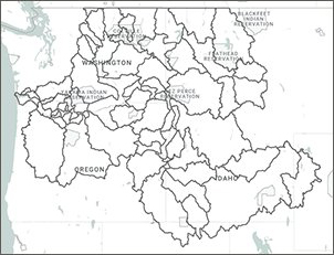
Find subbasins by map:
More information
- Subbasin Plans Home
- 2026 Program
- Overview
- How to cite subbasin plans
- Subbasin Planning QHA, EDT and other Models Geodatabase (maintained by CRITFC)
- Archived subbasin plans and datasets (maintained by StreamNet)