


Here’s a Columbia River trivia question for people who care about such things: Are the true headwaters of the river in Montana or British Columbia?
Before you answer, “British Columbia, of course,” wait a minute.
If you consider the true headwaters of a river to include the length of its longest tributary leading to the beginning of the river, then consider the Clark Fork/Pend Oreille river system – the combination of two rivers plus Lake Pend Oreille.
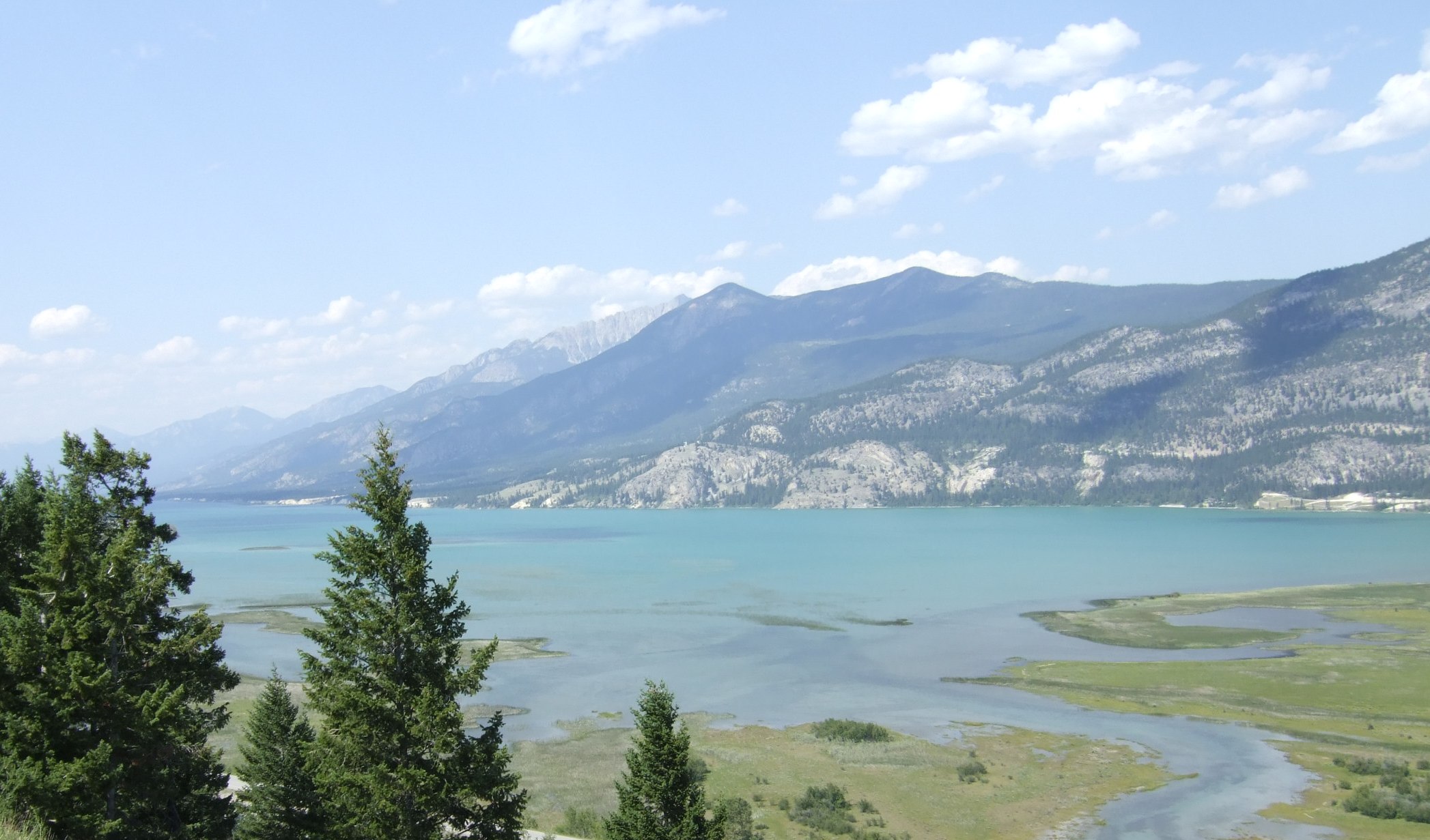
The Clark Fork River begins near Butte, Montana, hard against the Continental Divide of the Rocky Mountains. It forms from the confluence of two creeks, Silver Bow and Warm Springs. Both Silver Bow and Warm Springs creeks have their own headwaters. The longer of these is the Silver Bow system, which begins with Blacktail Creek (interesting factoid: the Salish name for Silver Bow Creek, Sntapqey, translates as 'where something is shot in the head,' as the Salish people harvested the abundant, large bull trout in the creek by shooting them in the head with bows and arrows). This adds 45 miles to the length of the Clark Fork River, according to the Geographic Information division of the Montana State Library in Helena. The Clark Fork then flows 310 miles to its mouth at Lake Pend Oreille, Idaho, across Lake Pend Oreille (22 miles from the mouth of the Clark Fork to Springy Point/Dover, the hydrologic start of the Pend Oreille River, according to the Idaho Department of Fish and Game), and then 130 miles down the Pend Oreille River through Northeastern Washington and into British Columbia, where it flows into the Columbia just across the international border. The Columbia crosses the border at River Mile 745. So in all, the Clark Fork/Pend Oreille river system stretches 1,252 miles from the Continental Divide to the Pacific Ocean (45 + 310 + 22 + 130 + 745 = 1,252).

The commonly accepted length of the Columbia is 1,243 miles, presumably measured from the head of Columbia Lake at Canal Flats, British Columbia, where the river emerges, flowing north. While the lake is nine miles long, and while there is a well-maintained loop trail encircling the very group of bubbling springs in a wetland area at the south end of the lake whose water gathers and flows into the lake, the longest tributary of the lake enters at its north end, within a couple hundred yards of its outlet. That would be Dutch Creek. According to the BC Freshwater Atlas, Dutch Creek is 42.6 miles long. So, if the Columbia is measured from the beginning of its longest headwaters tributary, Dutch Creek, the river is 1,285.6 miles long (42.6 + 1,243).
Dutch Creek begins in a glacier on TriKootenay Peak and has no headwaters stream, at least none named and measured. So British Columbia is the winner, but only by 33.6 miles, a mere 2.6-percent difference.
While the area around Butte and the Clark Fork River have been well known since a mining boom began in the late 1800s, particularly for copper, the headwaters of Dutch Creek were a mere blank spot on the map until the late 1920s. In 1928 the blank spot intrigued four adventurous men, experienced mountain climbers, who slogged and hacked their way to the glacial source of Dutch Creek, and then wrote about their wanderlust in an article full of mystery and striking detail entitled “The Purcell Source of the Columbia” (“Investigation showed that this region was blank on the maps.” And, “We crossed the sparkling torrent of Benabel Creek, and passed a trapper’s camping place where the bleached skeleton of a lynx was swinging from a tree …”).
The article was published in the The Geographical Journal of the Royal Geographical Society (with the Institute of British Geographers), Volume 77, No. 5, 1931, pages 455-64. The two primary authors were J. Monroe Thorington, a well-known Canadian mountaineer and author who made 52 first ascents and wrote many guidebooks and journal articles about the mountains of British Columbia, and Eaton Cromwell, an American mountaineer who also made many first ascents in the mountains of British Columbia and for whom one of those peaks is named.
The article concludes, humbly, “In this modern day it would be rash to make a claim of discovery. Some unknown trapper or prospector may have ventured in a bygone time to the very head of Dutch Creek.” With that caveat, and because there was no sign of earlier exploration, the authors concluded, “Our party is apparently the first to determine the length of Dutch Creek and to establish the geographical position of the glacial source of the Columbia river.”