


The Program relies on information gathered through monitoring efforts to ensure projects and measures ensures are implemented properly and to gather baseline information needed to track and report on progress toward program goals and objectives.
Consult the program for details on the monitoring principles and general measures
Existing and Ongoing Work (regional and staff)
Work related to coordinating monitoring efforts geographically and topically
- Ongoing work: regional coordinated effort for fish habitat status and trend, CHaMP and OBMEP and their ISRP review and Council Decision letter
- Completed work: Fish Monitoring Strategy (i.e., resident fish, ASMS, lamprey), draft MERR documents
Work related to reporting monitoring data using indicators
- Ongoing work: Table of Indicators
- Completed work: HLI report and Dashboard Indicators (Fish Data Report)
Council Decisions, Memos, ISRP reviews, ISAB documents
- ISRP 2003-6, ISRP review of Revised RME Mainstem Systemwide Proposals (e.g., ISEMP, IMWs, Effectiveness projects)
- 2007 Council staff document describing IMWs with focus on Entiat, John Day and Salmon IMWs
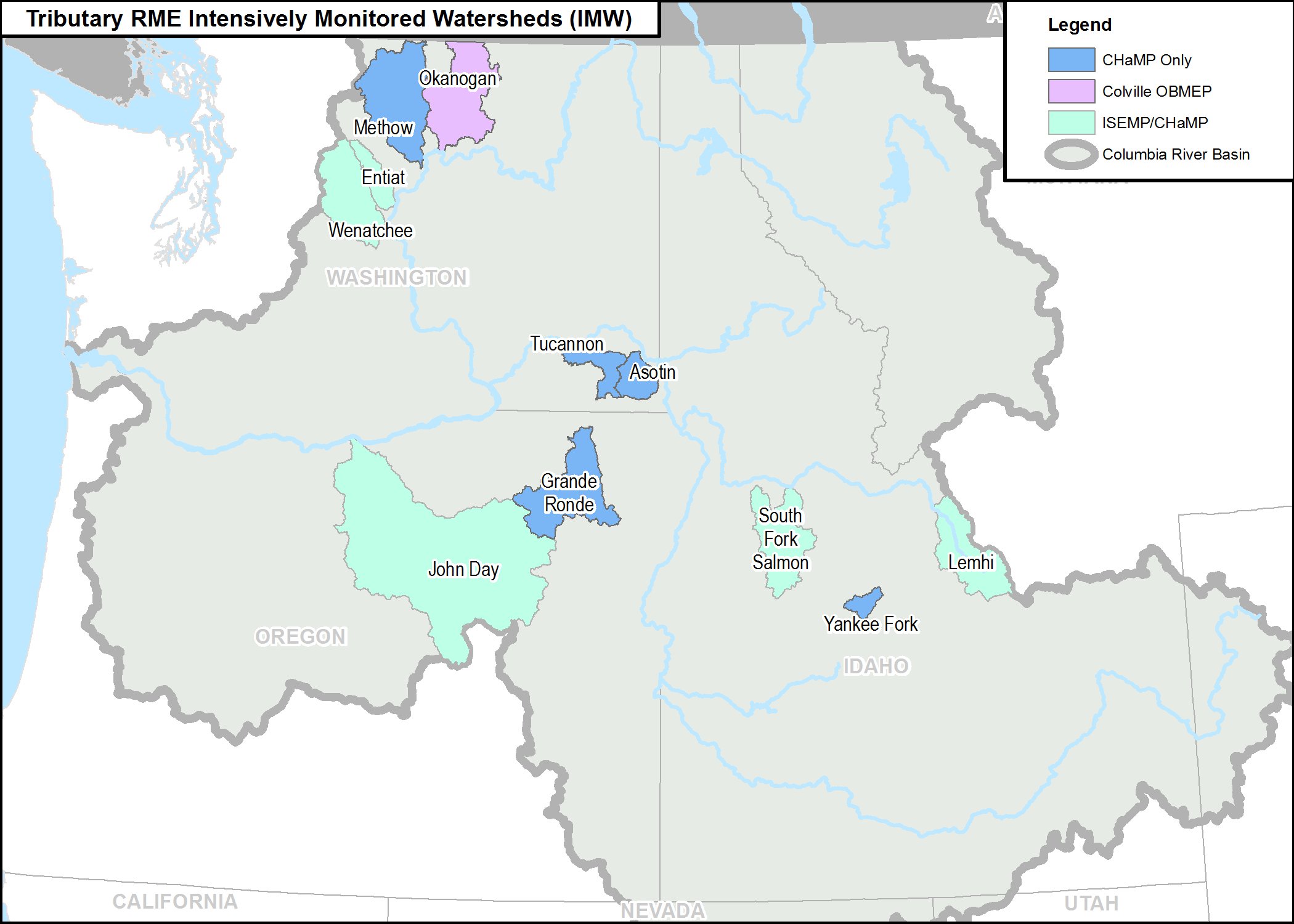
The above map, created by Bonneville Power Administration - GIS (2015), shows:
- BPA funded Intensively Monitored Watersheds (IMWs) where ISEMP is implementing BiOp Pilot Studies for evaluating the effects of restoration treatments at a watershed or population level (Entiat, Lemhi and Lower John Day “Bridge Creek”).
- ISEMP and Accord partner models are developed to guide restoration based on observed fish and habitat relationships ISEMP BiOp Pilot Studies (Wenatchee NREI and the Secesh AKA the “SF Salmon” watershed production model); and the Accords (Okanogans’: EDT by the Colville’s OBMEP; Grande Ronde’s: (Catherine Creek, Upper Grande Ronde and Minam populations) to support HabRate by ODFW and CRITFC;
- Where status and trends may link to limited site specific restoration treatments with intensive habitat status and trends to identify limiting factors based on 2010 BiOp recommendations for RPA 56 which in addition to 1 & 2 above include (the Tucannon CHaMP and SRSRFB) and the Accord Yankee Fork program by the Shoshone Bannock.; and
- Joint Federal/State funded Efforts: PSCRF IMWs (Asotin and John Day Middle Fork and South Fork study) and BOR BiOp (Methow). Credit BPA GIS 2015.
- Note that two IMWs in the PNAMP list that are not included in BPAs map are 1. the Wind River IMW, which is considered a BPA Barrier case study using ongoing fish monitoring status and trend monitoring because it excludes integrated habitat monitoring, it may be considered an IMW when more information about the US Dept. or Interior NEON program component is understood. and 2. the PCSRF funded Potlach IMW because BPA funding extent for fish monitoring only could not be determined to be associated with the IMW.